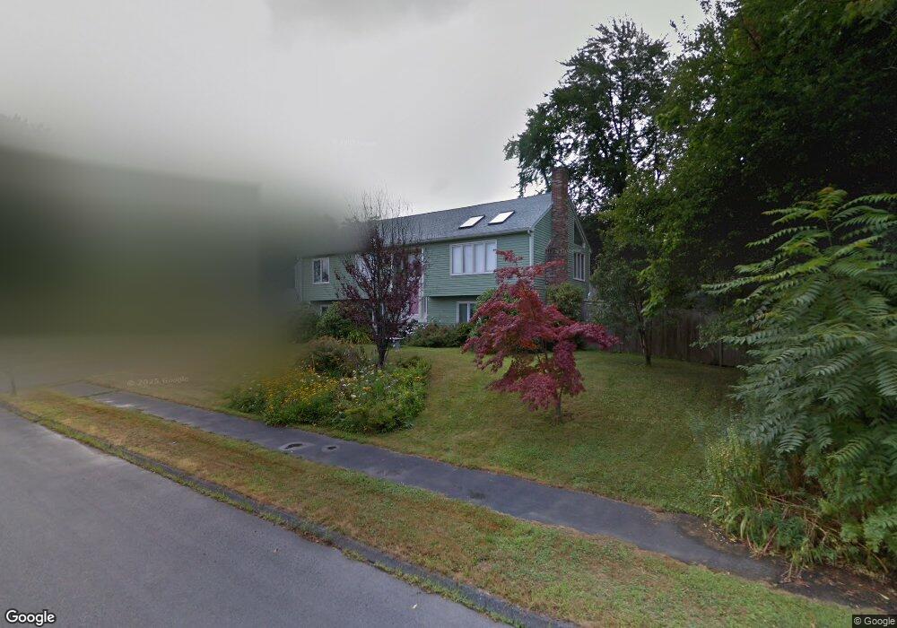
4 Hillside Ln Shrewsbury, MA 01545
Estimated Value: $564,000 - $730,000
3
Beds
3
Baths
1,344
Sq Ft
$500/Sq Ft
Est. Value
About This Home
This home is located at 4 Hillside Ln, Shrewsbury, MA 01545 and is currently estimated at $671,546, approximately $499 per square foot. 4 Hillside Ln is a home located in Worcester County with nearby schools including Sherwood Middle School, Floral Street School, and Oak Middle School.
Ownership History
Date
Name
Owned For
Owner Type
Purchase Details
Closed on
Dec 26, 2017
Sold by
Curtis Stephen J and Curtis Kathryn A
Bought by
Curtis Kathryn A
Current Estimated Value
Purchase Details
Closed on
Oct 29, 2002
Sold by
Curtis Katherine L and Curtis Thomas Anthony
Bought by
Curtis Stephen J and Curtis Kathryn A
Home Financials for this Owner
Home Financials are based on the most recent Mortgage that was taken out on this home.
Original Mortgage
$90,000
Interest Rate
6.2%
Mortgage Type
Purchase Money Mortgage
Purchase Details
Closed on
Sep 14, 1990
Sold by
Meredith Relocation
Bought by
Curtis T Anthony
Home Financials for this Owner
Home Financials are based on the most recent Mortgage that was taken out on this home.
Original Mortgage
$160,200
Interest Rate
9.76%
Mortgage Type
Purchase Money Mortgage
Purchase Details
Closed on
Jun 25, 1987
Sold by
Lapointe Family Tr
Bought by
Rao S K
Home Financials for this Owner
Home Financials are based on the most recent Mortgage that was taken out on this home.
Original Mortgage
$140,000
Interest Rate
10.5%
Mortgage Type
Purchase Money Mortgage
Create a Home Valuation Report for This Property
The Home Valuation Report is an in-depth analysis detailing your home's value as well as a comparison with similar homes in the area
Home Values in the Area
Average Home Value in this Area
Purchase History
| Date | Buyer | Sale Price | Title Company |
|---|---|---|---|
| Curtis Kathryn A | -- | -- | |
| Curtis Kathryn A | -- | -- | |
| Curtis Kathryn A | -- | -- | |
| Curtis Stephen J | $310,000 | -- | |
| Curtis Stephen J | $310,000 | -- | |
| Curtis T Anthony | $178,000 | -- | |
| Rao S K | $213,000 | -- |
Source: Public Records
Mortgage History
| Date | Status | Borrower | Loan Amount |
|---|---|---|---|
| Previous Owner | Rao S K | $90,000 | |
| Previous Owner | Rao S K | $160,200 | |
| Previous Owner | Rao S K | $140,000 |
Source: Public Records
Tax History Compared to Growth
Tax History
| Year | Tax Paid | Tax Assessment Tax Assessment Total Assessment is a certain percentage of the fair market value that is determined by local assessors to be the total taxable value of land and additions on the property. | Land | Improvement |
|---|---|---|---|---|
| 2025 | $78 | $649,000 | $255,200 | $393,800 |
| 2024 | $7,164 | $578,700 | $243,100 | $335,600 |
| 2023 | $6,623 | $504,800 | $243,100 | $261,700 |
| 2022 | $6,571 | $465,700 | $243,100 | $222,600 |
| 2021 | $5,462 | $414,100 | $194,500 | $219,600 |
| 2020 | $4,906 | $393,400 | $194,500 | $198,900 |
| 2019 | $4,671 | $371,600 | $177,700 | $193,900 |
| 2018 | $4,335 | $342,400 | $169,000 | $173,400 |
| 2017 | $4,151 | $323,500 | $153,100 | $170,400 |
| 2016 | $3,923 | $301,800 | $143,100 | $158,700 |
| 2015 | $3,902 | $295,600 | $136,900 | $158,700 |
Source: Public Records
Map
Nearby Homes
- 76 Hillside Dr
- 175 Oak St
- 20 Williamsburg Ct Unit 21
- 26 Williamsburg Ct Unit 22
- 7 Thoreau Cir
- 9 Heritage St
- 22 Adams Rd
- 43 Harriet Ave
- 10 Gleason Rd
- 315 Maple Ave
- 25 Harriet Ave
- 26 Browne Rd
- 468 Grafton St
- 495 Grafton St
- 102 Harrington Farms Way
- 31 Oak St
- 15 Conifer Cir Unit 31
- 5 Conifer Cir Unit 28
- 3 Conifer Cir Unit 29
- 60 Harrington Farms Way Unit 60
- 36 Beverly Hill Dr
- 3 Hillside Ln
- 72 Hillside Dr
- 1 Hillside Ln
- 33 Beverly Hill Dr
- 38 Beverly Hill Dr
- 68 Hillside Dr
- 26 Beverly Hill Dr
- 37 Beverly Hill Dr
- 31 Beverly Hill Dr
- 84 Hillside Dr
- 39 Beverly Hill Dr
- 64 Hillside Dr
- 81 Hillside Dr
- 77 Hillside Dr
- 40 Beverly Hill Dr
- 71 Beverly Hill Dr
- 73 Hillside Dr
- 85 Hillside Dr
- 86 Hillside Dr