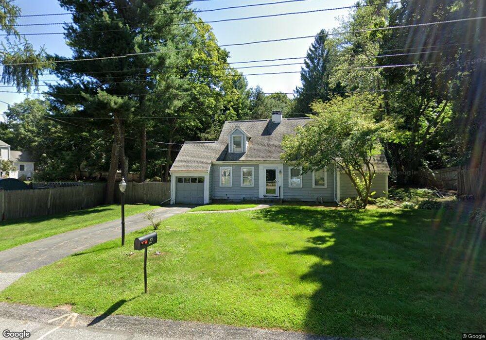
4 Irving Rd Unit 4 Weston, MA 02493
Estimated Value: $1,408,107 - $1,872,000
3
Beds
2
Baths
1,990
Sq Ft
$794/Sq Ft
Est. Value
About This Home
This home is located at 4 Irving Rd Unit 4, Weston, MA 02493 and is currently estimated at $1,580,777, approximately $794 per square foot. 4 Irving Rd Unit 4 is a home located in Middlesex County with nearby schools including Country Elementary School, Woodland Elementary School, and Field Elementary School.
Ownership History
Date
Name
Owned For
Owner Type
Purchase Details
Closed on
Jun 20, 2013
Sold by
Dyer Cheryl A Est
Bought by
Faass Patricia A
Current Estimated Value
Home Financials for this Owner
Home Financials are based on the most recent Mortgage that was taken out on this home.
Original Mortgage
$391,000
Outstanding Balance
$277,639
Interest Rate
3.45%
Mortgage Type
New Conventional
Estimated Equity
$1,303,138
Create a Home Valuation Report for This Property
The Home Valuation Report is an in-depth analysis detailing your home's value as well as a comparison with similar homes in the area
Home Values in the Area
Average Home Value in this Area
Purchase History
| Date | Buyer | Sale Price | Title Company |
|---|---|---|---|
| Faass Patricia A | $701,475 | -- |
Source: Public Records
Mortgage History
| Date | Status | Borrower | Loan Amount |
|---|---|---|---|
| Open | Faass Patricia A | $391,000 |
Source: Public Records
Tax History
| Year | Tax Paid | Tax Assessment Tax Assessment Total Assessment is a certain percentage of the fair market value that is determined by local assessors to be the total taxable value of land and additions on the property. | Land | Improvement |
|---|---|---|---|---|
| 2025 | $11,484 | $1,034,600 | $569,100 | $465,500 |
| 2024 | $11,193 | $1,006,600 | $569,100 | $437,500 |
| 2023 | $10,928 | $923,000 | $569,100 | $353,900 |
| 2022 | $10,831 | $845,500 | $542,500 | $303,000 |
| 2021 | $10,490 | $808,200 | $517,500 | $290,700 |
| 2020 | $10,149 | $791,000 | $517,500 | $273,500 |
| 2019 | $9,431 | $749,100 | $479,100 | $270,000 |
| 2018 | $9,831 | $749,100 | $479,100 | $270,000 |
| 2017 | $4,631 | $749,100 | $479,100 | $270,000 |
| 2016 | $9,109 | $749,100 | $479,100 | $270,000 |
| 2015 | $7,518 | $612,200 | $325,100 | $287,100 |
Source: Public Records
Map
Nearby Homes
- 30 Warren Ave
- 1 Pine Summit Cir
- 741 Boston Post Rd
- 16 Livermore Ln
- 16 Livermore Ln Unit 16
- 21 Jericho Rd Unit 21
- 15 Claridge Dr
- 823 Boston Post Rd
- 180 Highland St
- 9 Sanderson Ln
- 21 Westerly Rd
- 133 Wellesley St
- 135 Wellesley St
- 131 Wellesley St
- 180 Ash St
- 10 Audubon Rd
- 226 Ash St
- 253 Highland St
- 302 Concord Rd
- 23 Covered Bridge Ln
- 4 Irving Rd
- 6 Irving Rd
- 15 Highland St
- 11 Highland St
- 5 Irving Rd
- 5 Irving Rd Unit 5
- 7 Irving Rd
- 13 Highland St
- 8 Irving Rd
- 706 Boston Post Rd
- 17 Highland St
- 10 Irving Rd
- 6 Gambrill Ln Unit 6P
- 4 Gambrill Ln Unit 4GL
- 8 Cutting Ln Unit 8
- 8 Cutting Ln Unit 8CL
- 14 Irving Rd
- 6 Cutting Ln Unit 6
- 6 Cutting Ln Unit 6CL
- 250 Boston Post rd Bypass
Your Personal Tour Guide
Ask me questions while you tour the home.