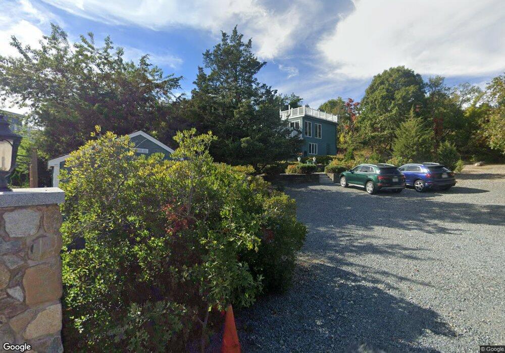
4 Jerjean Cir Gloucester, MA 01930
West Gloucester NeighborhoodEstimated Value: $1,224,000 - $1,420,434
3
Beds
3
Baths
2,400
Sq Ft
$556/Sq Ft
Est. Value
About This Home
This home is located at 4 Jerjean Cir, Gloucester, MA 01930 and is currently estimated at $1,333,859, approximately $555 per square foot. 4 Jerjean Cir is a home located in Essex County with nearby schools including West Parish, Ralph B O'maley Middle School, and Gloucester High School.
Ownership History
Date
Name
Owned For
Owner Type
Purchase Details
Closed on
Jan 20, 2006
Sold by
Roach Patricia A and Martin Robert A
Bought by
Cushing Michael J and Cushing Marianne A
Current Estimated Value
Home Financials for this Owner
Home Financials are based on the most recent Mortgage that was taken out on this home.
Original Mortgage
$417,000
Interest Rate
6.33%
Mortgage Type
Purchase Money Mortgage
Purchase Details
Closed on
Sep 16, 1987
Sold by
Kent Johna
Bought by
Martin Robert A
Create a Home Valuation Report for This Property
The Home Valuation Report is an in-depth analysis detailing your home's value as well as a comparison with similar homes in the area
Home Values in the Area
Average Home Value in this Area
Purchase History
| Date | Buyer | Sale Price | Title Company |
|---|---|---|---|
| Cushing Michael J | $660,000 | -- | |
| Martin Robert A | $306,000 | -- |
Source: Public Records
Mortgage History
| Date | Status | Borrower | Loan Amount |
|---|---|---|---|
| Open | Martin Robert A | $403,000 | |
| Closed | Martin Robert A | $415,800 | |
| Closed | Martin Robert A | $417,000 | |
| Closed | Martin Robert A | $111,000 |
Source: Public Records
Tax History
| Year | Tax Paid | Tax Assessment Tax Assessment Total Assessment is a certain percentage of the fair market value that is determined by local assessors to be the total taxable value of land and additions on the property. | Land | Improvement |
|---|---|---|---|---|
| 2025 | $9,674 | $995,300 | $508,500 | $486,800 |
| 2024 | $9,181 | $943,600 | $421,000 | $522,600 |
| 2023 | $8,551 | $807,500 | $359,300 | $448,200 |
| 2022 | $8,050 | $686,300 | $312,500 | $373,800 |
| 2021 | $7,876 | $633,100 | $284,100 | $349,000 |
| 2020 | $7,539 | $611,400 | $284,100 | $327,300 |
| 2019 | $7,540 | $594,200 | $270,900 | $323,300 |
| 2018 | $7,710 | $596,300 | $304,000 | $292,300 |
| 2017 | $7,332 | $555,900 | $289,400 | $266,500 |
| 2016 | $7,128 | $523,700 | $276,600 | $247,100 |
| 2015 | $6,585 | $482,400 | $270,300 | $212,100 |
Source: Public Records
Map
Nearby Homes
- 226 Atlantic St
- 178 Atlantic St
- 167 Atlantic St
- 2 Breezy Point Rd
- 672 Washington St
- 13 Honeysuckle Rd
- 3 Deacon Farm Ln
- 31 Echo Ave
- 7 Colburn St
- 7 Leaman Dr
- 5 Samoset Rd Unit B
- 13 Mystic Ave
- 8 Mystic Ave
- 6 Monroe Ct
- 145 Essex Ave Unit 402
- 24 Cobblestone Ln Unit 603
- 5 Lepage Ln
- 98 Maplewood Ave
- 1030 Washington St
- 368 Essex Ave
- 28 Waterman Rd
- 218 Atlantic St
- 26 Waterman Rd
- 24 Waterman Rd
- 224 Atlantic St
- 27 Waterman Rd
- 27 Waterman Rd
- 27 Waterman Rd Unit 27
- 29 Waterman Rd
- 220 Atlantic St
- 31 Waterman Rd
- 25 Waterman Rd
- 20 Waterman Rd
- 19 Waterman Rd
- 18 Waterman Road Winter Unit 1
- 18 Waterman Rd Unit 2
- 18 Waterman Rd Unit 2
- 18 Waterman Rd
- 18R Waterman Road Winter Unit 1
- 18 Waterman Rd Unit 1
Your Personal Tour Guide
Ask me questions while you tour the home.