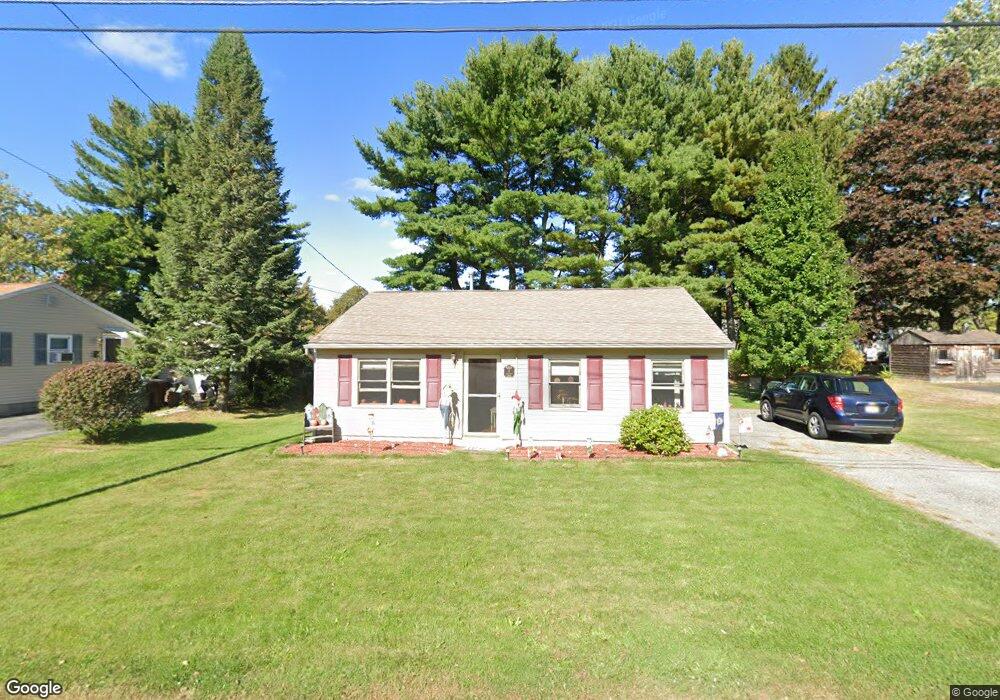
4 Kimball Rd Auburn, MA 01501
Pakachoag NeighborhoodEstimated Value: $312,000 - $366,000
2
Beds
1
Bath
971
Sq Ft
$354/Sq Ft
Est. Value
About This Home
This home is located at 4 Kimball Rd, Auburn, MA 01501 and is currently estimated at $343,287, approximately $353 per square foot. 4 Kimball Rd is a home located in Worcester County with nearby schools including Auburn Senior High School and Shrewsbury Montessori School - Auburn Campus.
Ownership History
Date
Name
Owned For
Owner Type
Purchase Details
Closed on
Sep 21, 2006
Sold by
Ware Katherine M and Ware Stephen J
Bought by
Nickerson Robert E and Dagostino Lori
Current Estimated Value
Home Financials for this Owner
Home Financials are based on the most recent Mortgage that was taken out on this home.
Original Mortgage
$172,000
Outstanding Balance
$102,842
Interest Rate
6.59%
Mortgage Type
Purchase Money Mortgage
Estimated Equity
$240,445
Purchase Details
Closed on
Jul 26, 2004
Sold by
4 Kimball Road Rt and Fall David T
Bought by
Ware Katherine M and Ware Stephen J
Home Financials for this Owner
Home Financials are based on the most recent Mortgage that was taken out on this home.
Original Mortgage
$175,000
Interest Rate
6.28%
Mortgage Type
Purchase Money Mortgage
Purchase Details
Closed on
Oct 7, 1998
Sold by
Leary William G and Leary Susan C
Bought by
Four Kimball Rd Rt and Fall David T
Purchase Details
Closed on
Dec 20, 1995
Sold by
Est Sherry Louise C and Mancini Nancy
Bought by
Leary William G and Leary Susan C
Create a Home Valuation Report for This Property
The Home Valuation Report is an in-depth analysis detailing your home's value as well as a comparison with similar homes in the area
Home Values in the Area
Average Home Value in this Area
Purchase History
| Date | Buyer | Sale Price | Title Company |
|---|---|---|---|
| Nickerson Robert E | $215,000 | -- | |
| Ware Katherine M | $188,000 | -- | |
| Four Kimball Rd Rt | $62,274 | -- | |
| Leary William G | $63,000 | -- |
Source: Public Records
Mortgage History
| Date | Status | Borrower | Loan Amount |
|---|---|---|---|
| Open | Nickerson Robert E | $172,000 | |
| Previous Owner | Ware Katherine M | $175,000 | |
| Previous Owner | Leary William G | $40,000 | |
| Previous Owner | Leary William G | $54,400 |
Source: Public Records
Tax History Compared to Growth
Tax History
| Year | Tax Paid | Tax Assessment Tax Assessment Total Assessment is a certain percentage of the fair market value that is determined by local assessors to be the total taxable value of land and additions on the property. | Land | Improvement |
|---|---|---|---|---|
| 2025 | $38 | $269,200 | $111,400 | $157,800 |
| 2024 | $3,794 | $254,100 | $105,300 | $148,800 |
| 2023 | $3,652 | $230,000 | $95,700 | $134,300 |
| 2022 | $3,470 | $206,300 | $95,700 | $110,600 |
| 2021 | $4,240 | $176,200 | $84,400 | $91,800 |
| 2020 | $4,339 | $176,200 | $84,400 | $91,800 |
| 2019 | $3,060 | $166,100 | $83,600 | $82,500 |
| 2018 | $5,485 | $152,200 | $78,100 | $74,100 |
| 2017 | $2,659 | $145,000 | $70,900 | $74,100 |
| 2016 | $2,534 | $140,100 | $73,400 | $66,700 |
| 2015 | $2,446 | $141,700 | $73,400 | $68,300 |
| 2014 | $2,301 | $133,100 | $69,900 | $63,200 |
Source: Public Records
Map
Nearby Homes
- 326 Pakachoag St
- 204-212 Hampton St
- 61 Elmwood St
- 31 Walsh Ave
- 33 Walsh Ave
- 31-33 Walsh Ave
- 52 Harrison Ave
- 2 Victoria Dr Unit 1
- 37 Elmwood St
- 34 Rockland Rd
- 2 Breezy Bend
- 25 Vinal St Unit 26
- 25 Vinal St Unit 29
- 25 Vinal St Unit 30
- 22 Lesley Ave
- 5 Commonwealth Ave
- 3 Lower Windbrook Dr
- 6 Newton St
- 177 Boyce St
- 47 Washington St Unit 26
- 6 Kimball Rd
- 2 Kimball Rd
- 3 Clarendon Rd
- 5 Clarendon Rd
- 1 Clarendon Rd
- 3 Kimball Rd
- 5 Kimball Rd
- 8 Kimball Rd
- 234 Pakachoag St
- 7 Clarendon Rd
- 236 Pakachoag St
- 232 Pakachoag St
- 7 Kimball Rd
- 4 Clarendon Rd
- 10 Kimball Rd
- 3103 Forest Park Dr
- 3102 Forest Park Dr
- 3101 Forest Park Dr
- 3101 Forest Park Dr Unit 70
- 3102 Forest Park Dr Unit 71