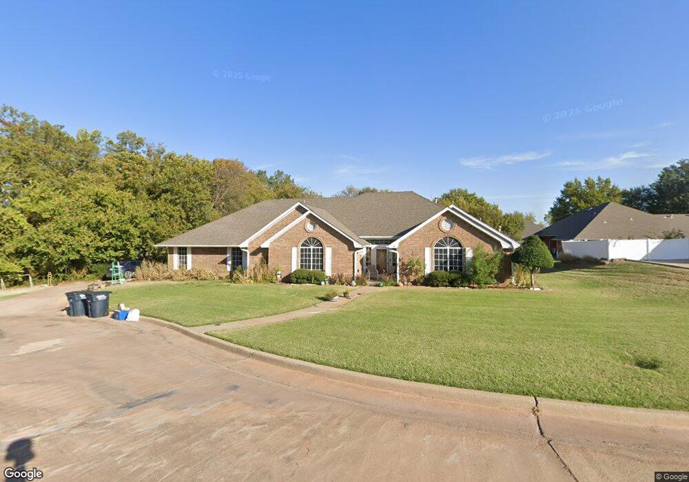
4 Lancet Cir Shawnee, OK 74804
Estimated Value: $288,000 - $332,000
4
Beds
3
Baths
2,474
Sq Ft
$125/Sq Ft
Est. Value
About This Home
This home is located at 4 Lancet Cir, Shawnee, OK 74804 and is currently estimated at $309,720, approximately $125 per square foot. 4 Lancet Cir is a home located in Pottawatomie County.
Ownership History
Date
Name
Owned For
Owner Type
Purchase Details
Closed on
Feb 7, 2020
Sold by
Leone Kenneth Dale and Leone Katina Beth
Bought by
Edwards Brad and Edwards Jamie
Current Estimated Value
Home Financials for this Owner
Home Financials are based on the most recent Mortgage that was taken out on this home.
Original Mortgage
$216,125
Outstanding Balance
$191,870
Interest Rate
3.74%
Mortgage Type
New Conventional
Estimated Equity
$117,850
Purchase Details
Closed on
Jun 17, 2005
Sold by
Wood Melvin E
Bought by
Canavan John G and Canavan Diane D
Home Financials for this Owner
Home Financials are based on the most recent Mortgage that was taken out on this home.
Original Mortgage
$100,000
Interest Rate
5.78%
Mortgage Type
New Conventional
Purchase Details
Closed on
Mar 31, 1992
Sold by
Landmark Land Co Oklahom
Bought by
Leone Kenneth and Leone Katina
Create a Home Valuation Report for This Property
The Home Valuation Report is an in-depth analysis detailing your home's value as well as a comparison with similar homes in the area
Home Values in the Area
Average Home Value in this Area
Purchase History
| Date | Buyer | Sale Price | Title Company |
|---|---|---|---|
| Edwards Brad | $227,500 | First American Title | |
| Canavan John G | -- | None Available | |
| Leone Kenneth | $18,000 | -- |
Source: Public Records
Mortgage History
| Date | Status | Borrower | Loan Amount |
|---|---|---|---|
| Open | Edwards Brad | $216,125 | |
| Previous Owner | Canavan John G | $100,000 |
Source: Public Records
Tax History Compared to Growth
Tax History
| Year | Tax Paid | Tax Assessment Tax Assessment Total Assessment is a certain percentage of the fair market value that is determined by local assessors to be the total taxable value of land and additions on the property. | Land | Improvement |
|---|---|---|---|---|
| 2024 | $2,594 | $28,665 | $1,200 | $27,465 |
| 2023 | $2,594 | $27,300 | $1,200 | $26,100 |
| 2022 | $2,545 | $27,300 | $1,200 | $26,100 |
| 2021 | $2,569 | $27,300 | $1,200 | $26,100 |
| 2020 | $2,011 | $22,402 | $999 | $21,403 |
| 2019 | $1,971 | $21,749 | $958 | $20,791 |
| 2018 | $1,921 | $21,116 | $929 | $20,187 |
| 2017 | $1,848 | $20,500 | $1,920 | $18,580 |
| 2016 | $1,811 | $19,904 | $1,920 | $17,984 |
| 2015 | $1,550 | $19,324 | $1,920 | $17,404 |
| 2014 | $1,502 | $18,761 | $1,920 | $16,841 |
Source: Public Records
Map
Nearby Homes
- 2 Lancet Cir
- 3 Norwich Ct
- 6 Lancet Ct
- 64 Northridge Rd
- 13 Brentwood Place
- 2024 Lantana Cir
- 40 Northridge Rd
- 23 Crown Point
- 1305 Castle Creek St
- 1309 Nottingham Cir
- 27 N Rice Ave
- 17 Beckley St
- 1301 Manchester
- 43138 Rain Rd
- 43147 Rain Rd
- 31 E Oak Hill
- 1406 E Bradley St
- 1104 Adeline
- 806 E Midland St
- 0000 N Rd