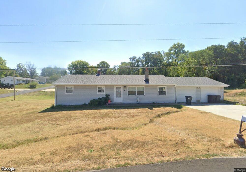
4 Laura Ave Saint Peters, MO 63376
Estimated Value: $256,000 - $331,000
3
Beds
1
Bath
1,632
Sq Ft
$187/Sq Ft
Est. Value
About This Home
This home is located at 4 Laura Ave, Saint Peters, MO 63376 and is currently estimated at $304,966, approximately $186 per square foot. 4 Laura Ave is a home located in St. Charles County with nearby schools including Rock Creek Elementary School, Fort Zumwalt South Middle School, and Fort Zumwalt South High School.
Ownership History
Date
Name
Owned For
Owner Type
Purchase Details
Closed on
May 1, 2013
Sold by
Deterding Robert J and Deterding Marcia A
Bought by
Deterding Robert Joseph and Deterding Marcia A
Current Estimated Value
Home Financials for this Owner
Home Financials are based on the most recent Mortgage that was taken out on this home.
Original Mortgage
$92,000
Outstanding Balance
$65,484
Interest Rate
3.58%
Mortgage Type
VA
Estimated Equity
$239,482
Purchase Details
Closed on
Jul 24, 1998
Sold by
Naes Debra J and Naes William R
Bought by
Union Planters Bank Na
Create a Home Valuation Report for This Property
The Home Valuation Report is an in-depth analysis detailing your home's value as well as a comparison with similar homes in the area
Home Values in the Area
Average Home Value in this Area
Purchase History
| Date | Buyer | Sale Price | Title Company |
|---|---|---|---|
| Deterding Robert Joseph | $42,500 | Nations Title Agency Mo Inc | |
| Union Planters Bank Na | $65,972 | -- |
Source: Public Records
Mortgage History
| Date | Status | Borrower | Loan Amount |
|---|---|---|---|
| Open | Deterding Robert Joseph | $92,000 |
Source: Public Records
Tax History Compared to Growth
Tax History
| Year | Tax Paid | Tax Assessment Tax Assessment Total Assessment is a certain percentage of the fair market value that is determined by local assessors to be the total taxable value of land and additions on the property. | Land | Improvement |
|---|---|---|---|---|
| 2025 | $2,804 | $49,717 | -- | -- |
| 2023 | $2,803 | $45,940 | $0 | $0 |
| 2022 | $2,512 | $38,345 | $0 | $0 |
| 2021 | $2,511 | $38,345 | $0 | $0 |
| 2020 | $2,505 | $36,989 | $0 | $0 |
| 2019 | $2,496 | $36,989 | $0 | $0 |
| 2018 | $2,285 | $32,382 | $0 | $0 |
| 2017 | $2,273 | $32,382 | $0 | $0 |
| 2016 | $1,866 | $26,548 | $0 | $0 |
| 2015 | $1,729 | $26,548 | $0 | $0 |
| 2014 | -- | $24,693 | $0 | $0 |
Source: Public Records
Map
Nearby Homes
- 1814 Springhill Dr
- 5 Arborgate Dr Unit 69A
- 1910 Pebble Brook Dr
- 113 Stage Coach Landing Dr
- 211 Butternut Stage Dr
- 217 Roaring River Dr
- 300 Mill Pond Dr
- 307 Santa Fe Trail Dr
- 31 Lace Bark Ct
- 146 Huntington Crossing Dr
- 32 Gulf Shores Dr
- 7 Park City Ct
- 8360 Mexico Rd
- 367 Shamrock St
- 361 Shamrock St
- 42 Kingspointe Dr
- Adams Plan at Strawberry Farms - Liberty Series
- Franklin Plan at Strawberry Farms - Liberty Series
- Madison Plan at Strawberry Farms - Liberty Series
- Hamilton II Plan at Strawberry Farms - Liberty Series