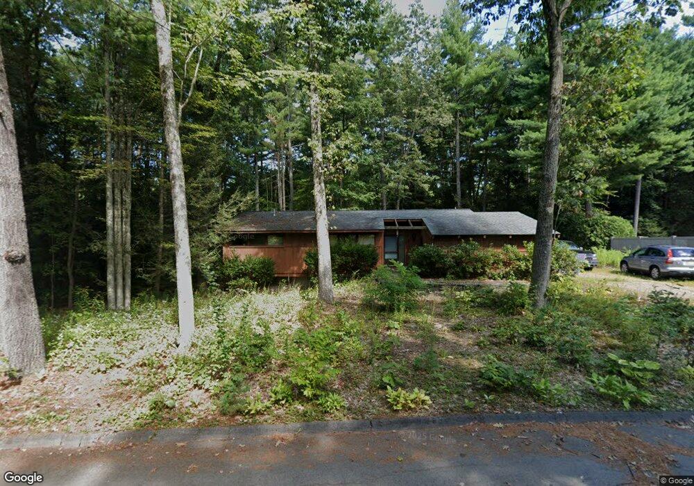
4 Laurel Ln Amherst, MA 01002
Estimated Value: $413,657 - $486,000
3
Beds
2
Baths
1,220
Sq Ft
$367/Sq Ft
Est. Value
About This Home
This home is located at 4 Laurel Ln, Amherst, MA 01002 and is currently estimated at $447,914, approximately $367 per square foot. 4 Laurel Ln is a home located in Hampshire County with nearby schools including Fort River Elementary School, Amherst Regional Middle School, and Amherst Regional High School.
Ownership History
Date
Name
Owned For
Owner Type
Purchase Details
Closed on
Jan 24, 2023
Sold by
Silva-Morales Victoria I
Bought by
Morrison Nashema I
Current Estimated Value
Purchase Details
Closed on
May 28, 1999
Sold by
Mary B Ivey Funding T and Ivey Allen E
Bought by
Morales Valdimer and Silva-Morales Victoria
Home Financials for this Owner
Home Financials are based on the most recent Mortgage that was taken out on this home.
Original Mortgage
$146,927
Interest Rate
6.82%
Mortgage Type
Purchase Money Mortgage
Create a Home Valuation Report for This Property
The Home Valuation Report is an in-depth analysis detailing your home's value as well as a comparison with similar homes in the area
Home Values in the Area
Average Home Value in this Area
Purchase History
| Date | Buyer | Sale Price | Title Company |
|---|---|---|---|
| Morrison Nashema I | -- | None Available | |
| Morrison Nashema I | -- | None Available | |
| Morales Valdimer | $148,900 | -- | |
| Morales Valdimer | $148,900 | -- |
Source: Public Records
Mortgage History
| Date | Status | Borrower | Loan Amount |
|---|---|---|---|
| Previous Owner | Morales Valdimer | $146,927 |
Source: Public Records
Tax History
| Year | Tax Paid | Tax Assessment Tax Assessment Total Assessment is a certain percentage of the fair market value that is determined by local assessors to be the total taxable value of land and additions on the property. | Land | Improvement |
|---|---|---|---|---|
| 2025 | $6,719 | $374,300 | $183,300 | $191,000 |
| 2024 | $6,547 | $353,700 | $172,900 | $180,800 |
| 2023 | $6,293 | $313,100 | $157,200 | $155,900 |
| 2022 | $6,192 | $291,100 | $142,900 | $148,200 |
| 2021 | $5,883 | $269,600 | $132,400 | $137,200 |
| 2020 | $5,748 | $269,600 | $132,400 | $137,200 |
| 2019 | $5,603 | $257,000 | $132,400 | $124,600 |
| 2018 | $5,433 | $257,000 | $132,400 | $124,600 |
| 2017 | $5,233 | $239,700 | $126,100 | $113,600 |
| 2016 | $5,086 | $239,700 | $126,100 | $113,600 |
| 2015 | $5,289 | $257,500 | $138,700 | $118,800 |
Source: Public Records
Map
Nearby Homes
- 204 Aubinwood Rd
- 0 Heatherstone Rd
- 61 S Valley Rd
- 310 Belchertown Rd
- 0 Amherst Rd
- 9 Harkness Rd
- 53 Pine Grove Unit 53
- 67 Pine Grove Unit 67
- 27 Summerfield Rd
- 16 N Valley Rd
- 130 Linden Ridge Rd
- 100 Larkspur Dr
- 23 Alyssum Dr
- 242 N East St Unit 24
- 16 Hawthorn Rd
- 48 Gray St
- 0 Red Gate Ln Unit 73348273
- 6 Eveningstar Dr
- 0 Main St
- 1114 S East St
Your Personal Tour Guide
Ask me questions while you tour the home.