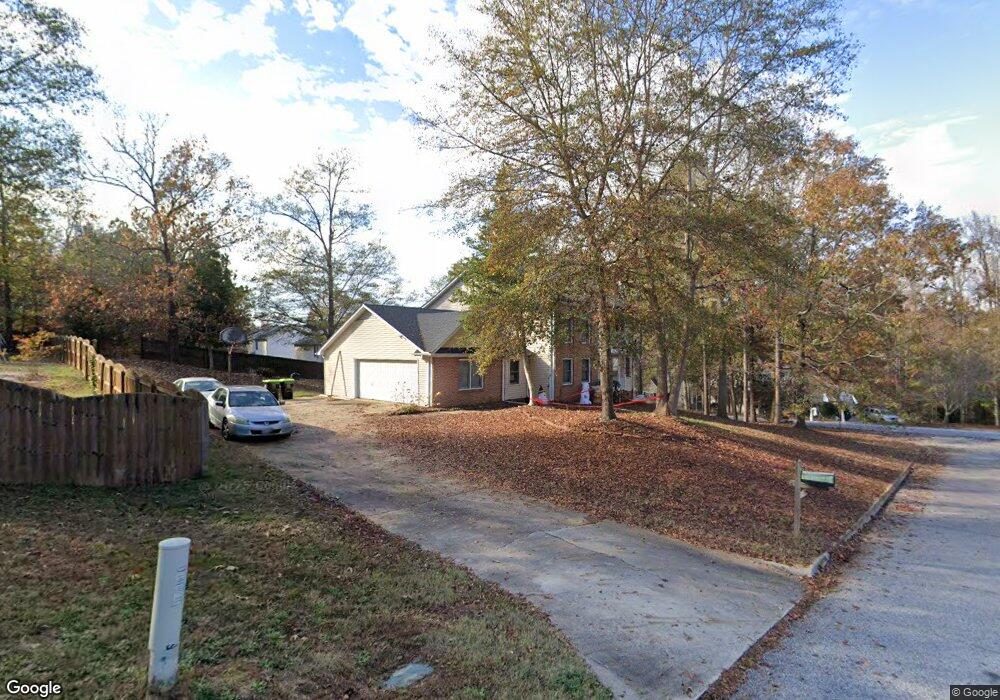
4 Lindseybrook Trail Mauldin, SC 29662
Estimated Value: $338,000 - $366,704
4
Beds
3
Baths
2,791
Sq Ft
$125/Sq Ft
Est. Value
About This Home
This home is located at 4 Lindseybrook Trail, Mauldin, SC 29662 and is currently estimated at $348,426, approximately $124 per square foot. 4 Lindseybrook Trail is a home located in Greenville County with nearby schools including Greenbrier Elementary School, Hillcrest Middle School, and Mauldin High School.
Ownership History
Date
Name
Owned For
Owner Type
Purchase Details
Closed on
Feb 20, 2020
Sold by
Look Up Lodge Christian Camp Llc
Bought by
Somerville David
Current Estimated Value
Home Financials for this Owner
Home Financials are based on the most recent Mortgage that was taken out on this home.
Original Mortgage
$188,977
Outstanding Balance
$165,891
Interest Rate
3.6%
Mortgage Type
VA
Estimated Equity
$182,535
Purchase Details
Closed on
Oct 19, 2018
Sold by
Baltz Duane D and Donald E Baltz Trust
Bought by
Look Up Lodge Christian Camp Inc
Purchase Details
Closed on
Sep 30, 2009
Sold by
Estate Of Donald Elbert Baltz and Baltz Duane D
Bought by
Baltz Duane D and Trust U/A Of Donald E Baltz
Create a Home Valuation Report for This Property
The Home Valuation Report is an in-depth analysis detailing your home's value as well as a comparison with similar homes in the area
Home Values in the Area
Average Home Value in this Area
Purchase History
| Date | Buyer | Sale Price | Title Company |
|---|---|---|---|
| Somerville David | $185,000 | None Available | |
| Look Up Lodge Christian Camp Inc | $3,439,882 | None Available | |
| Baltz Duane D | -- | -- |
Source: Public Records
Mortgage History
| Date | Status | Borrower | Loan Amount |
|---|---|---|---|
| Open | Somerville David | $188,977 |
Source: Public Records
Tax History
| Year | Tax Paid | Tax Assessment Tax Assessment Total Assessment is a certain percentage of the fair market value that is determined by local assessors to be the total taxable value of land and additions on the property. | Land | Improvement |
|---|---|---|---|---|
| 2025 | $1,177 | $8,500 | $1,630 | $6,870 |
| 2024 | $1,177 | $7,390 | $1,080 | $6,310 |
| 2023 | $1,128 | $7,390 | $1,080 | $6,310 |
| 2022 | $1,087 | $7,390 | $1,080 | $6,310 |
| 2021 | $1,088 | $7,390 | $1,080 | $6,310 |
| 2020 | $1,010 | $6,430 | $940 | $5,490 |
| 2019 | $2,896 | $9,650 | $1,410 | $8,240 |
| 2018 | $2,935 | $9,650 | $1,410 | $8,240 |
| 2017 | $2,890 | $9,650 | $1,410 | $8,240 |
| 2016 | $2,798 | $160,780 | $23,500 | $137,280 |
| 2015 | $2,801 | $160,780 | $23,500 | $137,280 |
| 2014 | $2,905 | $168,750 | $27,000 | $141,750 |
Source: Public Records
Map
Nearby Homes
- 712 Brooks Rd
- 24 Poplar Springs Dr
- 14 Croftstone Ct
- 7 Murraymill Ct
- 8 Chelseabrook Ct
- 9 Colombard Ct
- 2 Knollvine Cove
- 111 Golden Crest Ct
- 116 Canyon Ct
- 420 Peach Grove Place
- 144 Silver Hill Ln
- 202 Greenport Way
- 309 Garrett St
- 101 Lawnfield St
- 244 Paperbark Dr
- 237 Paperbark Dr
- 248 Paperbark Dr
- 245 Paperbark Dr
- 247 Paperbark Dr
- 249 Paperbark Dr
- 9 Lindseybrook Trail
- 203 Courtneybrook Trail
- 200 Courtneybrook Trail
- 3 Lindseybrook Trail
- 8 Lindseybrook Trail
- 120 Courtneybrook Trail
- 205 Courtneybrook Trail
- 118 Courtneybrook Trail
- 202 Courtneybrook Trail
- 5 Lindseybrook Trail
- 109 Courtneybrook Trail
- 204 Courtneybrook Trail
- 6 Kimberlybrook Ct
- 10 Kimberlybrook Ct
- 207 Courtneybrook Trail
- 116 Courtneybrook Trail
- 7 Lindseybrook Trail
- 12 Lindseybrook Trail
- 107 Courtneybrook Trail
- 11 Lindseybrook Trail
Your Personal Tour Guide
Ask me questions while you tour the home.