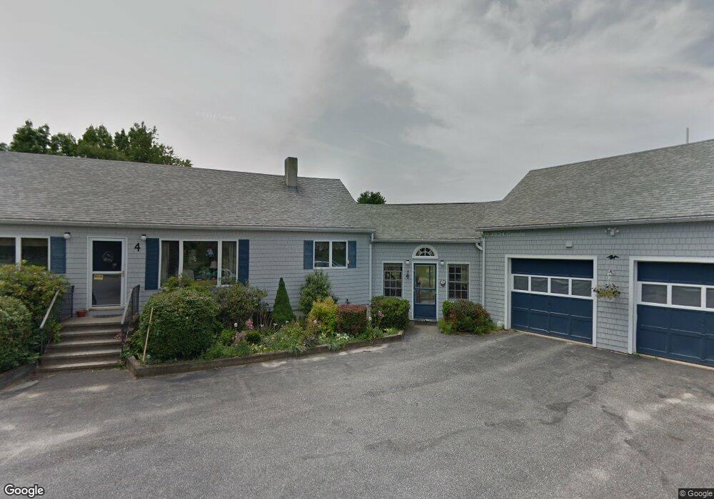
4 Lower Methodist Rd Cumberland Center, ME 04021
West Cumberland NeighborhoodEstimated Value: $607,000 - $680,469
3
Beds
4
Baths
2,329
Sq Ft
$276/Sq Ft
Est. Value
About This Home
This home is located at 4 Lower Methodist Rd, Cumberland Center, ME 04021 and is currently estimated at $642,823, approximately $276 per square foot. 4 Lower Methodist Rd is a home located in Cumberland County with nearby schools including Mabel I. Wilson School, Greely Middle School 4-5, and Greely Middle School.
Ownership History
Date
Name
Owned For
Owner Type
Purchase Details
Closed on
Feb 27, 2020
Sold by
Mckague Douglas S and Mckague Dennise M
Bought by
Mckague Dennise M and Mckague Douglas S
Current Estimated Value
Purchase Details
Closed on
Aug 5, 2019
Sold by
Miner Carol A
Bought by
Mckague Douglas S and Mckague Dennise M
Purchase Details
Closed on
Oct 16, 2018
Sold by
Miner Carol A
Bought by
Mckague Douglas S and Mckague Dennise M
Purchase Details
Closed on
Aug 29, 2018
Sold by
Mckague Douglas S and Mckague Dennise M
Bought by
Miner Carol A
Purchase Details
Closed on
Mar 15, 2018
Sold by
Miner Carol A
Bought by
Mckague Douglas S and Mckague Dennise M
Purchase Details
Closed on
Oct 8, 2013
Sold by
Miner Carol A
Bought by
Adams Benjamin A and Adams Amy E
Create a Home Valuation Report for This Property
The Home Valuation Report is an in-depth analysis detailing your home's value as well as a comparison with similar homes in the area
Home Values in the Area
Average Home Value in this Area
Purchase History
| Date | Buyer | Sale Price | Title Company |
|---|---|---|---|
| Mckague Dennise M | -- | None Available | |
| Mckague Dennise M | -- | None Available | |
| Mckague Douglas S | -- | -- | |
| Mckague Douglas S | -- | -- | |
| Mckague Douglas S | -- | -- | |
| Mckague Douglas S | -- | -- | |
| Miner Carol A | -- | -- | |
| Miner Carol A | -- | -- | |
| Mckague Douglas S | -- | -- | |
| Mckague Douglas S | -- | -- | |
| Adams Benjamin A | -- | -- | |
| Adams Benjamin A | -- | -- |
Source: Public Records
Tax History Compared to Growth
Tax History
| Year | Tax Paid | Tax Assessment Tax Assessment Total Assessment is a certain percentage of the fair market value that is determined by local assessors to be the total taxable value of land and additions on the property. | Land | Improvement |
|---|---|---|---|---|
| 2025 | $9,498 | $377,200 | $155,500 | $221,700 |
| 2024 | $8,770 | $377,200 | $155,500 | $221,700 |
| 2023 | $8,277 | $373,700 | $155,500 | $218,200 |
| 2022 | $7,922 | $373,700 | $155,500 | $218,200 |
| 2021 | $7,680 | $373,700 | $155,500 | $218,200 |
| 2020 | $7,605 | $373,700 | $155,500 | $218,200 |
| 2019 | $6,920 | $348,600 | $133,300 | $215,300 |
| 2018 | $6,672 | $338,700 | $139,800 | $198,900 |
| 2017 | $6,777 | $360,500 | $152,800 | $207,700 |
| 2016 | $6,579 | $360,500 | $152,800 | $207,700 |
| 2015 | $6,525 | $360,500 | $152,800 | $207,700 |
| 2014 | $6,273 | $360,500 | $152,800 | $207,700 |
| 2013 | $6,331 | $372,400 | $164,700 | $207,700 |
Source: Public Records
Map
Nearby Homes
- 7 Castle Rock Dr
- 8 Castle Rock
- 57&57D Tinker Ln and Pointer Way
- 0 Tinker Ln Unit 57D
- 0 Pointer Way Unit LOT 57
- 26 Feldspar Ln Unit 22
- 23 Feldspar Ln Unit 12
- 21 Feldspar Ln Unit 11
- 24 Feldspar Ln Unit 23
- 31 Feldspar Ln Unit 16
- 30 Feldspar Ln Unit 21
- 13 Feldspar Ln Unit 7
- 27 Feldspar Ln Unit 14
- 1 Feldspar Ln Unit 1
- 5 Feldspar Ln Unit 3
- 8 Feldspar Ln Unit 29
- 25 Feldspar Ln Unit 13
- 5 Skillin Rd
- 43 Skillin Rd
- 8 Summer Way
- 45 Old Farm Rd
- 8 Lower Methodist Rd
- 2 Lower Methodist Rd
- 7 Northwind Farm Rd
- 30 Old Farm Rd
- 72 Gray Rd
- 26 Lower Methodist Rd
- 80 Gray Rd
- 73 Gray Rd
- 23 Old Farm Rd
- 0 Lot 67 Gray Rd Unit 1044741
- Lot 67 Gray Rd (A K A Map U20- Lot 67
- 71 Gray Rd
- 17 Old Farm Rd
- 48 Old Farm Rd
- 32 Lower Methodist Rd
- 79 Gray Rd
- 83 Gray
- Lot 1 Deer Run Dr
- Lot 3 Deer Run Dr