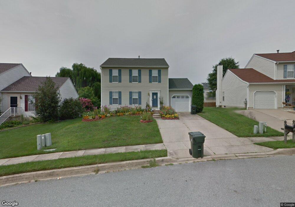
4 Mackenzie Dr Newark, DE 19711
Estimated Value: $371,000 - $401,000
3
Beds
2
Baths
1,512
Sq Ft
$256/Sq Ft
Est. Value
About This Home
This home is located at 4 Mackenzie Dr, Newark, DE 19711 and is currently estimated at $386,696, approximately $255 per square foot. 4 Mackenzie Dr is a home located in New Castle County with nearby schools including Downes (John R.) Elementary School, Shue-Medill Middle School, and Newark High School.
Ownership History
Date
Name
Owned For
Owner Type
Purchase Details
Closed on
Apr 13, 2001
Sold by
Faulls Drew L and Faulls Luwannah K
Bought by
Barlow Cynthia E
Current Estimated Value
Home Financials for this Owner
Home Financials are based on the most recent Mortgage that was taken out on this home.
Original Mortgage
$122,300
Outstanding Balance
$44,682
Interest Rate
6.9%
Estimated Equity
$342,014
Create a Home Valuation Report for This Property
The Home Valuation Report is an in-depth analysis detailing your home's value as well as a comparison with similar homes in the area
Home Values in the Area
Average Home Value in this Area
Purchase History
| Date | Buyer | Sale Price | Title Company |
|---|---|---|---|
| Barlow Cynthia E | $152,900 | -- |
Source: Public Records
Mortgage History
| Date | Status | Borrower | Loan Amount |
|---|---|---|---|
| Open | Barlow Cynthia E | $122,300 |
Source: Public Records
Tax History Compared to Growth
Tax History
| Year | Tax Paid | Tax Assessment Tax Assessment Total Assessment is a certain percentage of the fair market value that is determined by local assessors to be the total taxable value of land and additions on the property. | Land | Improvement |
|---|---|---|---|---|
| 2024 | $767 | $72,700 | $12,300 | $60,400 |
| 2023 | $2,629 | $72,700 | $12,300 | $60,400 |
| 2022 | $2,601 | $72,700 | $12,300 | $60,400 |
| 2021 | $2,534 | $72,700 | $12,300 | $60,400 |
| 2020 | $2,461 | $72,700 | $12,300 | $60,400 |
| 2019 | $2,531 | $72,700 | $12,300 | $60,400 |
| 2018 | $2,108 | $72,700 | $12,300 | $60,400 |
| 2017 | $2,045 | $72,700 | $12,300 | $60,400 |
| 2016 | $2,039 | $72,700 | $12,300 | $60,400 |
| 2015 | -- | $72,700 | $12,300 | $60,400 |
| 2014 | $1,827 | $72,700 | $12,300 | $60,400 |
Source: Public Records
Map
Nearby Homes
- 117 W Shetland Ct
- GALEN Plan at Barksdale Crossing
- 11 Buttercup Cir
- 01a Leahy Dr
- 104 Leahy Dr
- 04a Leahy Dr
- 02a Leahy Dr
- 405 Leahy Dr
- 406 Leahy Dr
- 724 Fiske Ln
- 914 Quail Ln
- 133 Madison Dr
- 44 Cornwall Dr
- 158 Kirkcaldy Dr
- 69 Mule Deer Ct
- 72 Mule Deer Ct
- 119 Delrem Dr
- 34 Chestnut Dr
- 203 Fletchwood Rd
- 104 Country Club Dr
- 2 Mackenzie Dr
- 6 Mackenzie Dr
- 405 Abbotsford Ln
- 403 Abbotsford Ln
- 407 Abbotsford Ln
- 8 Mackenzie Dr
- 401 Abbotsford Ln
- 3 Mackenzie Dr
- 409 Abbotsford Ln
- 5 Mackenzie Dr
- 104 Macduff Rd
- 7 Mackenzie Dr
- 102 Macduff Rd
- 106 Macduff Rd
- 100 Macduff Rd
- 108 Macduff Rd
- 14 Macduff Ct
- 13 Macduff Ct
- 404 Abbotsford Ln
- 402 Abbotsford Ln