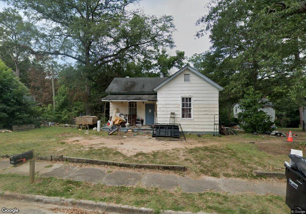
4 Maple St Manchester, GA 31816
Estimated Value: $51,116 - $113,000
1
Bed
1
Bath
888
Sq Ft
$88/Sq Ft
Est. Value
About This Home
This home is located at 4 Maple St, Manchester, GA 31816 and is currently estimated at $78,279, approximately $88 per square foot. 4 Maple St is a home located in Meriwether County with nearby schools including Mountain View Elementary School, Manchester Middle School, and Manchester High School.
Ownership History
Date
Name
Owned For
Owner Type
Purchase Details
Closed on
Feb 24, 2021
Sold by
Richmond Hill Holiness Church Keca Inc
Bought by
Pike Ronald Samuel and Kimball Jean J
Current Estimated Value
Purchase Details
Closed on
May 30, 2019
Sold by
Buitrago Orlando R
Bought by
Richmond Hill Holiness Church Keca Inc
Purchase Details
Closed on
Dec 8, 2007
Sold by
Dolby Ellen L
Bought by
Buitrago Orlando R
Purchase Details
Closed on
May 1, 1986
Bought by
Shearouse David
Create a Home Valuation Report for This Property
The Home Valuation Report is an in-depth analysis detailing your home's value as well as a comparison with similar homes in the area
Home Values in the Area
Average Home Value in this Area
Purchase History
| Date | Buyer | Sale Price | Title Company |
|---|---|---|---|
| Pike Ronald Samuel | $5,000 | -- | |
| Richmond Hill Holiness Church Keca Inc | -- | -- | |
| Buitrago Orlando R | $9,900 | -- | |
| Shearouse David | $6,000 | -- |
Source: Public Records
Tax History
| Year | Tax Paid | Tax Assessment Tax Assessment Total Assessment is a certain percentage of the fair market value that is determined by local assessors to be the total taxable value of land and additions on the property. | Land | Improvement |
|---|---|---|---|---|
| 2024 | $430 | $9,120 | $2,040 | $7,080 |
| 2023 | $442 | $9,120 | $2,040 | $7,080 |
| 2022 | $442 | $9,120 | $2,040 | $7,080 |
| 2021 | $291 | $9,120 | $2,040 | $7,080 |
| 2020 | $293 | $9,120 | $2,040 | $7,080 |
| 2019 | $294 | $9,120 | $2,040 | $7,080 |
| 2018 | $297 | $9,120 | $2,040 | $7,080 |
| 2017 | $301 | $9,120 | $2,040 | $7,080 |
| 2016 | $300 | $9,120 | $2,040 | $7,080 |
| 2015 | $301 | $9,120 | $2,040 | $7,080 |
| 2014 | $301 | $9,120 | $2,040 | $7,080 |
| 2013 | -- | $9,120 | $2,040 | $7,080 |
Source: Public Records
Map
Nearby Homes
Your Personal Tour Guide
Ask me questions while you tour the home.