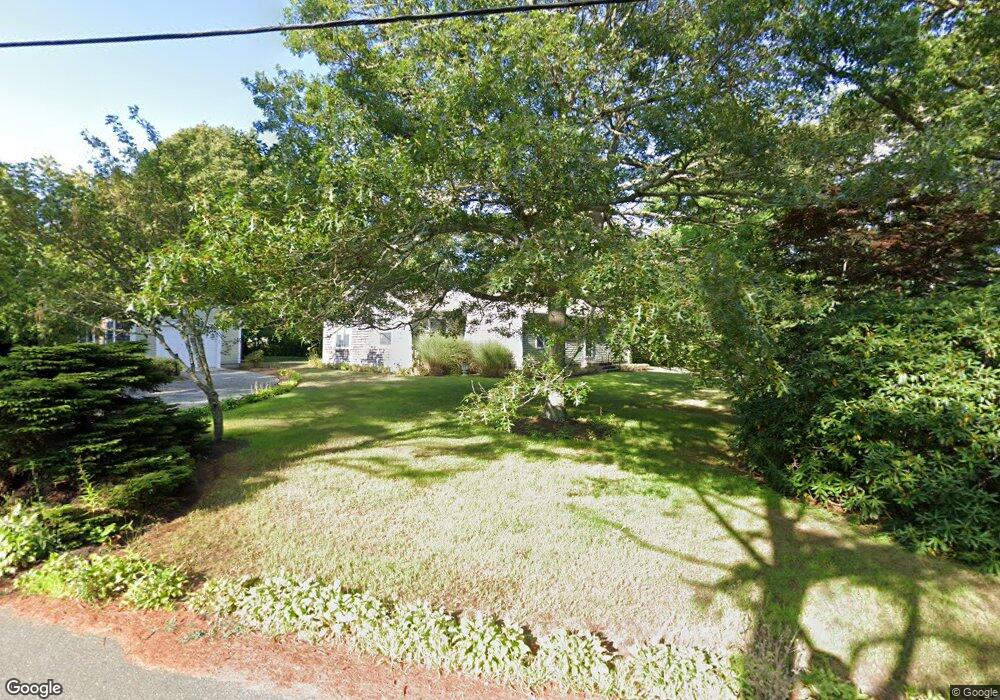
4 Matheson Rd Brewster, MA 02631
Estimated Value: $668,000 - $855,000
2
Beds
1
Bath
1,320
Sq Ft
$559/Sq Ft
Est. Value
About This Home
This home is located at 4 Matheson Rd, Brewster, MA 02631 and is currently estimated at $738,235, approximately $559 per square foot. 4 Matheson Rd is a home located in Barnstable County with nearby schools including Stony Brook Elementary School, Eddy Elementary School, and Nauset Regional Middle School.
Ownership History
Date
Name
Owned For
Owner Type
Purchase Details
Closed on
Sep 23, 2025
Sold by
Macdonald Martin L and Saintgermain Joanne
Bought by
Boesch Timothy J and Macdonald Martin J
Current Estimated Value
Purchase Details
Closed on
Nov 8, 2021
Sold by
Macdonald Martin L
Bought by
Macdonald Martin L and Stgermain Joanne
Purchase Details
Closed on
Aug 11, 2010
Sold by
Macdonald Martin L and Macdonald Martin J
Bought by
Macdonald Martin L
Purchase Details
Closed on
May 30, 2007
Sold by
Robert H Bielefeld T H and Robert Bielefeld
Bought by
Macdonald Martin J and Macdonald Martin L
Purchase Details
Closed on
Feb 12, 2004
Sold by
Bielefeld Dorothy J and Bielefeld Robert H
Bought by
Robert H Bielefeld T H and Robert Bielefeld
Create a Home Valuation Report for This Property
The Home Valuation Report is an in-depth analysis detailing your home's value as well as a comparison with similar homes in the area
Home Values in the Area
Average Home Value in this Area
Purchase History
| Date | Buyer | Sale Price | Title Company |
|---|---|---|---|
| Boesch Timothy J | $682,000 | -- | |
| Macdonald Martin L | -- | None Available | |
| Macdonald Martin L | -- | -- | |
| Macdonald Martin L | -- | -- | |
| Macdonald Martin J | $410,000 | -- | |
| Macdonald Martin J | $410,000 | -- | |
| Robert H Bielefeld T H | -- | -- | |
| Robert H Bielefeld T H | -- | -- |
Source: Public Records
Tax History
| Year | Tax Paid | Tax Assessment Tax Assessment Total Assessment is a certain percentage of the fair market value that is determined by local assessors to be the total taxable value of land and additions on the property. | Land | Improvement |
|---|---|---|---|---|
| 2025 | $4,973 | $722,800 | $356,200 | $366,600 |
| 2024 | $4,676 | $686,600 | $336,000 | $350,600 |
| 2023 | $4,291 | $613,900 | $299,900 | $314,000 |
| 2022 | $4,051 | $516,100 | $249,900 | $266,200 |
| 2021 | $3,874 | $451,500 | $217,200 | $234,300 |
| 2020 | $1,629 | $442,200 | $217,200 | $225,000 |
| 2019 | $1,594 | $426,200 | $209,000 | $217,200 |
| 2018 | $3,470 | $420,100 | $209,000 | $211,100 |
| 2017 | $1,450 | $393,300 | $209,000 | $184,300 |
| 2016 | $3,385 | $401,500 | $218,600 | $182,900 |
| 2015 | $3,245 | $392,800 | $214,200 | $178,600 |
Source: Public Records
Map
Nearby Homes
- 39 Spruce Run Dr
- 958 Long Pond Rd
- 184 Barons Way
- 61 Sheffield Rd
- 337 Jonathans Way
- 58 Aunt Molls Ridge Rd
- 235 Old Chatham Rd
- 274 Commons Way
- 737 Thousand Oaks Dr
- 52 Eaton Ln Unit (52)
- 127 Eaton Ln Unit 127
- 204 Eaton Ln Unit 204
- 0 Old Chatham Rd
- 16 Commons Way
- 63 Trevor Ln Unit 63
- 103 Trevor Ln Unit 103
- 0 Commons Way Unit 22504099
- 60 Fletcher Ln Unit H
- 100 Fletcher Ln Unit E
- 14 Howland Cir Unit 14
- 35 Matheson Rd
- 882 Crowells Bog Rd
- 896 Crowells Bog Rd
- 26 Matheson Rd
- 925 Crowells Bog Rd
- 910 Crowells Bog Rd
- 17 Newport Rd
- 15 Marion Ln
- 21 Newport Rd
- 36 Matheson Rd
- 926 Crowells Bog Rd
- 44 Marion Ln
- 8 Woodward Rd
- 21 Marion Ln
- 37 Newport Rd
- 21 Woodward Rd
- 873 Crowells Bog Rd
- 42 Matheson Rd
- 8 Newport Rd
- 18 Newport Rd
Your Personal Tour Guide
Ask me questions while you tour the home.