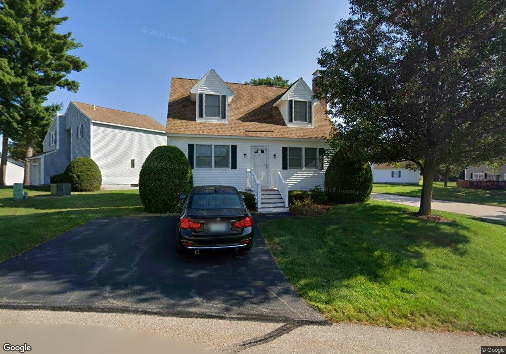
4 Mctavish Dr Unit U89 Nashua, NH 03063
Northwest Nashua NeighborhoodEstimated Value: $380,860 - $417,000
2
Beds
2
Baths
1,170
Sq Ft
$335/Sq Ft
Est. Value
About This Home
This home is located at 4 Mctavish Dr Unit U89, Nashua, NH 03063 and is currently estimated at $392,465, approximately $335 per square foot. 4 Mctavish Dr Unit U89 is a home located in Hillsborough County with nearby schools including Broad Street Elementary School, Elm Street Middle School, and Nashua High School North.
Ownership History
Date
Name
Owned For
Owner Type
Purchase Details
Closed on
Jan 14, 2005
Sold by
Iandosca Mary M
Bought by
Lee Moso
Current Estimated Value
Home Financials for this Owner
Home Financials are based on the most recent Mortgage that was taken out on this home.
Original Mortgage
$188,000
Outstanding Balance
$95,295
Interest Rate
5.81%
Estimated Equity
$297,170
Create a Home Valuation Report for This Property
The Home Valuation Report is an in-depth analysis detailing your home's value as well as a comparison with similar homes in the area
Home Values in the Area
Average Home Value in this Area
Purchase History
| Date | Buyer | Sale Price | Title Company |
|---|---|---|---|
| Lee Moso | $235,000 | -- |
Source: Public Records
Mortgage History
| Date | Status | Borrower | Loan Amount |
|---|---|---|---|
| Open | Lee Moso | $188,000 |
Source: Public Records
Tax History Compared to Growth
Tax History
| Year | Tax Paid | Tax Assessment Tax Assessment Total Assessment is a certain percentage of the fair market value that is determined by local assessors to be the total taxable value of land and additions on the property. | Land | Improvement |
|---|---|---|---|---|
| 2024 | $5,497 | $345,700 | $0 | $345,700 |
| 2023 | $5,155 | $282,800 | $0 | $282,800 |
| 2022 | $5,110 | $282,800 | $0 | $282,800 |
| 2021 | $4,565 | $196,600 | $0 | $196,600 |
| 2020 | $4,373 | $193,400 | $0 | $193,400 |
| 2019 | $4,208 | $193,400 | $0 | $193,400 |
| 2018 | $4,102 | $193,400 | $0 | $193,400 |
| 2017 | $4,036 | $156,500 | $0 | $156,500 |
| 2016 | $3,923 | $156,500 | $0 | $156,500 |
| 2015 | $3,839 | $156,500 | $0 | $156,500 |
| 2014 | $3,764 | $156,500 | $0 | $156,500 |
Source: Public Records
Map
Nearby Homes
- 27 Country Hill Rd Unit U90
- 4 Nelson St
- 3 Richmond St
- 5 Meghan Dr Unit U23
- 11 Inca Dr
- 6 Cornwall Ln Unit 7
- 46 Scenic Dr
- 599 W Hollis St
- 14 Parrish Hill Dr
- 76 Bartemus Trail Unit U231
- 424 Broad St
- 22 Cathedral Cir
- 40 Spring Cove Rd Unit U117
- 11 Bartemus Trail Unit 204
- 12 Spring Cove Rd Unit U103
- 8 Althea Ln Unit U26
- 47 Dogwood Dr Unit U202
- 20 Martha St
- 334 Broad St
- 16 Laurel Ct Unit U320
- 6 Mctavish Dr Unit U88
- 5 Brussels Dr Unit U118
- 3 Brussels Dr Unit U117
- 3 Mctavish Dr Unit U84
- 8 Mctavish Dr Unit U87
- 8 Mctavish Dr Unit 11-87
- 7 Brussels Dr Unit U119
- 5 Mctavish Dr Unit U85
- 9 Brussels Dr Unit U120
- 7 Mctavish Dr Unit U86
- 4 Brussels Dr Unit U137
- 14 Scarborough Dr Unit U71
- 29 Country Hill Rd Unit U91
- 12 Scarborough Dr Unit U72
- 27 Brussels Dr Unit U128
- 11 Brussels Dr Unit U121
- 6 Brussels Dr Unit U136
- 8 Scarborough Dr Unit U74
- 6 Scarborough Dr Unit U75
- 18 Brussels Dr Unit U130