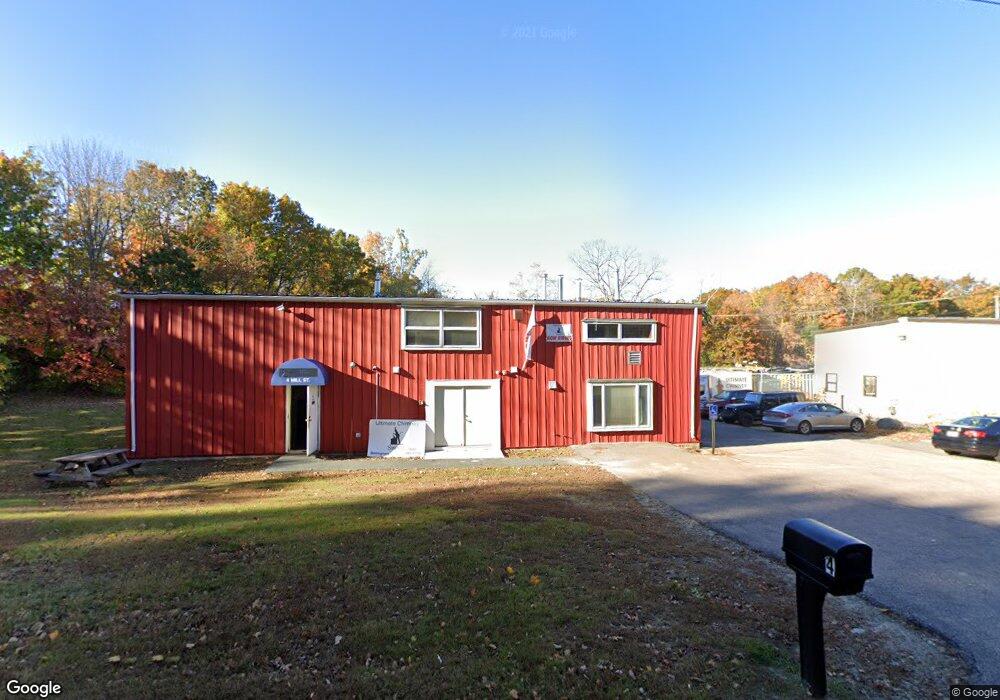
4 Mill St Bellingham, MA 02019
Estimated Value: $859,210
--
Bed
1
Bath
2,400
Sq Ft
$358/Sq Ft
Est. Value
About This Home
This home is located at 4 Mill St, Bellingham, MA 02019 and is currently estimated at $859,210, approximately $358 per square foot. 4 Mill St is a home located in Norfolk County with nearby schools including Stall Brook Elementary School, Bellingham High School, and Bethany Christian Academy.
Ownership History
Date
Name
Owned For
Owner Type
Purchase Details
Closed on
Jan 9, 2013
Sold by
Mill Street Prop Llc
Bought by
Mill Street Holdings L
Current Estimated Value
Home Financials for this Owner
Home Financials are based on the most recent Mortgage that was taken out on this home.
Original Mortgage
$280,000
Outstanding Balance
$194,594
Interest Rate
3.36%
Mortgage Type
Commercial
Estimated Equity
$664,616
Purchase Details
Closed on
Jan 30, 1987
Sold by
Kaplan Sanford A
Bought by
Nautilus Rt
Create a Home Valuation Report for This Property
The Home Valuation Report is an in-depth analysis detailing your home's value as well as a comparison with similar homes in the area
Home Values in the Area
Average Home Value in this Area
Purchase History
| Date | Buyer | Sale Price | Title Company |
|---|---|---|---|
| Mill Street Holdings L | $375,000 | -- | |
| Mill Street Prop Llc | -- | -- | |
| Nautilus Rt | $5,000 | -- |
Source: Public Records
Mortgage History
| Date | Status | Borrower | Loan Amount |
|---|---|---|---|
| Open | Nautilus Rt | $280,000 | |
| Previous Owner | Nautilus Rt | $168,000 |
Source: Public Records
Tax History Compared to Growth
Tax History
| Year | Tax Paid | Tax Assessment Tax Assessment Total Assessment is a certain percentage of the fair market value that is determined by local assessors to be the total taxable value of land and additions on the property. | Land | Improvement |
|---|---|---|---|---|
| 2025 | $11,365 | $584,900 | $227,100 | $357,800 |
| 2024 | $8,708 | $470,200 | $222,900 | $247,300 |
| 2023 | $8,401 | $452,400 | $212,300 | $240,100 |
| 2022 | $8,389 | $417,800 | $194,400 | $223,400 |
| 2021 | $8,351 | $405,800 | $194,400 | $211,400 |
| 2020 | $8,131 | $395,100 | $194,000 | $201,100 |
| 2019 | $8,105 | $392,100 | $194,000 | $198,100 |
| 2018 | $7,737 | $371,800 | $184,700 | $187,100 |
| 2017 | $7,584 | $366,000 | $184,700 | $181,300 |
| 2016 | $7,643 | $370,300 | $192,100 | $178,200 |
| 2015 | $7,580 | $370,300 | $192,100 | $178,200 |
| 2014 | $6,301 | $351,800 | $184,700 | $167,100 |
Source: Public Records
Map
Nearby Homes
- 1136 S Main St
- 108 N Main St
- 123-125 Mendon St
- 7 Debra Ln
- 49 Horseshoe Dr
- 1099 S Main St
- 125 Blackstone St
- 501 Old Bridge Ln Unit 501
- 1501 Old Bridge Ln Unit 1501
- 1303 Old Bridge Ln Unit 1303
- 6 Lisa Ann Dr
- 11 Silver Ave
- 49 Monique Dr
- 975 S Main St
- 46 Douglas Dr
- 19 Geordan Ave
- 89 Lakeview Ave
- 0 Hartford Ave
- 22 Roger Belanger Dr
- 214 Conlyn Ave
- 3 N Main St
- 10 Mill St
- 9 N Main St
- 5 N Main St
- 17 N Main St
- 1 N Main St
- 1 N Main St
- 1 N Main St Unit 1
- 15 N Main St Unit B3 & B4
- 15 N Main St Unit A7, A8 & A9
- 15 N Main St Unit C-15
- 15 N Main St Unit C8 & C9
- 15 N Main St Unit A1-2
- 15 N Main St Unit C-16
- 15 N Main St Unit C-10
- 15 N Main St Unit C16 & C17
- 15 N Main St Unit A2
- 15 N Main St Unit B8
- 15 N Main St Unit C-13
- 15 N Main St