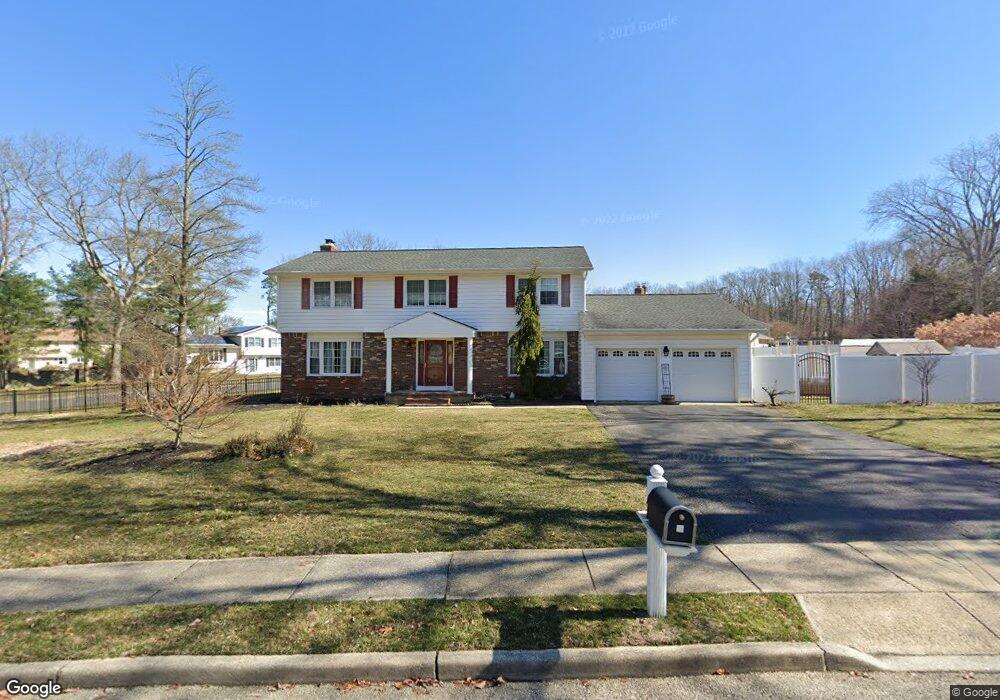
4 N Tunesbrook Dr Toms River, NJ 08753
Estimated Value: $663,744 - $767,000
4
Beds
4
Baths
3,716
Sq Ft
$190/Sq Ft
Est. Value
About This Home
This home is located at 4 N Tunesbrook Dr, Toms River, NJ 08753 and is currently estimated at $705,436, approximately $189 per square foot. 4 N Tunesbrook Dr is a home located in Ocean County.
Ownership History
Date
Name
Owned For
Owner Type
Purchase Details
Closed on
Feb 10, 2010
Sold by
Fallon Lisa and Fallon Sarah Lisa
Bought by
Serrao Graigory D and Piniat Alicia D
Current Estimated Value
Home Financials for this Owner
Home Financials are based on the most recent Mortgage that was taken out on this home.
Original Mortgage
$289,890
Outstanding Balance
$196,315
Interest Rate
5.5%
Mortgage Type
FHA
Estimated Equity
$509,121
Purchase Details
Closed on
Nov 21, 2005
Sold by
Noll Janice and Karwoski Richard
Bought by
Fallon Lisa and Palmer Louise C
Home Financials for this Owner
Home Financials are based on the most recent Mortgage that was taken out on this home.
Original Mortgage
$200,000
Interest Rate
6.37%
Mortgage Type
Fannie Mae Freddie Mac
Purchase Details
Closed on
Oct 10, 1997
Sold by
Vuono Kathleen M and Mcbride Md Herbert J
Bought by
Noll Janice
Home Financials for this Owner
Home Financials are based on the most recent Mortgage that was taken out on this home.
Original Mortgage
$60,000
Interest Rate
7.46%
Create a Home Valuation Report for This Property
The Home Valuation Report is an in-depth analysis detailing your home's value as well as a comparison with similar homes in the area
Home Values in the Area
Average Home Value in this Area
Purchase History
| Date | Buyer | Sale Price | Title Company |
|---|---|---|---|
| Serrao Graigory D | $299,900 | Fidelity Natl Title Ins Co | |
| Fallon Lisa | $450,000 | -- | |
| Noll Janice | $145,000 | -- |
Source: Public Records
Mortgage History
| Date | Status | Borrower | Loan Amount |
|---|---|---|---|
| Open | Serrao Graigory D | $289,890 | |
| Previous Owner | Fallon Lisa | $200,000 | |
| Previous Owner | Noll Janice | $60,000 |
Source: Public Records
Tax History Compared to Growth
Tax History
| Year | Tax Paid | Tax Assessment Tax Assessment Total Assessment is a certain percentage of the fair market value that is determined by local assessors to be the total taxable value of land and additions on the property. | Land | Improvement |
|---|---|---|---|---|
| 2025 | $8,810 | $483,800 | $129,000 | $354,800 |
| 2024 | $8,375 | $483,800 | $129,000 | $354,800 |
| 2023 | $8,075 | $483,800 | $129,000 | $354,800 |
| 2022 | $8,075 | $483,800 | $129,000 | $354,800 |
| 2021 | $7,826 | $312,400 | $101,000 | $211,400 |
| 2020 | $7,791 | $312,400 | $101,000 | $211,400 |
| 2019 | $7,387 | $309,600 | $101,000 | $208,600 |
| 2018 | $7,288 | $309,600 | $101,000 | $208,600 |
| 2017 | $7,226 | $309,600 | $101,000 | $208,600 |
| 2016 | $7,037 | $309,600 | $101,000 | $208,600 |
| 2015 | $6,771 | $309,600 | $101,000 | $208,600 |
| 2014 | $6,446 | $309,600 | $101,000 | $208,600 |
Source: Public Records
Map
Nearby Homes
- 918 Briar Ave
- 855 Derry Dr
- 883 Astoria Dr
- 977 Stafford Dr
- 968 Goose Creek Rd
- 984 Westminster Dr
- 1013 Bay Ave
- 1004 Sheila Dr
- 904 Nantucket Ct
- 1016 Sheila Dr
- 741 Michigan Ave
- 1050 Sheila Dr
- 886 Ocean View Dr
- 1042 Roxbury Ln
- 696 Schoolhouse Ln
- 693 Vaughn Ave
- 786 Nebraska Ave
- 308 Tradewinds Ave
- 919 Somerset Dr
- 779 Nebraska Ave