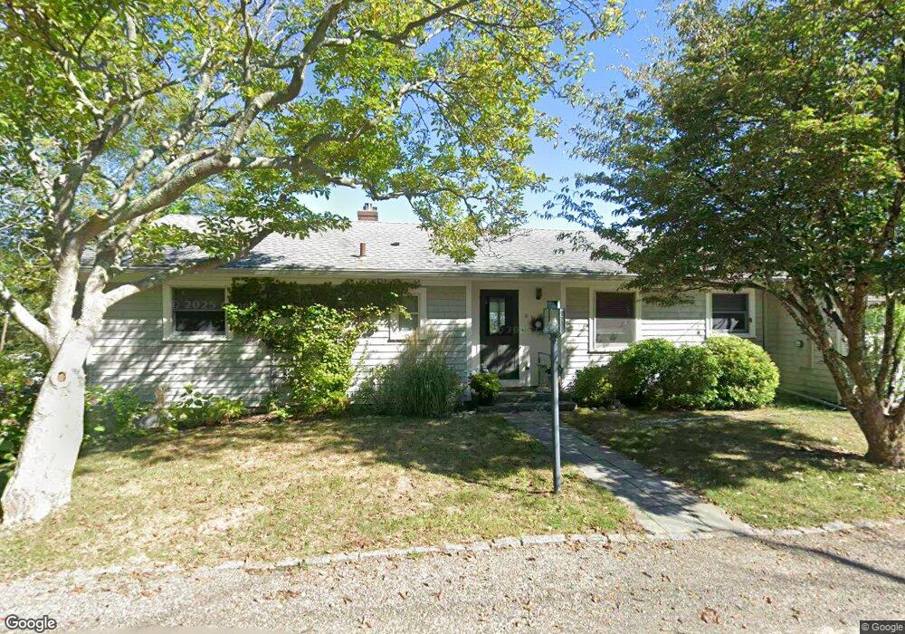
4 Pasture Rd Rockport, MA 01966
Estimated Value: $918,000 - $1,124,000
3
Beds
2
Baths
1,558
Sq Ft
$638/Sq Ft
Est. Value
About This Home
This home is located at 4 Pasture Rd, Rockport, MA 01966 and is currently estimated at $994,233, approximately $638 per square foot. 4 Pasture Rd is a home located in Essex County with nearby schools including Rockport Elementary School, Rockport Middle School, and Rockport High School.
Ownership History
Date
Name
Owned For
Owner Type
Purchase Details
Closed on
Dec 5, 2008
Sold by
Pardee Michael J and Pardee Mary Alice
Bought by
Pardee Tr Michael J
Current Estimated Value
Purchase Details
Closed on
Jun 3, 1994
Sold by
Anderson George and Anderson Jean B
Bought by
Pardee Michael J and Pardee Mary Alice
Purchase Details
Closed on
Oct 3, 1990
Sold by
Cape Ann Sb
Bought by
Pardee Michael J
Create a Home Valuation Report for This Property
The Home Valuation Report is an in-depth analysis detailing your home's value as well as a comparison with similar homes in the area
Home Values in the Area
Average Home Value in this Area
Purchase History
| Date | Buyer | Sale Price | Title Company |
|---|---|---|---|
| Pardee Tr Michael J | -- | -- | |
| Pardee Tr Michael J | -- | -- | |
| Pardee Michael J | $23,000 | -- | |
| Pardee Michael J | $23,000 | -- | |
| Pardee Michael J | $200,000 | -- |
Source: Public Records
Mortgage History
| Date | Status | Borrower | Loan Amount |
|---|---|---|---|
| Open | Pardee Michael J | $20,000 | |
| Previous Owner | Pardee Michael J | $20,000 | |
| Previous Owner | Pardee Michael J | $125,500 |
Source: Public Records
Tax History Compared to Growth
Tax History
| Year | Tax Paid | Tax Assessment Tax Assessment Total Assessment is a certain percentage of the fair market value that is determined by local assessors to be the total taxable value of land and additions on the property. | Land | Improvement |
|---|---|---|---|---|
| 2025 | $6,829 | $779,600 | $353,900 | $425,700 |
| 2024 | $6,422 | $762,700 | $337,000 | $425,700 |
| 2023 | $6,241 | $661,800 | $280,900 | $380,900 |
| 2022 | $5,794 | $590,000 | $250,000 | $340,000 |
| 2021 | $5,474 | $562,000 | $238,100 | $323,900 |
| 2020 | $5,620 | $556,400 | $268,000 | $288,400 |
| 2019 | $5,280 | $535,500 | $262,900 | $272,600 |
| 2018 | $5,201 | $514,400 | $262,900 | $251,500 |
| 2017 | $4,990 | $442,400 | $238,400 | $204,000 |
| 2016 | $4,902 | $435,700 | $231,700 | $204,000 |
| 2015 | $4,773 | $433,900 | $231,700 | $202,200 |
| 2014 | $4,506 | $399,800 | $208,600 | $191,200 |
Source: Public Records
Map
Nearby Homes
- 2 Wharf Rd
- 2 Boulder Top
- 13 Rowe Point
- 165 Granite St
- 26 Quarry Ridge Ln
- 1 Doctors Run
- 25 Stockholm Ave
- 13 Phillips Ave
- 63R Main St Unit 2
- 36 Broadway Ave
- 123 Main St Unit 2
- 2 Mount Pleasant St Unit 3
- 15 High St Unit D
- 135 A&B Main St
- 4 Norwood Ave
- 5 Allen Ave
- 5 Marshall Ln
- 13 Pleasant St Unit 3
- 57 Mt Pleasant St Unit 2B
- 34 Mount Pleasant St
- 66 Granite St
- 68 Granite St
- 60 Granite St
- 5 Pasture Rd
- 58 Granite St
- 105 Granite St Unit 6
- 105 Granite St Unit 5
- 105 Granite St Unit 4
- 105 Granite St Unit 3
- 105 Granite St Unit 2
- 105 Granite St Unit 1
- 105 Granite St Unit 2-105
- 74 Granite St
- 74 Granite St Unit 1
- 6 Pasture Rd
- 6 Pasture Rd Unit B
- 6 Pasture Rd Unit 6B
- 1 Pasture Rd
- 6B Pasture Rd Unit 1
- 6B Pasture Rd