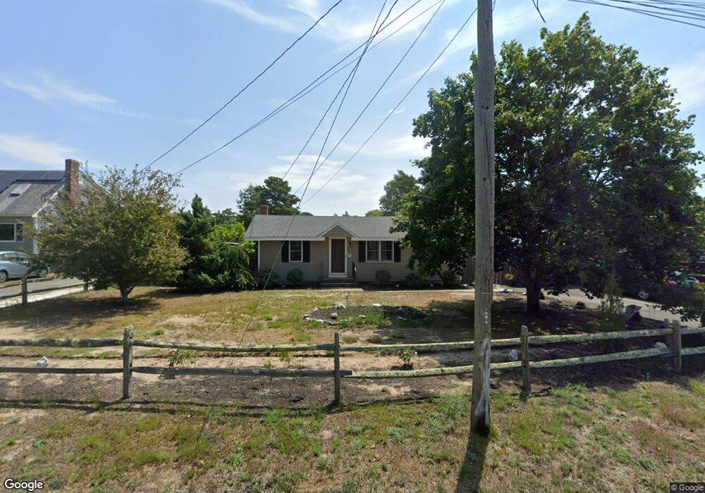
4 Pheasant Ave Wareham, MA 02571
Estimated Value: $382,944 - $420,000
2
Beds
1
Bath
720
Sq Ft
$566/Sq Ft
Est. Value
About This Home
This home is located at 4 Pheasant Ave, Wareham, MA 02571 and is currently estimated at $407,236, approximately $565 per square foot. 4 Pheasant Ave is a home located in Plymouth County.
Ownership History
Date
Name
Owned For
Owner Type
Purchase Details
Closed on
Sep 24, 2004
Sold by
Fontanez Antonio and Fontanez Helen
Bought by
King Gabriel A and King Shelley M
Current Estimated Value
Home Financials for this Owner
Home Financials are based on the most recent Mortgage that was taken out on this home.
Original Mortgage
$179,920
Interest Rate
5.89%
Mortgage Type
Purchase Money Mortgage
Create a Home Valuation Report for This Property
The Home Valuation Report is an in-depth analysis detailing your home's value as well as a comparison with similar homes in the area
Purchase History
| Date | Buyer | Sale Price | Title Company |
|---|---|---|---|
| King Gabriel A | $224,900 | -- | |
| King Gabriel A | $224,900 | -- |
Source: Public Records
Mortgage History
| Date | Status | Borrower | Loan Amount |
|---|---|---|---|
| Open | King Gabriel A | $222,500 | |
| Closed | King Gabriel A | $179,920 |
Source: Public Records
Tax History
| Year | Tax Paid | Tax Assessment Tax Assessment Total Assessment is a certain percentage of the fair market value that is determined by local assessors to be the total taxable value of land and additions on the property. | Land | Improvement |
|---|---|---|---|---|
| 2025 | $3,147 | $302,000 | $111,600 | $190,400 |
| 2024 | $3,143 | $279,900 | $87,700 | $192,200 |
| 2023 | $2,861 | $250,800 | $79,700 | $171,100 |
| 2022 | $2,861 | $217,100 | $79,700 | $137,400 |
| 2021 | $2,835 | $210,800 | $79,700 | $131,100 |
| 2020 | $2,655 | $200,200 | $79,700 | $120,500 |
| 2019 | $2,556 | $192,300 | $78,700 | $113,600 |
| 2018 | $2,426 | $178,000 | $78,700 | $99,300 |
| 2017 | $2,303 | $171,200 | $78,700 | $92,500 |
| 2016 | $2,140 | $158,200 | $78,400 | $79,800 |
| 2015 | $2,068 | $158,200 | $78,400 | $79,800 |
| 2014 | $1,940 | $151,000 | $74,500 | $76,500 |
Source: Public Records
Map
Nearby Homes
- 2711 Cranberry Hwy
- 2697 Cranberry Hwy Unit 21
- 2743 Cranberry Hwy Unit 5D
- 156 Sandwich Rd
- 2645 Cranberry Hwy Unit A
- 12 Oakdale St
- 12 Linwood Ave
- 110 Mayflower Ridge Dr
- 10 Oak St
- 2838 Cranberry Hwy
- 0 Charge Pond Rd
- 437 Main St
- 124 Minot Ave Unit 1
- 7 Knowles Ave
- 9 Old Glen Charlie Rd
- 91 Agawam Lake Shore Dr
- 1 Nimrod Way
- 7 Cranberry Ln
- 10 Longmeadow Dr
- 6 Bourne Terrace
- 2 Pheasant Ave
- 23 Whipoorwill Way
- 21 Whipoorwill Way
- 5 Pheasant Ave Unit 1/A
- 5 Pheasant Ave
- 5 Pheasant Ave Unit 4
- 5 Pheasant Ave Unit 3
- 5 Pheasant Ave Unit 2
- 5 Pheasant Ave Unit 1
- 5 Pheasant Ave Unit 3
- 5 Pheasant Ave Unit 4
- 5 Pheasant Ave Unit 3
- 5 Pheasant Ave Unit 1
- 5 Pheasant Ave Unit 5
- 3 Pheasant Ave
- 19 Whippoorwill Way
- 19 Whipoorwill Way
- 1 Pheasant Ave
- 18 Whipoorwill Way
- 16 Whippoorwill Way
Your Personal Tour Guide
Ask me questions while you tour the home.