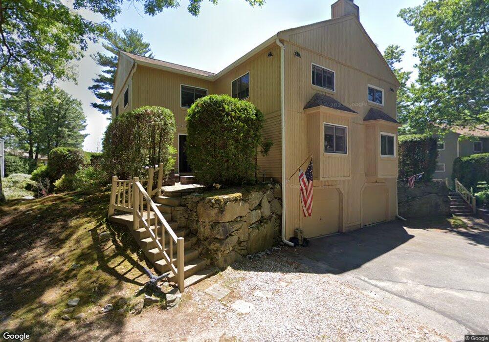
4 Princess Path Uxbridge, MA 01569
Estimated Value: $351,000 - $371,000
2
Beds
2
Baths
1,339
Sq Ft
$271/Sq Ft
Est. Value
About This Home
This home is located at 4 Princess Path, Uxbridge, MA 01569 and is currently estimated at $362,386, approximately $270 per square foot. 4 Princess Path is a home located in Worcester County with nearby schools including Uxbridge High School and Our Lady of the Valley Regional School.
Ownership History
Date
Name
Owned For
Owner Type
Purchase Details
Closed on
Feb 29, 2024
Sold by
Macdonald Daniel A and Macdonald Kathy A
Bought by
Macdonald
Current Estimated Value
Purchase Details
Closed on
Jul 27, 1999
Sold by
Larkin Edward W and Larkin Edward D
Bought by
Macdonald Daniel A and Macdonald Kathy A
Home Financials for this Owner
Home Financials are based on the most recent Mortgage that was taken out on this home.
Original Mortgage
$30,000
Interest Rate
7.61%
Create a Home Valuation Report for This Property
The Home Valuation Report is an in-depth analysis detailing your home's value as well as a comparison with similar homes in the area
Home Values in the Area
Average Home Value in this Area
Purchase History
| Date | Buyer | Sale Price | Title Company |
|---|---|---|---|
| Macdonald | -- | None Available | |
| Macdonald Daniel A | $104,500 | -- |
Source: Public Records
Mortgage History
| Date | Status | Borrower | Loan Amount |
|---|---|---|---|
| Previous Owner | Macdonald Daniel A | $60,000 | |
| Previous Owner | Macdonald Daniel A | $8,000 | |
| Previous Owner | Macdonald Daniel A | $30,000 | |
| Previous Owner | Macdonald Daniel A | $60,000 |
Source: Public Records
Tax History
| Year | Tax Paid | Tax Assessment Tax Assessment Total Assessment is a certain percentage of the fair market value that is determined by local assessors to be the total taxable value of land and additions on the property. | Land | Improvement |
|---|---|---|---|---|
| 2025 | $37 | $280,000 | $0 | $280,000 |
| 2024 | $3,603 | $278,900 | $0 | $278,900 |
| 2023 | $3,225 | $231,200 | $0 | $231,200 |
| 2022 | $2,935 | $193,600 | $0 | $193,600 |
| 2021 | $3,093 | $195,500 | $0 | $195,500 |
| 2020 | $3,114 | $186,000 | $0 | $186,000 |
| 2019 | $2,936 | $169,200 | $0 | $169,200 |
| 2018 | $2,787 | $162,300 | $0 | $162,300 |
| 2017 | $2,929 | $172,700 | $0 | $172,700 |
| 2016 | $2,941 | $167,400 | $0 | $167,400 |
| 2015 | $2,913 | $167,400 | $0 | $167,400 |
Source: Public Records
Map
Nearby Homes
- 197 Crownshield Ave Unit 16B
- 197 Crownshield Ave Unit 16A
- 197 Crownshield Ave Unit 16C
- 79 High St
- 5 Peter St Unit D
- 16 Farnum St
- 56 S Main St
- 314 Richardson St
- 86 Hunter Rd
- 61 Spring Hill Dr Unit 61
- 395 High St
- 376 Douglas St
- 11 Summerfield Dr Unit 11
- 223 Mendon St
- 24 Olde Canal Way Unit 24
- 70 Chocolog Rd
- 127 Old Millville Rd
- 145 Mantell Rd
- 169 Mantell Rd
- 137 Mantell Rd
- 2 Princess Path
- 3 Manor House Ln
- 2 Princess Path Unit 2
- 3 Manor House Ln Unit 3
- 4 Princess Path Unit C2
- 1 Manor House Ln
- 6 Princess Path
- 8 Princess Path
- 6 Princess Path Unit 6
- 6 Princess Path Unit 22
- 6 Princess Path Unit D
- 7 Manor House Ln
- 5 Manor House Ln
- 7 Manor House Ln Unit 7
- 7 Manor House Ln
- 2 Manor House Ln
- 2 Manor House Ln Unit 2 21D
- 4 Manor House Ln
- 1 Loyalist Dr
- 10 Highness Dr
Your Personal Tour Guide
Ask me questions while you tour the home.