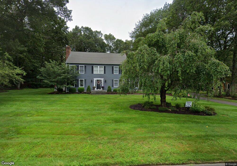
4 Queens Peak Unit 12 Canton, CT 06019
Estimated Value: $749,100 - $879,000
3
Beds
4
Baths
3,079
Sq Ft
$262/Sq Ft
Est. Value
About This Home
This home is located at 4 Queens Peak Unit 12, Canton, CT 06019 and is currently estimated at $805,775, approximately $261 per square foot. 4 Queens Peak Unit 12 is a home located in Hartford County with nearby schools including Roaring Brook School, Thompson Brook School, and Avon Middle School.
Ownership History
Date
Name
Owned For
Owner Type
Purchase Details
Closed on
Jun 30, 2005
Sold by
Williams Chad L
Bought by
Lindquist Eric T and Lindquist Kelly C
Current Estimated Value
Purchase Details
Closed on
Sep 20, 2004
Sold by
Trimble David W and Trimble Christine M
Bought by
Williams Chad L
Create a Home Valuation Report for This Property
The Home Valuation Report is an in-depth analysis detailing your home's value as well as a comparison with similar homes in the area
Home Values in the Area
Average Home Value in this Area
Purchase History
| Date | Buyer | Sale Price | Title Company |
|---|---|---|---|
| Lindquist Eric T | $510,000 | -- | |
| Lindquist Eric T | $510,000 | -- | |
| Williams Chad L | $465,000 | -- | |
| Williams Chad L | $465,000 | -- |
Source: Public Records
Mortgage History
| Date | Status | Borrower | Loan Amount |
|---|---|---|---|
| Open | Williams Chad L | $46,000 | |
| Open | Williams Chad L | $416,666 |
Source: Public Records
Tax History
| Year | Tax Paid | Tax Assessment Tax Assessment Total Assessment is a certain percentage of the fair market value that is determined by local assessors to be the total taxable value of land and additions on the property. | Land | Improvement |
|---|---|---|---|---|
| 2025 | $13,201 | $394,060 | $104,650 | $289,410 |
| 2024 | $13,457 | $394,060 | $104,650 | $289,410 |
| 2023 | $10,021 | $283,320 | $100,100 | $183,220 |
| 2022 | $9,545 | $283,320 | $100,100 | $183,220 |
| 2021 | $9,412 | $283,320 | $100,100 | $183,220 |
| 2020 | $9,233 | $283,320 | $100,100 | $183,220 |
| 2019 | $9,075 | $283,320 | $100,100 | $183,220 |
| 2018 | $9,980 | $325,070 | $105,000 | $220,070 |
| 2017 | $9,911 | $325,070 | $105,000 | $220,070 |
| 2016 | $9,674 | $325,070 | $105,000 | $220,070 |
| 2015 | $9,489 | $325,070 | $105,000 | $220,070 |
| 2014 | $9,284 | $325,070 | $105,000 | $220,070 |
Source: Public Records
Map
Nearby Homes
- 29 Lovely St
- 12 Craigemore Cir
- 30 Cliff Dr
- 48 Weatherstone
- 102 Cold Spring Rd
- 26 Forest Ln
- 61 Weatherstone
- 58 Weatherstone
- 3 Clearwater Ct
- 49 Applegate Ln Unit 49
- 40 E Hill Rd
- 7 Woodmont Rd
- 138 Northington Dr
- 370A W Mountain Rd
- 706 Timber Ln Unit 706
- 187 W Avon Rd
- 4 Tanglewood Dr
- 51 Westland Rd
- 64 Bridge St
- 27 Fernwood Dr
- 6 Queens Peak
- 2 Queens Peak
- 3 Queens Peak
- 0 Queens Peak Unit G577215
- 1 Queens Peak
- 8 Queens Peak
- 7 Queens Peak
- 39 Princeton Dr Unit LOT 79
- 6 Jeff Ln
- 4 Jeff Ln
- 23 Sunrise Dr
- 26 Sunrise Dr
- 28 Sunrise Dr
- 11 Queens Peak
- 0 Princeton Dr
- 31 Pond View Dr
- 24 Sunrise Dr
- 8 Jeff Ln
- 8 Jeffs Ln
- 55 Princeton Dr Unit LOT 81
Your Personal Tour Guide
Ask me questions while you tour the home.