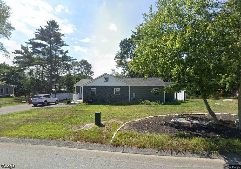
4 Ridge St Unit 1 Berkley, MA 02779
Camp Merriwood/Camp Welch NeighborhoodEstimated Value: $537,000 - $592,000
2
Beds
1
Bath
1,115
Sq Ft
$507/Sq Ft
Est. Value
About This Home
This home is located at 4 Ridge St Unit 1, Berkley, MA 02779 and is currently estimated at $565,265, approximately $506 per square foot. 4 Ridge St Unit 1 is a home located in Bristol County with nearby schools including Berkley Community School.
Ownership History
Date
Name
Owned For
Owner Type
Purchase Details
Closed on
Jan 6, 2025
Sold by
Rivera Dev Group Llc
Bought by
Mcgarty Shawna-Marie and Mcgarty Steven E
Current Estimated Value
Home Financials for this Owner
Home Financials are based on the most recent Mortgage that was taken out on this home.
Original Mortgage
$503,500
Outstanding Balance
$496,850
Interest Rate
6.84%
Mortgage Type
Purchase Money Mortgage
Estimated Equity
$68,415
Purchase Details
Closed on
Dec 18, 2023
Sold by
Oneill George and Freedom Mortgage Corp
Bought by
Rivera Juan
Home Financials for this Owner
Home Financials are based on the most recent Mortgage that was taken out on this home.
Original Mortgage
$320,000
Interest Rate
7.76%
Mortgage Type
Purchase Money Mortgage
Purchase Details
Closed on
Oct 21, 1998
Sold by
Tracy Herbert
Bought by
Oneill George
Home Financials for this Owner
Home Financials are based on the most recent Mortgage that was taken out on this home.
Original Mortgage
$96,000
Interest Rate
6.74%
Mortgage Type
Purchase Money Mortgage
Create a Home Valuation Report for This Property
The Home Valuation Report is an in-depth analysis detailing your home's value as well as a comparison with similar homes in the area
Home Values in the Area
Average Home Value in this Area
Purchase History
We collect this data history from publicly available records. To have your information removed, we recommend requesting removal directly through your county’s website.
| Date | Buyer | Sale Price | Title Company |
|---|---|---|---|
| Mcgarty Shawna-Marie | $530,000 | None Available | |
| Mcgarty Shawna-Marie F | $530,000 | None Available | |
| Rivera Juan | $251,000 | None Available | |
| Rivera Dev Group Llc | -- | None Available | |
| Rivera Dev Group Llc | -- | None Available | |
| Rivera Juan | $251,000 | None Available | |
| Rivera Juan | $251,000 | None Available | |
| Oneill George | $120,000 | -- | |
| Oneill George | $120,000 | -- |
Source: Public Records
Mortgage History
We collect this data history from publicly available records. To have your information removed, we recommend requesting removal directly through your county’s website.
| Date | Status | Borrower | Loan Amount |
|---|---|---|---|
| Open | Mcgarty Shawna-Marie F | $503,500 | |
| Closed | Mcgarty Shawna-Marie F | $503,500 | |
| Previous Owner | Rivera Juan | $320,000 | |
| Previous Owner | Rivera Juan | $0 | |
| Previous Owner | Oneill George | $96,000 |
Source: Public Records
Tax History
| Year | Tax Paid | Tax Assessment Tax Assessment Total Assessment is a certain percentage of the fair market value that is determined by local assessors to be the total taxable value of land and additions on the property. | Land | Improvement |
|---|---|---|---|---|
| 2025 | $50 | $419,200 | $131,800 | $287,400 |
| 2024 | $3,471 | $278,800 | $113,500 | $165,300 |
| 2023 | $3,457 | $261,500 | $113,500 | $148,000 |
| 2022 | $3,325 | $241,800 | $98,700 | $143,100 |
| 2021 | $3,243 | $227,100 | $94,000 | $133,100 |
| 2020 | $3,184 | $219,100 | $83,100 | $136,000 |
| 2019 | $3,112 | $212,600 | $83,100 | $129,500 |
| 2018 | $3,996 | $203,600 | $79,900 | $123,700 |
| 2017 | $3,621 | $199,500 | $89,500 | $110,000 |
| 2016 | $2,790 | $188,000 | $89,500 | $98,500 |
| 2015 | $2,550 | $183,300 | $89,500 | $93,800 |
| 2014 | $2,463 | $192,300 | $97,200 | $95,100 |
Source: Public Records
Map
Nearby Homes
- 526 Pleasant St
- 9 Hillside Ave
- 9 Valley St
- 8 Ferry Ln
- 16 Assonet Blvd
- 43 Cliff Dr
- 430 Hart St
- 1206 Old North St
- 2729/2734 Elm St
- 2165 Pleasant St
- 586 Hart St
- 5455 N Main St Unit 3D
- 5455 N Main St Unit 4D
- 5455 N Main St Unit 4E
- 240 Horizon Way
- 205 Eastview Ave
- 18 Duke St
- 4700 N Main St Unit 1
- 39 Water St
- 16 Water St Unit C
- 4 Ridge St
- 4 Ridge St
- 21 Shore Rd
- 55 Riverside Dr
- 1 Ridge St
- 1 Ridge St
- 1 Ridge St
- 1 Ridge St
- 0 Ridge Rd Unit 72342616
- 0 Ridge Rd Unit 72202332
- 2 Ridge Rd
- Lot 0000 Ridge St
- 49 Riverside Dr
- 63 Riverside Dr
- Lot 000 Ridge St
- Lot 00 Ridge St
- 8 Ridge Rd
- 16 Broadview Ave
- 65 Riverside Dr
- 46 Riverside Drive (Waterfront)
Your Personal Tour Guide
Ask me questions while you tour the home.