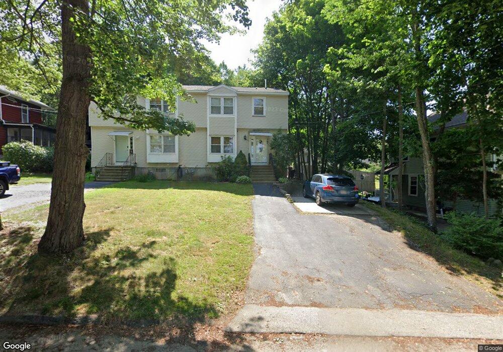
4 Robertson Rd Worcester, MA 01602
West Tatnuck NeighborhoodEstimated Value: $365,000 - $420,000
3
Beds
2
Baths
1,327
Sq Ft
$301/Sq Ft
Est. Value
About This Home
This home is located at 4 Robertson Rd, Worcester, MA 01602 and is currently estimated at $399,168, approximately $300 per square foot. 4 Robertson Rd is a home located in Worcester County with nearby schools including West Tatnuck School, Chandler Magnet, and Jacob Hiatt Magnet School.
Ownership History
Date
Name
Owned For
Owner Type
Purchase Details
Closed on
Sep 25, 2001
Sold by
Setaro Christopher A and Setaro Sharon
Bought by
Kazinik Sergey and Kazinik Nina
Current Estimated Value
Home Financials for this Owner
Home Financials are based on the most recent Mortgage that was taken out on this home.
Original Mortgage
$100,000
Interest Rate
6.98%
Mortgage Type
Purchase Money Mortgage
Purchase Details
Closed on
Mar 3, 1993
Sold by
Fnma
Bought by
Setaro Christopher and Setaro Sharon
Home Financials for this Owner
Home Financials are based on the most recent Mortgage that was taken out on this home.
Original Mortgage
$74,575
Interest Rate
7.96%
Mortgage Type
Purchase Money Mortgage
Create a Home Valuation Report for This Property
The Home Valuation Report is an in-depth analysis detailing your home's value as well as a comparison with similar homes in the area
Home Values in the Area
Average Home Value in this Area
Purchase History
| Date | Buyer | Sale Price | Title Company |
|---|---|---|---|
| Kazinik Sergey | $127,500 | -- | |
| Setaro Christopher | $78,500 | -- |
Source: Public Records
Mortgage History
| Date | Status | Borrower | Loan Amount |
|---|---|---|---|
| Open | Setaro Christopher | $101,500 | |
| Closed | Setaro Christopher | $100,000 | |
| Previous Owner | Setaro Christopher | $74,575 |
Source: Public Records
Tax History
| Year | Tax Paid | Tax Assessment Tax Assessment Total Assessment is a certain percentage of the fair market value that is determined by local assessors to be the total taxable value of land and additions on the property. | Land | Improvement |
|---|---|---|---|---|
| 2025 | $4,701 | $356,400 | $100,600 | $255,800 |
| 2024 | $4,478 | $325,700 | $100,600 | $225,100 |
| 2023 | $4,243 | $295,900 | $87,500 | $208,400 |
| 2022 | $3,810 | $250,500 | $70,000 | $180,500 |
| 2021 | $3,575 | $219,600 | $56,000 | $163,600 |
| 2020 | $3,529 | $207,600 | $56,000 | $151,600 |
| 2019 | $3,395 | $188,600 | $50,400 | $138,200 |
| 2018 | $3,406 | $180,100 | $50,400 | $129,700 |
| 2017 | $3,237 | $168,400 | $50,400 | $118,000 |
| 2016 | $3,155 | $153,100 | $37,600 | $115,500 |
| 2015 | $3,073 | $153,100 | $37,600 | $115,500 |
| 2014 | $2,992 | $153,100 | $37,600 | $115,500 |
Source: Public Records
Map
Nearby Homes
- 21 Baxter St
- 9 Newburn Rd
- 20 Wedgewood Rd
- 23 Tiverton Pkwy
- 432 Mower St
- 8 Sussex Ln
- 58 Wedgewood Rd
- 15 Sunny Hill Dr
- 122 Copperfield Rd
- 148A Tory Fort Ln
- 12 Cardinal Rd
- 47R Yarnie Unit 3A
- 47R Yarnie Unit 1B
- 47R Yarnie Unit 2B
- 47R Yarnie Unit 4B
- 47R Yarnie Unit 8B
- 47R Yarnie Unit 5A
- 47R Yarnie Unit 6B
- 47R Yarnie Unit 4A
- 47R Yarnie Unit 1A
- 6 Robertson Rd
- 3 Robertson Rd
- 3 Robertson Rd Unit B
- 3B Robertson Rd
- 3A Robertson Rd
- 9 Jenkins St
- 11 Jenkins St
- 5 Jenkins St
- 8 Robertson Rd
- 8A Robertson Rd
- 2 Robertson Rd
- 8 Jenkins St
- 10 Robertson Rd
- 1 Jenkins St
- 6 Jenkins St
- 1226 Pleasant St
- 12 Robertson Rd
- 2 Jenkins St
- 1228 Pleasant St
- 1230 Pleasant St
Your Personal Tour Guide
Ask me questions while you tour the home.