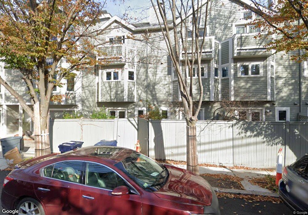
4 Rollins Ct Cambridge, MA 02139
Cambridgeport NeighborhoodEstimated Value: $1,519,987 - $1,692,000
3
Beds
3
Baths
1,927
Sq Ft
$821/Sq Ft
Est. Value
About This Home
This home is located at 4 Rollins Ct, Cambridge, MA 02139 and is currently estimated at $1,582,247, approximately $821 per square foot. 4 Rollins Ct is a home located in Middlesex County with nearby schools including Prospect Hill Academy Charter School.
Ownership History
Date
Name
Owned For
Owner Type
Purchase Details
Closed on
Apr 29, 2022
Sold by
Cattonar Maren M
Bought by
Maren M Cattonar Ret
Current Estimated Value
Purchase Details
Closed on
Mar 9, 2012
Sold by
Carinci Adam J
Bought by
Cattonar Maren M
Home Financials for this Owner
Home Financials are based on the most recent Mortgage that was taken out on this home.
Original Mortgage
$465,750
Interest Rate
3.99%
Mortgage Type
New Conventional
Purchase Details
Closed on
Jul 7, 2011
Sold by
Est Poth Paul P and Palma Kristin L
Bought by
Carinci Adam J and Cattonar Maren M
Home Financials for this Owner
Home Financials are based on the most recent Mortgage that was taken out on this home.
Original Mortgage
$521,600
Interest Rate
4.6%
Mortgage Type
Purchase Money Mortgage
Purchase Details
Closed on
Dec 12, 2006
Sold by
Poth Paul P and Palma Kristen
Bought by
Palma Kristen L and Poth Paul P
Purchase Details
Closed on
Feb 14, 2002
Sold by
Relocation Prudential
Bought by
Poth Paul P and Palma Kristen
Home Financials for this Owner
Home Financials are based on the most recent Mortgage that was taken out on this home.
Original Mortgage
$300,700
Interest Rate
7.14%
Mortgage Type
Purchase Money Mortgage
Purchase Details
Closed on
Apr 29, 1999
Sold by
Skinner Robert A and Skinner Jody C
Bought by
Tahn Albert
Home Financials for this Owner
Home Financials are based on the most recent Mortgage that was taken out on this home.
Original Mortgage
$31,400
Interest Rate
6.88%
Purchase Details
Closed on
Apr 22, 1996
Sold by
Friedman Lawrence S
Bought by
Skinner Robert A and Collins-Skinner Jody
Home Financials for this Owner
Home Financials are based on the most recent Mortgage that was taken out on this home.
Original Mortgage
$199,500
Interest Rate
7.34%
Mortgage Type
Purchase Money Mortgage
Purchase Details
Closed on
Sep 13, 1988
Sold by
Rollins Court Rt
Bought by
Friedman Lawrence S
Home Financials for this Owner
Home Financials are based on the most recent Mortgage that was taken out on this home.
Original Mortgage
$160,000
Interest Rate
10.43%
Mortgage Type
Purchase Money Mortgage
Create a Home Valuation Report for This Property
The Home Valuation Report is an in-depth analysis detailing your home's value as well as a comparison with similar homes in the area
Home Values in the Area
Average Home Value in this Area
Purchase History
| Date | Buyer | Sale Price | Title Company |
|---|---|---|---|
| Maren M Cattonar Ret | -- | None Available | |
| Cattonar Maren M | -- | -- | |
| Carinci Adam J | $652,000 | -- | |
| Palma Kristen L | -- | -- | |
| Poth Paul P | $545,000 | -- | |
| Relocation Prudential | $545,000 | -- | |
| Tahn Albert | $315,000 | -- | |
| Skinner Robert A | $210,000 | -- | |
| Friedman Lawrence S | $260,000 | -- |
Source: Public Records
Mortgage History
| Date | Status | Borrower | Loan Amount |
|---|---|---|---|
| Previous Owner | Cattonar Maren M | $465,750 | |
| Previous Owner | Carinci Adam J | $521,600 | |
| Previous Owner | Poth Paul P | $300,700 | |
| Previous Owner | Friedman Lawrence S | $31,400 | |
| Previous Owner | Friedman Lawrence S | $252,000 | |
| Previous Owner | Friedman Lawrence S | $199,500 | |
| Previous Owner | Friedman Lawrence S | $160,000 |
Source: Public Records
Tax History
| Year | Tax Paid | Tax Assessment Tax Assessment Total Assessment is a certain percentage of the fair market value that is determined by local assessors to be the total taxable value of land and additions on the property. | Land | Improvement |
|---|---|---|---|---|
| 2025 | $8,264 | $1,301,400 | $0 | $1,301,400 |
| 2024 | $7,604 | $1,284,500 | $0 | $1,284,500 |
| 2023 | $7,032 | $1,200,000 | $0 | $1,200,000 |
| 2022 | $6,762 | $1,142,300 | $0 | $1,142,300 |
| 2021 | $6,414 | $1,096,400 | $0 | $1,096,400 |
| 2020 | $5,935 | $1,032,100 | $0 | $1,032,100 |
| 2019 | $5,703 | $960,100 | $0 | $960,100 |
| 2018 | $5,562 | $884,200 | $0 | $884,200 |
| 2017 | $5,474 | $843,500 | $0 | $843,500 |
| 2016 | $5,255 | $751,800 | $0 | $751,800 |
| 2015 | $5,673 | $725,400 | $0 | $725,400 |
| 2014 | $5,618 | $670,400 | $0 | $670,400 |
Source: Public Records
Map
Nearby Homes
- 6 Watson St Unit 1
- 104-106 Auburn St
- 127 Auburn St
- 129 Auburn St
- 62 Pearl St
- 172-174 Auburn St Unit 3
- 280 Green St
- 10 Corporal McTernan St Unit 406
- 39 Cottage St
- 300 Franklin St Unit 5
- 300 Franklin St Unit 1
- 174 Hamilton St
- 260 Brookline St Unit 1
- 13 Howard St Unit 1
- 149A Bishop Allen Unit A
- 7 Marvin Place
- 260 Sidney St Unit 3R
- 860 Massachusetts Ave Unit 852-3
- 872 Massachusetts Ave Unit 303
- 863 Massachusetts Ave Unit 25
- 9 Rollins Ct Unit 9
- 10 Rollins Ct
- 9 Rollins Ct
- 8 Rollins Ct
- 7 Rollins Ct
- 6 Rollins Ct
- 5 Rollins Ct
- 3 Rollins Ct
- 27 Lopez St
- 10 Rollins Ct Unit 10
- 6 Rollins Ct Unit 6
- 9 Rollins Ct Unit 1
- 27 Lopez St Unit 27
- 27 Lopez St Unit 2
- 11 Rollins Ct
- 12 Watson St Unit B
- 12 Watson St Unit A
- 12B Watson St
- 12 Watson St Unit 1
- 12B Watson St
Your Personal Tour Guide
Ask me questions while you tour the home.