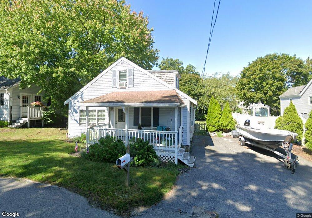
4 Roslin Rd Scituate, MA 02066
Estimated Value: $542,000 - $819,000
3
Beds
2
Baths
1,050
Sq Ft
$641/Sq Ft
Est. Value
About This Home
This home is located at 4 Roslin Rd, Scituate, MA 02066 and is currently estimated at $672,868, approximately $640 per square foot. 4 Roslin Rd is a home located in Plymouth County with nearby schools including Jenkins Elementary School, Lester J. Gates Middle School, and Scituate High School.
Ownership History
Date
Name
Owned For
Owner Type
Purchase Details
Closed on
Mar 24, 2021
Sold by
Fuller Richard F
Bought by
Fuller Adam and Fuller Danae
Current Estimated Value
Purchase Details
Closed on
May 21, 2010
Sold by
Callahan Libby and Callahan John J
Bought by
Fuller Adam and Fuller Danae
Home Financials for this Owner
Home Financials are based on the most recent Mortgage that was taken out on this home.
Original Mortgage
$314,761
Interest Rate
3.75%
Mortgage Type
FHA
Purchase Details
Closed on
Jul 30, 2004
Sold by
Cordner Darcy J
Bought by
Callahan Libby and Callahan John J
Purchase Details
Closed on
Apr 1, 1994
Sold by
Mee Marie L
Bought by
Cordner Darcy J
Purchase Details
Closed on
Aug 12, 1993
Sold by
Fhlmc
Bought by
Callahan John J
Purchase Details
Closed on
Oct 31, 1990
Sold by
Mee Kenneth E
Bought by
Mee Marie L
Create a Home Valuation Report for This Property
The Home Valuation Report is an in-depth analysis detailing your home's value as well as a comparison with similar homes in the area
Home Values in the Area
Average Home Value in this Area
Purchase History
| Date | Buyer | Sale Price | Title Company |
|---|---|---|---|
| Fuller Adam | -- | None Available | |
| Fuller Adam | $319,000 | -- | |
| Callahan Libby | $315,000 | -- | |
| Cordner Darcy J | $135,000 | -- | |
| Callahan John J | $21,500 | -- | |
| Mee Marie L | $15,000 | -- |
Source: Public Records
Mortgage History
| Date | Status | Borrower | Loan Amount |
|---|---|---|---|
| Previous Owner | Fuller Adam | $314,761 | |
| Previous Owner | Mee Marie L | $282,000 | |
| Previous Owner | Mee Marie L | $252,000 |
Source: Public Records
Tax History Compared to Growth
Tax History
| Year | Tax Paid | Tax Assessment Tax Assessment Total Assessment is a certain percentage of the fair market value that is determined by local assessors to be the total taxable value of land and additions on the property. | Land | Improvement |
|---|---|---|---|---|
| 2025 | $4,286 | $429,000 | $351,200 | $77,800 |
| 2024 | $4,145 | $400,100 | $319,300 | $80,800 |
| 2023 | $4,254 | $382,300 | $306,400 | $75,900 |
| 2022 | $4,254 | $337,100 | $266,700 | $70,400 |
| 2021 | $4,211 | $315,900 | $254,000 | $61,900 |
| 2020 | $4,131 | $306,000 | $244,200 | $61,800 |
| 2019 | $4,127 | $300,400 | $239,400 | $61,000 |
| 2018 | $4,292 | $307,700 | $244,200 | $63,500 |
| 2017 | $4,192 | $297,500 | $234,000 | $63,500 |
| 2016 | $3,918 | $277,100 | $213,600 | $63,500 |
| 2015 | $3,498 | $267,000 | $203,500 | $63,500 |
Source: Public Records
Map
Nearby Homes
- 76 A Brook St
- 76 A Brook St Unit 1
- 50 First Parish Rd
- 74 Tilden Rd
- 12 Meeting House Ln Unit 308
- 91 Front St Unit 106
- 111 Elm St
- 67 Greenfield Ln
- 115 Elm St
- 59 Greenfield Ln
- 148 Tilden Rd
- 18 James Way
- 12 Richfield Rd
- 290 Beaver Dam Rd
- 32 Barker Rd Unit 3
- 12 Sassamon Rd
- 19 Ford Place Unit 3
- 19 Ford Place Unit 1
- 19 Ford Place Unit 4
- 29 Ladds Way Unit 29
- 6 Roslin Rd
- 125 First Parish Rd
- 123 First Parish Rd
- 125 First Parish Rd Unit 1
- 5 Roslin Rd
- 121 First Parish Rd
- 45 Station St
- 119 First Parish Rd
- 3 Chester St
- 129 First Parish Rd
- 2 Chester St
- 136 First Parish Rd
- 67 Station St
- 67 Common St
- 8 Stone Rd
- 30 Station St
- 140 First Parish Rd
- 20 Station St
- 15 Stone Rd
- 56 Station St