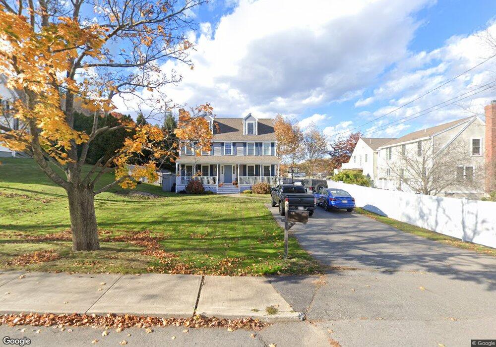
4 Rowell St Amesbury, MA 01913
Estimated Value: $669,000 - $754,000
5
Beds
2
Baths
1,901
Sq Ft
$375/Sq Ft
Est. Value
About This Home
This home is located at 4 Rowell St, Amesbury, MA 01913 and is currently estimated at $712,414, approximately $374 per square foot. 4 Rowell St is a home located in Essex County with nearby schools including Amesbury High School and Amesbury Seventh-Day Adventist School.
Ownership History
Date
Name
Owned For
Owner Type
Purchase Details
Closed on
May 29, 2015
Sold by
Maguire Todd
Bought by
Castro Katherine
Current Estimated Value
Home Financials for this Owner
Home Financials are based on the most recent Mortgage that was taken out on this home.
Original Mortgage
$161,500
Outstanding Balance
$123,918
Interest Rate
3.65%
Mortgage Type
New Conventional
Estimated Equity
$588,496
Purchase Details
Closed on
May 1, 1997
Sold by
Mccarthy John M and Mccarthy Linda D
Bought by
Digrazia Joseph A and Digrazia Jennifer E
Purchase Details
Closed on
Feb 15, 1995
Sold by
Bradku Rt
Bought by
Mccarthy John M and Mccarthy Linda
Purchase Details
Closed on
Apr 9, 1992
Sold by
Gray Robert J
Bought by
Costello Christopher and Costello Brenda
Create a Home Valuation Report for This Property
The Home Valuation Report is an in-depth analysis detailing your home's value as well as a comparison with similar homes in the area
Home Values in the Area
Average Home Value in this Area
Purchase History
| Date | Buyer | Sale Price | Title Company |
|---|---|---|---|
| Castro Katherine | $190,000 | -- | |
| Digrazia Joseph A | $185,000 | -- | |
| Mccarthy John M | $172,000 | -- | |
| Costello Christopher | $87,000 | -- |
Source: Public Records
Mortgage History
| Date | Status | Borrower | Loan Amount |
|---|---|---|---|
| Open | Castro Katherine | $161,500 | |
| Previous Owner | Costello Christopher | $135,000 | |
| Previous Owner | Costello Christopher | $154,000 | |
| Previous Owner | Costello Christopher | $157,000 |
Source: Public Records
Tax History Compared to Growth
Tax History
| Year | Tax Paid | Tax Assessment Tax Assessment Total Assessment is a certain percentage of the fair market value that is determined by local assessors to be the total taxable value of land and additions on the property. | Land | Improvement |
|---|---|---|---|---|
| 2025 | $9,377 | $612,900 | $213,900 | $399,000 |
| 2024 | $9,151 | $585,100 | $201,800 | $383,300 |
| 2023 | $8,360 | $511,600 | $175,400 | $336,200 |
| 2022 | $7,994 | $451,900 | $152,500 | $299,400 |
| 2021 | $7,479 | $409,800 | $117,800 | $292,000 |
| 2020 | $6,621 | $385,400 | $113,300 | $272,100 |
| 2019 | $6,861 | $373,500 | $113,300 | $260,200 |
| 2018 | $6,580 | $346,500 | $107,900 | $238,600 |
| 2017 | $6,739 | $337,800 | $107,900 | $229,900 |
| 2016 | $6,646 | $327,700 | $107,900 | $219,800 |
| 2015 | $6,503 | $316,600 | $107,900 | $208,700 |
| 2014 | $6,312 | $301,000 | $107,900 | $193,100 |
Source: Public Records
Map
Nearby Homes
- 105 Market St Unit B
- 3 Arlington St
- 103 Market St Unit A
- 101 Market St Unit B
- 101 Market St Unit A
- 25 Cedar St Unit 4
- 25 Cedar St Unit 14
- 25 Cedar St Unit 7
- 25 Cedar St Unit 3
- 57 Clinton St
- 48 Orchard St
- 4 Clark St
- 97 Elm St
- 13 High St Unit 2
- 5 Richs Ct Unit 3
- 1 Brown Ave Unit 1-37
- 1 Brown Ave Unit 3-80
- 37 Millyard Unit 204
- 118 Elm St
- 25 Whittier Meadows Dr
- 14 S Hampton Rd
- 15 S Hampton Rd Unit A
- 15 S Hampton Rd Unit B
- 3 Rowell St
- 10 Rowell St
- 12 S Hampton Rd
- 12 S Hampton Rd
- 12 S Hampton Rd Unit 12
- 5 Rowell St
- 17 S Hampton Rd
- 9 S Hampton Rd
- 13 S Hampton Rd
- 10 S Hampton Rd
- 7 Rowell St
- 19 S Hampton Rd
- 8 S Hampton Rd
- 9 Rowell St
- 7 S Hampton Rd
- 130 Market St Unit A
- 138 Market St