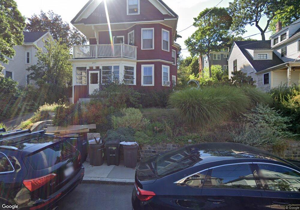
4 Sheldon St Unit 2 Roslindale, MA 02131
Roslindale NeighborhoodEstimated Value: $634,000 - $802,000
4
Beds
2
Baths
1,756
Sq Ft
$395/Sq Ft
Est. Value
About This Home
This home is located at 4 Sheldon St Unit 2, Roslindale, MA 02131 and is currently estimated at $693,322, approximately $394 per square foot. 4 Sheldon St Unit 2 is a home located in Suffolk County with nearby schools including Brooke Charter School Roslindale, Sacred Heart STEM School, and St. Clare High School.
Ownership History
Date
Name
Owned For
Owner Type
Purchase Details
Closed on
Jan 3, 2007
Sold by
Sirva Relocation Crdt
Bought by
Lester Aaron and Barrali Kristin
Current Estimated Value
Home Financials for this Owner
Home Financials are based on the most recent Mortgage that was taken out on this home.
Original Mortgage
$292,000
Outstanding Balance
$169,397
Interest Rate
6.24%
Mortgage Type
Purchase Money Mortgage
Estimated Equity
$523,925
Create a Home Valuation Report for This Property
The Home Valuation Report is an in-depth analysis detailing your home's value as well as a comparison with similar homes in the area
Home Values in the Area
Average Home Value in this Area
Purchase History
| Date | Buyer | Sale Price | Title Company |
|---|---|---|---|
| Lester Aaron | $365,000 | -- | |
| Sirva Relocation Crdt | $365,000 | -- |
Source: Public Records
Mortgage History
| Date | Status | Borrower | Loan Amount |
|---|---|---|---|
| Open | Lester Aaron | $292,000 |
Source: Public Records
Tax History
| Year | Tax Paid | Tax Assessment Tax Assessment Total Assessment is a certain percentage of the fair market value that is determined by local assessors to be the total taxable value of land and additions on the property. | Land | Improvement |
|---|---|---|---|---|
| 2025 | $7,337 | $633,600 | $0 | $633,600 |
| 2024 | $4,820 | $442,200 | $0 | $442,200 |
| 2023 | $4,519 | $420,800 | $0 | $420,800 |
| 2022 | $4,269 | $392,400 | $0 | $392,400 |
| 2021 | $3,913 | $366,700 | $0 | $366,700 |
| 2020 | $3,443 | $326,000 | $0 | $326,000 |
| 2019 | $3,272 | $310,440 | $0 | $310,440 |
| 2018 | $2,654 | $253,200 | $0 | $253,200 |
| 2017 | $2,554 | $241,200 | $0 | $241,200 |
| 2016 | $2,412 | $219,300 | $0 | $219,300 |
| 2015 | $2,726 | $225,100 | $0 | $225,100 |
| 2014 | $2,659 | $211,400 | $0 | $211,400 |
Source: Public Records
Map
Nearby Homes
- 132 Sycamore St
- 23 Rowe St Unit 23 Rowe
- 472 Hyde Park Ave Unit 472
- 68 Rowe St Unit 3
- 68 Rowe St Unit 2
- 375 Hyde Park Ave Unit 3
- 167 Poplar St Unit 1
- 61 Fawndale Rd
- 543 Hyde Park Ave Unit 1
- 16 Hilburn Place
- 626 South St
- 4 Albano St Unit 2
- 4 Rowe Ct
- 8 Hillview Ave
- 14 Whitford St
- 46 Belgrade Ave Unit 2
- 11 S Fairview St Unit 2R
- 19 Delford St
- 60 Stella Rd
- 18 Robert St Unit 4
- 4 Sheldon St Unit 1
- 2 Sheldon St
- 2 Sheldon St Unit 2
- 2 Sheldon St Unit 1
- 2 1/2 Sheldon St
- 6 Sheldon St
- 48 Sherwood St
- 8 Sheldon St
- 40 Sherwood St
- 40 Sherwood St Unit 2
- 40 Sherwood St Unit 1
- 5 Sheldon St
- 3 Sheldon St
- 10 Sheldon St
- 10 Sheldon St Unit 2
- 7 Sheldon St
- 1 Sheldon St
- 9 Sheldon St
- 34 Sherwood St
- 12 Sheldon St Unit 1
Your Personal Tour Guide
Ask me questions while you tour the home.