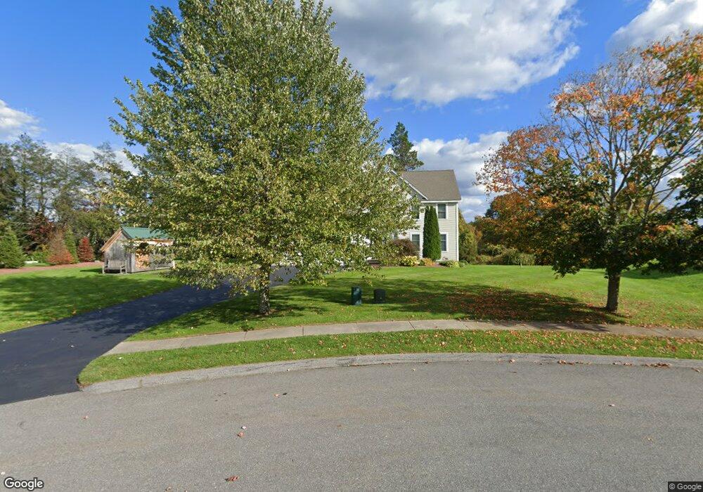
4 Thomas Ln Sterling, MA 01564
Estimated Value: $675,243 - $1,049,000
4
Beds
3
Baths
2,467
Sq Ft
$327/Sq Ft
Est. Value
About This Home
This home is located at 4 Thomas Ln, Sterling, MA 01564 and is currently estimated at $806,061, approximately $326 per square foot. 4 Thomas Ln is a home located in Worcester County with nearby schools including Wachusett Regional High School and South Lancaster Academy.
Ownership History
Date
Name
Owned For
Owner Type
Purchase Details
Closed on
Aug 4, 2010
Sold by
Dboss & Son Builders Inc
Bought by
Kershaw Michael J and Kershaw Sharon L
Current Estimated Value
Home Financials for this Owner
Home Financials are based on the most recent Mortgage that was taken out on this home.
Original Mortgage
$299,000
Outstanding Balance
$198,016
Interest Rate
4.73%
Mortgage Type
Purchase Money Mortgage
Estimated Equity
$608,045
Create a Home Valuation Report for This Property
The Home Valuation Report is an in-depth analysis detailing your home's value as well as a comparison with similar homes in the area
Home Values in the Area
Average Home Value in this Area
Purchase History
| Date | Buyer | Sale Price | Title Company |
|---|---|---|---|
| Kershaw Michael J | $384,900 | -- |
Source: Public Records
Mortgage History
| Date | Status | Borrower | Loan Amount |
|---|---|---|---|
| Open | Kershaw Michael J | $299,000 |
Source: Public Records
Tax History
| Year | Tax Paid | Tax Assessment Tax Assessment Total Assessment is a certain percentage of the fair market value that is determined by local assessors to be the total taxable value of land and additions on the property. | Land | Improvement |
|---|---|---|---|---|
| 2025 | $8,203 | $636,900 | $142,300 | $494,600 |
| 2024 | $7,981 | $599,600 | $137,500 | $462,100 |
| 2023 | $7,588 | $530,600 | $130,400 | $400,200 |
| 2022 | $7,000 | $459,000 | $120,800 | $338,200 |
| 2021 | $6,983 | $422,700 | $118,600 | $304,100 |
| 2020 | $7,025 | $417,900 | $129,400 | $288,500 |
| 2019 | $6,708 | $388,400 | $129,400 | $259,000 |
| 2018 | $6,558 | $373,900 | $118,500 | $255,400 |
| 2017 | $6,503 | $360,700 | $108,800 | $251,900 |
| 2016 | $6,386 | $348,400 | $108,800 | $239,600 |
| 2015 | $6,133 | $354,700 | $126,100 | $228,600 |
| 2014 | $5,898 | $348,400 | $126,100 | $222,300 |
Source: Public Records
Map
Nearby Homes
- 96 Clinton Rd
- 54 S Meadow Rd
- 6A Patriots Way Unit 37
- 121 &125 Flanagan Hill Rd
- 0 Magnolia Ave
- 134 Leominster Rd
- 37 Sterling St
- 300 Greeley St
- 113 Parker Rd Unit 1
- 0 Parker Rd
- 20 Willow St
- 2 Turtle Ln Unit 2
- 73 Prescott St
- 18 Highfield Dr
- 76 Mill St Unit 3
- 2 Lydia Ln
- 51 Rigby St
- 132 Kilbourn Rd
- 861 Main St
- 25 Greeley St Unit 2
- 4 Thomas Ln Unit 1
- 4 Thomas Ln
- 4 Thomas Ln
- 6 Thomas Ln
- 2 Thomas Ln
- LOT6 Thomas Ln
- 6 Thomas Ln
- 177 Clinton Rd
- 177 Clinton Rd
- 181 Clinton Rd Unit 2
- 181 Clinton Rd
- 181 Clinton Rd Unit C
- 181 Clinton Rd Unit B
- 181 Clinton Rd Unit First Floor
- 3 Thomas Ln
- 3 Thomas Ln
- 3A Thomas Ln
- 3 Thomas Ln
- 175 Clinton Rd
- 175 Clinton Rd
Your Personal Tour Guide
Ask me questions while you tour the home.