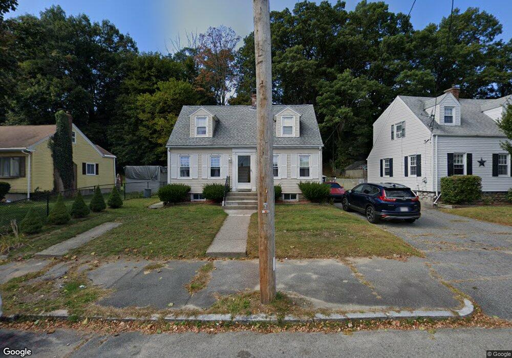
4 Varnum St Worcester, MA 01603
Webster Square NeighborhoodEstimated Value: $236,000 - $352,000
2
Beds
1
Bath
900
Sq Ft
$351/Sq Ft
Est. Value
About This Home
This home is located at 4 Varnum St, Worcester, MA 01603 and is currently estimated at $315,675, approximately $350 per square foot. 4 Varnum St is a home located in Worcester County with nearby schools including Gates Lane, Jacob Hiatt Magnet School, and Chandler Magnet.
Ownership History
Date
Name
Owned For
Owner Type
Purchase Details
Closed on
Oct 17, 2011
Sold by
Mcdermott John P
Bought by
Montes-Acosta Luis A
Current Estimated Value
Home Financials for this Owner
Home Financials are based on the most recent Mortgage that was taken out on this home.
Original Mortgage
$136,881
Outstanding Balance
$94,031
Interest Rate
4.25%
Mortgage Type
Purchase Money Mortgage
Estimated Equity
$221,644
Create a Home Valuation Report for This Property
The Home Valuation Report is an in-depth analysis detailing your home's value as well as a comparison with similar homes in the area
Home Values in the Area
Average Home Value in this Area
Purchase History
| Date | Buyer | Sale Price | Title Company |
|---|---|---|---|
| Montes-Acosta Luis A | $134,000 | -- |
Source: Public Records
Mortgage History
| Date | Status | Borrower | Loan Amount |
|---|---|---|---|
| Open | Montes-Acosta Luis A | $136,881 |
Source: Public Records
Tax History
| Year | Tax Paid | Tax Assessment Tax Assessment Total Assessment is a certain percentage of the fair market value that is determined by local assessors to be the total taxable value of land and additions on the property. | Land | Improvement |
|---|---|---|---|---|
| 2025 | $3,652 | $276,900 | $93,500 | $183,400 |
| 2024 | $3,587 | $260,900 | $93,500 | $167,400 |
| 2023 | $3,430 | $239,200 | $81,300 | $157,900 |
| 2022 | $3,133 | $206,000 | $65,100 | $140,900 |
| 2021 | $2,926 | $179,700 | $52,000 | $127,700 |
| 2020 | $2,853 | $167,800 | $51,700 | $116,100 |
| 2019 | $2,686 | $149,200 | $45,100 | $104,100 |
| 2018 | $2,693 | $142,400 | $45,100 | $97,300 |
| 2017 | $2,550 | $132,700 | $45,100 | $87,600 |
| 2016 | $2,475 | $120,100 | $32,500 | $87,600 |
| 2015 | $2,410 | $120,100 | $32,500 | $87,600 |
| 2014 | $2,347 | $120,100 | $32,500 | $87,600 |
Source: Public Records
Map
Nearby Homes
- 26 Sylvan St
- 103 Henshaw St
- 55 Grandview Ave
- 2 Montague St
- 11 Hulbert Rd Unit 13
- 27 Montague St
- 32 Goddard Memorial Dr
- 35 Genessee St Unit E
- 37 Gates Rd
- 56 Goddard Memorial Dr
- 31 B Gates Rd Unit 22R
- 23 Lakewood St
- 128 Wildwood Ave
- 13 Merchant St
- 215 Mill St Unit 113
- 215 Mill St Unit 115
- 11 Timrod Dr
- 1511 Main St Unit C405
- 57 1st St
- 99 Clover St
- 2 Varnum St
- 6 Varnum St
- 16 Curtis Pkwy
- 10 Varnum St
- 17 Cleveland Ave
- 17 Cleveland Ave Unit 3
- 13 Cleveland Ave Unit 3
- 13 Cleveland Ave Unit 2
- 13 Cleveland Ave Unit 1
- 12 Varnum St
- 23 Cleveland Ave
- 3 Varnum St
- 11 Cleveland Ave
- 29 Cleveland Ave
- 14 Varnum St
- 5 Cleveland Ave
- 5 Varnum St
- 16 Varnum St
- 9 Varnum St
- 3 Cleveland Ave
Your Personal Tour Guide
Ask me questions while you tour the home.