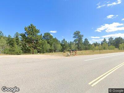
4 Wagener Rd Allenspark, CO 80510
Allenspark NeighborhoodEstimated Value: $493,000 - $527,000
2
Beds
1
Bath
896
Sq Ft
$570/Sq Ft
Est. Value
About This Home
This home is located at 4 Wagener Rd, Allenspark, CO 80510 and is currently estimated at $510,334, approximately $569 per square foot. 4 Wagener Rd is a home located in Boulder County with nearby schools including Estes Park K-5 School, Estes Park Options School, and Estes Park Middle School.
Ownership History
Date
Name
Owned For
Owner Type
Purchase Details
Closed on
Feb 4, 2021
Sold by
Strunk Ronald A and Strunk Janice I
Bought by
Strunk Ronald A and Strunk Janice I
Current Estimated Value
Purchase Details
Closed on
Dec 19, 1997
Sold by
Rider Richard E and Rider Delores I
Bought by
Strunk Ronald A
Purchase Details
Closed on
Jan 5, 1995
Sold by
Strunk Ronald A and Strunk Janice I
Bought by
Strunk Ronald A
Purchase Details
Closed on
Nov 24, 1993
Sold by
Rider Richard E and Rider Delores I
Bought by
Strunk Ronald A
Home Financials for this Owner
Home Financials are based on the most recent Mortgage that was taken out on this home.
Original Mortgage
$39,500
Interest Rate
6.71%
Create a Home Valuation Report for This Property
The Home Valuation Report is an in-depth analysis detailing your home's value as well as a comparison with similar homes in the area
Home Values in the Area
Average Home Value in this Area
Purchase History
| Date | Buyer | Sale Price | Title Company |
|---|---|---|---|
| Strunk Ronald A | -- | None Available | |
| Strunk Ronald A | -- | -- | |
| Strunk Ronald A | -- | -- | |
| Strunk Ronald A | -- | Commonwealth Land Title Ins |
Source: Public Records
Mortgage History
| Date | Status | Borrower | Loan Amount |
|---|---|---|---|
| Previous Owner | Strunk Ronald A | $39,500 |
Source: Public Records
Tax History Compared to Growth
Tax History
| Year | Tax Paid | Tax Assessment Tax Assessment Total Assessment is a certain percentage of the fair market value that is determined by local assessors to be the total taxable value of land and additions on the property. | Land | Improvement |
|---|---|---|---|---|
| 2024 | $1,927 | $32,669 | $1,621 | $31,048 |
| 2023 | $1,927 | $32,669 | $5,306 | $31,048 |
| 2022 | $1,800 | $27,918 | $5,414 | $22,504 |
| 2021 | $1,841 | $28,722 | $5,570 | $23,152 |
| 2020 | $1,550 | $23,767 | $6,364 | $17,403 |
| 2019 | $1,494 | $23,767 | $6,364 | $17,403 |
| 2018 | $1,365 | $21,211 | $6,912 | $14,299 |
| 2017 | $1,351 | $23,451 | $7,642 | $15,809 |
| 2016 | $1,302 | $21,081 | $7,812 | $13,269 |
Source: Public Records
Map
Nearby Homes
- 246 Tahosa Park Rd S
- 177 Bill Waite Rd
- 1217 Big Owl Rd
- 494 N Skinner Rd
- 11563 Peak To Peak Dr
- 287 S Skinner Rd
- 2420 Big Owl Rd
- 1134 Highway 7 Business
- 223 Taylor Rd
- 585 Taylor Rd
- 10 Kittle Ct
- 212 Valley Rd
- 928 Ski Rd
- 138 Moss Brook Rd
- 565 Hemlock Dr
- 0 Hemlock Dr
- 430 Hickory Dr
- 2426 Riverside Dr
- 2637 Riverside Dr
- 3154 Riverside Dr
