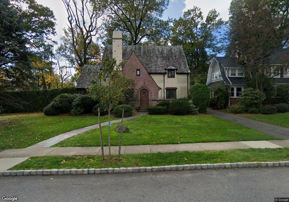
4 Wellesley Rd Montclair, NJ 07043
Estimated Value: $1,620,000 - $1,856,193
Studio
--
Bath
3,268
Sq Ft
$539/Sq Ft
Est. Value
About This Home
This home is located at 4 Wellesley Rd, Montclair, NJ 07043 and is currently estimated at $1,760,298, approximately $538 per square foot. 4 Wellesley Rd is a home located in Essex County with nearby schools including Bradford School, Hillside School, and Nishuane School.
Ownership History
Date
Name
Owned For
Owner Type
Purchase Details
Closed on
Jul 14, 2008
Sold by
Cucurello Nancy Jo
Bought by
Girard David and Girard Stacey
Current Estimated Value
Home Financials for this Owner
Home Financials are based on the most recent Mortgage that was taken out on this home.
Original Mortgage
$289,000
Outstanding Balance
$187,385
Interest Rate
6.17%
Mortgage Type
Purchase Money Mortgage
Estimated Equity
$1,572,913
Purchase Details
Closed on
Feb 23, 1999
Sold by
Vandenroucke Pol
Bought by
Ruhl William and Ruhl Kimberly
Home Financials for this Owner
Home Financials are based on the most recent Mortgage that was taken out on this home.
Original Mortgage
$378,000
Interest Rate
7.02%
Purchase Details
Closed on
Jun 12, 1991
Sold by
Sanford Iii Sanford Iii G and Sanford Cecelia G
Bought by
Vandenbroucke Pol D and Vandenbroucke Adriana S
Create a Home Valuation Report for This Property
The Home Valuation Report is an in-depth analysis detailing your home's value as well as a comparison with similar homes in the area
Home Values in the Area
Average Home Value in this Area
Purchase History
| Date | Buyer | Sale Price | Title Company |
|---|---|---|---|
| Girard David | $674,000 | Chicago Title Insurance Co | |
| Ruhl William | $472,500 | -- | |
| Vandenbroucke Pol D | $330,200 | -- |
Source: Public Records
Mortgage History
| Date | Status | Borrower | Loan Amount |
|---|---|---|---|
| Open | Girard David | $289,000 | |
| Previous Owner | Ruhl William | $378,000 |
Source: Public Records
Tax History
| Year | Tax Paid | Tax Assessment Tax Assessment Total Assessment is a certain percentage of the fair market value that is determined by local assessors to be the total taxable value of land and additions on the property. | Land | Improvement |
|---|---|---|---|---|
| 2025 | $36,156 | $1,069,700 | $430,500 | $639,200 |
| 2024 | $36,156 | $1,069,700 | $430,500 | $639,200 |
| 2022 | $35,172 | $1,069,700 | $430,500 | $639,200 |
| 2021 | $34,562 | $1,069,700 | $430,500 | $639,200 |
| 2020 | $34,006 | $1,069,700 | $430,500 | $639,200 |
| 2019 | $33,653 | $1,069,700 | $430,500 | $639,200 |
| 2018 | $33,131 | $1,070,800 | $430,500 | $640,300 |
| 2017 | $34,801 | $932,000 | $463,300 | $468,700 |
| 2016 | $33,451 | $920,500 | $463,300 | $457,200 |
| 2015 | $32,457 | $884,900 | $463,300 | $421,600 |
| 2014 | $30,157 | $884,900 | $463,300 | $421,600 |
Source: Public Records
Map
Nearby Homes
- 8350 Blvd E Unit 3A
- 15 Garfield Place
- 138 Alexander Ave
- 31 Nassau Rd
- 11 Valley Place
- 11 Kenneth Rd
- 9 Windermere Rd
- 200 Inwood Ave
- 10 Mountain Terrace
- 117 Yantacaw Brook Rd
- 112 Heller Way
- 30 Edgecliff Rd
- 1283 Valley Rd Unit 7
- 386 Park St
- 47 Northview Ave
- 33 Tuers Place
- 16 Lenape Trail
- 363 Park St
- 34 Carline Dr
- 40 Golf Rd
Your Personal Tour Guide
Ask me questions while you tour the home.