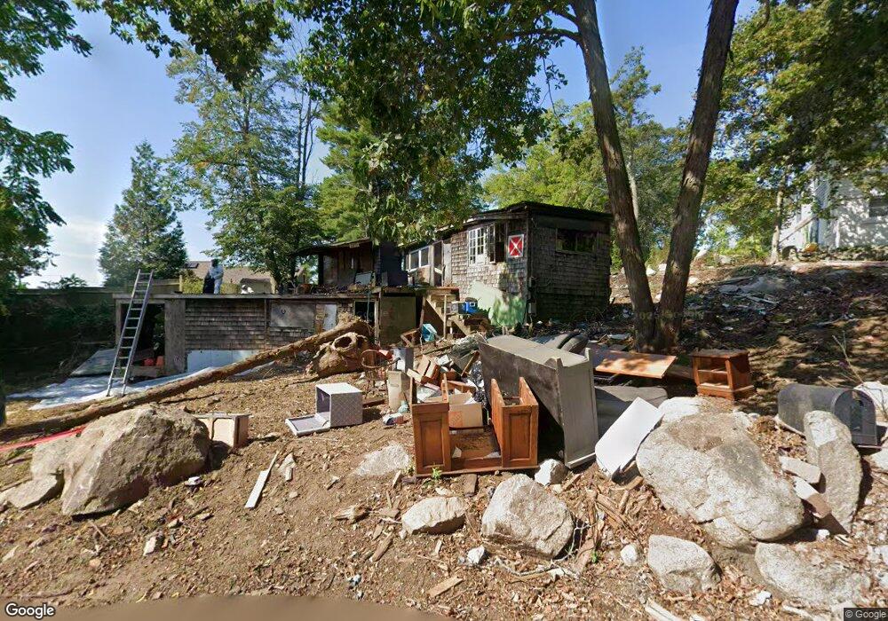
4 Youngs Rd Gloucester, MA 01930
Estimated Value: $223,000 - $296,877
2
Beds
1
Bath
1,753
Sq Ft
$147/Sq Ft
Est. Value
About This Home
This home is located at 4 Youngs Rd, Gloucester, MA 01930 and is currently estimated at $257,969, approximately $147 per square foot. 4 Youngs Rd is a home with nearby schools including Plum Cove School, Ralph B O'maley Middle School, and Gloucester High School.
Ownership History
Date
Name
Owned For
Owner Type
Purchase Details
Closed on
May 16, 2025
Sold by
D Young Sole Benefit T R
Bought by
Round Rock Llc
Current Estimated Value
Purchase Details
Closed on
Feb 13, 2012
Sold by
Young Jean E
Bought by
Robert D Young T D and Robert Young
Purchase Details
Closed on
Jun 2, 1981
Bought by
Young Kristopher M
Create a Home Valuation Report for This Property
The Home Valuation Report is an in-depth analysis detailing your home's value as well as a comparison with similar homes in the area
Purchase History
| Date | Buyer | Sale Price | Title Company |
|---|---|---|---|
| Round Rock Llc | $220,000 | None Available | |
| Round Rock Llc | $220,000 | None Available | |
| Round Rock Llc | $220,000 | None Available | |
| Robert D Young T D | -- | -- | |
| Robert D Young T D | -- | -- | |
| Young Kristopher M | -- | -- |
Source: Public Records
Mortgage History
| Date | Status | Borrower | Loan Amount |
|---|---|---|---|
| Previous Owner | Young Kristopher M | $25,000 |
Source: Public Records
Tax History
| Year | Tax Paid | Tax Assessment Tax Assessment Total Assessment is a certain percentage of the fair market value that is determined by local assessors to be the total taxable value of land and additions on the property. | Land | Improvement |
|---|---|---|---|---|
| 2025 | $2,309 | $237,600 | $180,100 | $57,500 |
| 2024 | $2,290 | $235,400 | $171,500 | $63,900 |
| 2023 | $2,237 | $211,200 | $153,200 | $58,000 |
| 2022 | $2,225 | $189,700 | $133,200 | $56,500 |
| 2021 | $2,208 | $177,500 | $121,100 | $56,400 |
| 2020 | $2,189 | $177,500 | $121,100 | $56,400 |
| 2019 | $2,200 | $173,400 | $121,100 | $52,300 |
| 2018 | $2,229 | $172,400 | $121,100 | $51,300 |
| 2017 | $2,171 | $164,600 | $115,300 | $49,300 |
| 2016 | $2,282 | $167,700 | $120,400 | $47,300 |
| 2015 | $2,334 | $171,000 | $120,400 | $50,600 |
Source: Public Records
Map
Nearby Homes
- 672 Washington St
- 136 Leonard St
- 2 Breezy Point Rd
- 4 Ciaramitaro Ct
- 226 Atlantic St
- 3 Deacon Farm Ln
- 178 Atlantic St
- 167 Atlantic St
- 13 Honeysuckle Rd
- 31 Echo Ave
- 9 Hickory St
- 1030 Washington St
- 43 High St Unit B
- 13 Mystic Ave
- 8 Mystic Ave
- 3 Rockland St
- 98 Maplewood Ave
- 6 Monroe Ct
- 12 Arthur St
- 9 Cleveland Place
- 10 Dennison St
- 6 Youngs Rd
- 3 Youngs Rd
- 1 Youngs Rd
- 5 Youngs Rd
- 11 Dennison St Winter Rental
- 11 Dennison St Summer Rental
- 11 Dennison St
- 11 Dennison St Unit SUMMER
- 695 Washington St
- 7 Dennison St
- 19 Dennison St
- 8 Youngs Rd
- 2 Dennison St
- 22 Dennison St
- 22 Dennison St
- 4 Costa Dr
- 11 Youngs Rd
- 28 Dennison St
- 701 Washington St
Your Personal Tour Guide
Ask me questions while you tour the home.