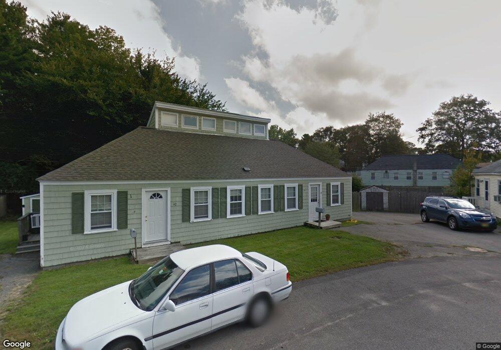
40-42 Cromwell St Kittery, ME 03904
Estimated Value: $536,223 - $699,000
4
Beds
2
Baths
1,628
Sq Ft
$380/Sq Ft
Est. Value
About This Home
This home is located at 40-42 Cromwell St, Kittery, ME 03904 and is currently estimated at $619,306, approximately $380 per square foot. 40-42 Cromwell St is a home located in York County with nearby schools including Shapleigh School, Horace Mitchell Primary School, and Robert W Traip Academy.
Ownership History
Date
Name
Owned For
Owner Type
Purchase Details
Closed on
Mar 4, 2007
Sold by
Gould Denise L
Bought by
Taylor Brian
Current Estimated Value
Home Financials for this Owner
Home Financials are based on the most recent Mortgage that was taken out on this home.
Original Mortgage
$255,274
Interest Rate
6.27%
Mortgage Type
FHA
Create a Home Valuation Report for This Property
The Home Valuation Report is an in-depth analysis detailing your home's value as well as a comparison with similar homes in the area
Home Values in the Area
Average Home Value in this Area
Purchase History
| Date | Buyer | Sale Price | Title Company |
|---|---|---|---|
| Taylor Brian | -- | -- |
Source: Public Records
Mortgage History
| Date | Status | Borrower | Loan Amount |
|---|---|---|---|
| Open | Taylor Brian | $261,660 | |
| Closed | Taylor Brian | $255,274 |
Source: Public Records
Tax History Compared to Growth
Tax History
| Year | Tax Paid | Tax Assessment Tax Assessment Total Assessment is a certain percentage of the fair market value that is determined by local assessors to be the total taxable value of land and additions on the property. | Land | Improvement |
|---|---|---|---|---|
| 2024 | $4,196 | $295,500 | $118,300 | $177,200 |
| 2023 | $4,022 | $295,500 | $118,300 | $177,200 |
| 2022 | $3,983 | $295,500 | $118,300 | $177,200 |
| 2021 | $3,842 | $295,500 | $118,300 | $177,200 |
| 2020 | $3,812 | $295,500 | $118,300 | $177,200 |
| 2019 | $3,461 | $198,900 | $67,800 | $131,100 |
| 2018 | $2,954 | $198,900 | $67,800 | $131,100 |
| 2017 | $3,196 | $198,900 | $67,800 | $131,100 |
| 2016 | $3,192 | $198,900 | $67,800 | $131,100 |
| 2015 | $3,037 | $193,800 | $67,800 | $126,000 |
| 2014 | -- | $193,800 | $67,800 | $126,000 |
| 2013 | $2,950 | $193,800 | $67,800 | $126,000 |
Source: Public Records
Map
Nearby Homes
- 12 Gillis Dr Unit 3
- 116 Whipple Rd
- 165 Rogers Rd
- 10-12 Pine St
- 205 Whipple Rd
- 8 Spruce Point Rd
- 100 Shepards Cove Rd Unit F204
- 100 Shepards Cove Rd Unit G204
- 197 State Rd
- 299 Haley Rd
- 8 Water St Unit 2
- 8 Water St Unit 1
- 122 Haley Rd
- 20 Mendum Ave
- 5 Spinney Way Unit 9
- 27 Oak Terrace
- 35 Badgers Island W Unit 203
- 35 Badgers Island W Unit 301
- 35 Badgers Island W Unit 204
- 35 Badgers Island W Unit 103
- 40 Cromwell St
- 42 Cromwell St Unit 42 Cromwell Street
- 44 Cromwell St
- 36-38 Cromwell St
- 44-46 Cromwell St
- 36 Cromwell St
- 35 Cromwell St
- 127 Manson Ave
- 123 Manson Ave
- 48 Cromwell St
- 48-50 Cromwell St
- 37-39 Cromwell St
- 32-34 Cromwell St
- 131 Manson Ave
- 119 Manson Ave
- 32 Cromwell St
- 50 Boush St
- 122 Manson Ave
- 1 Halstead St
- 49 Boush St