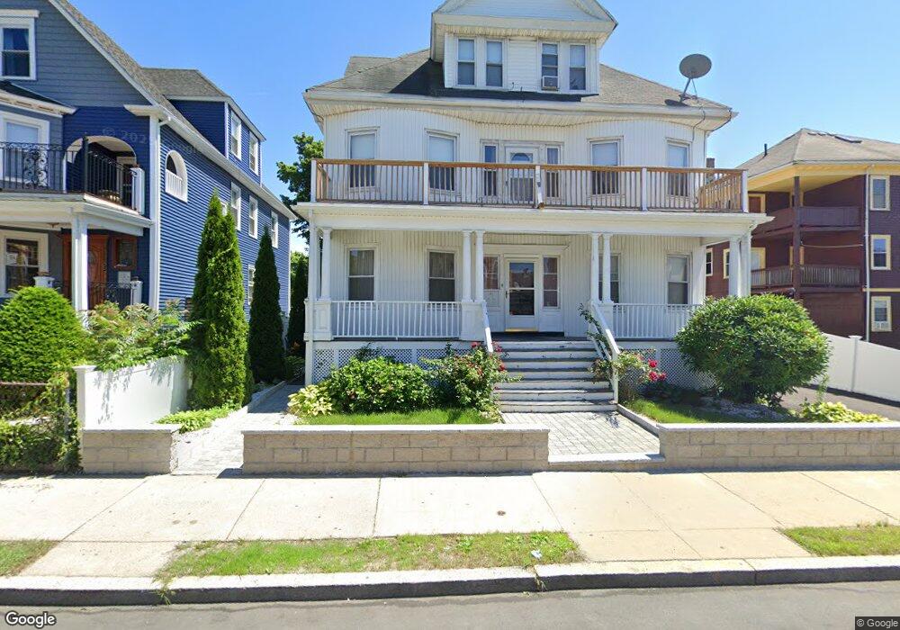
40 Aspinwall Rd Dorchester Center, MA 02124
Codman Square NeighborhoodEstimated Value: $956,000 - $1,306,000
10
Beds
3
Baths
4,062
Sq Ft
$268/Sq Ft
Est. Value
About This Home
This home is located at 40 Aspinwall Rd, Dorchester Center, MA 02124 and is currently estimated at $1,089,717, approximately $268 per square foot. 40 Aspinwall Rd is a home located in Suffolk County with nearby schools including Codman Academy Charter Public School.
Ownership History
Date
Name
Owned For
Owner Type
Purchase Details
Closed on
Apr 3, 1995
Sold by
Aspinwall Rt
Bought by
Bell Lucinda
Current Estimated Value
Purchase Details
Closed on
Dec 23, 1994
Sold by
Alliance Funding Co
Bought by
Aspinwall Rt
Purchase Details
Closed on
Aug 16, 1994
Sold by
Williams Orliane F and Alliance Funding Co
Bought by
Alliance Funding Co
Create a Home Valuation Report for This Property
The Home Valuation Report is an in-depth analysis detailing your home's value as well as a comparison with similar homes in the area
Home Values in the Area
Average Home Value in this Area
Purchase History
| Date | Buyer | Sale Price | Title Company |
|---|---|---|---|
| Bell Lucinda | $155,000 | -- | |
| Aspinwall Rt | $55,000 | -- | |
| Alliance Funding Co | $65,000 | -- |
Source: Public Records
Mortgage History
| Date | Status | Borrower | Loan Amount |
|---|---|---|---|
| Open | Alliance Funding Co | $29,982 | |
| Open | Alliance Funding Co | $180,000 |
Source: Public Records
Tax History Compared to Growth
Tax History
| Year | Tax Paid | Tax Assessment Tax Assessment Total Assessment is a certain percentage of the fair market value that is determined by local assessors to be the total taxable value of land and additions on the property. | Land | Improvement |
|---|---|---|---|---|
| 2025 | $9,471 | $817,900 | $249,900 | $568,000 |
| 2024 | $8,214 | $753,600 | $231,400 | $522,200 |
| 2023 | $7,495 | $697,900 | $214,300 | $483,600 |
| 2022 | $6,902 | $634,400 | $194,800 | $439,600 |
| 2021 | $6,326 | $592,900 | $182,100 | $410,800 |
| 2020 | $5,627 | $532,900 | $179,400 | $353,500 |
| 2019 | $5,109 | $484,700 | $134,600 | $350,100 |
| 2018 | $4,837 | $461,500 | $134,600 | $326,900 |
| 2017 | $4,654 | $439,500 | $134,600 | $304,900 |
| 2016 | $4,396 | $399,600 | $134,600 | $265,000 |
| 2015 | $4,189 | $345,900 | $114,600 | $231,300 |
| 2014 | $4,085 | $324,700 | $114,600 | $210,100 |
Source: Public Records
Map
Nearby Homes
- 23 Dunlap St
- 19 Elmhurst St
- 92 Spencer St
- 43 Withington St Unit 7
- 31 Chipman St
- 52 Withington St Unit 7
- 39 Chipman St
- 39 Torrey St Unit 1
- 29 Torrey St
- 10 Westcott St Unit 3
- 10 Westcott St Unit 1
- 61 Lyndhurst St Unit A
- 141 Norfolk St
- 33 Kenberma Rd Unit 3
- 45-45A Spencer St
- 438 Talbot Ave
- 10 School St
- 28 Melville Ave
- 123-125 Centre St Unit TH 6
- 123-125 Centre St Unit TH4
- 36 Aspinwall Rd
- 43 Whitfield St Unit 3
- 43 Whitfield St Unit 2
- 43 Whitfield St Unit 1
- 43 Whitfield St
- 41 Whitfield St
- 306 Talbot Ave
- 32 Aspinwall Rd
- 32 Aspinwall Rd Unit 2
- 41 Aspinwall Rd
- 41 Aspinwall Rd Unit 1
- 37 Aspinwall Rd
- 308 Talbot Ave
- 308 Talbot Ave Unit B
- 308 Talbot Ave Unit A
- 308 Talbot Ave Unit 1
- 308 Talbot Ave Unit 2
- 33 Aspinwall Rd
- 5 Hopestill St
- 310 Talbot Ave