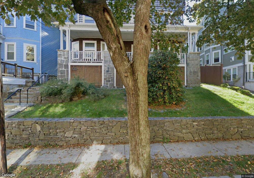
40 Atherton Rd Brookline, MA 02446
Washington Square NeighborhoodEstimated Value: $2,044,000 - $3,062,000
7
Beds
4
Baths
4,044
Sq Ft
$645/Sq Ft
Est. Value
About This Home
This home is located at 40 Atherton Rd, Brookline, MA 02446 and is currently estimated at $2,609,133, approximately $645 per square foot. 40 Atherton Rd is a home located in Norfolk County with nearby schools including Michael Driscoll, Brookline High School, and Match Charter Public School.
Ownership History
Date
Name
Owned For
Owner Type
Purchase Details
Closed on
Sep 29, 1987
Sold by
Gruber Rosalind H
Bought by
Codoon Jonathan
Current Estimated Value
Home Financials for this Owner
Home Financials are based on the most recent Mortgage that was taken out on this home.
Original Mortgage
$315,000
Interest Rate
10.37%
Mortgage Type
Purchase Money Mortgage
Create a Home Valuation Report for This Property
The Home Valuation Report is an in-depth analysis detailing your home's value as well as a comparison with similar homes in the area
Home Values in the Area
Average Home Value in this Area
Purchase History
| Date | Buyer | Sale Price | Title Company |
|---|---|---|---|
| Codoon Jonathan | $450,000 | -- |
Source: Public Records
Mortgage History
| Date | Status | Borrower | Loan Amount |
|---|---|---|---|
| Open | Codoon Jonathan | $30,000 | |
| Closed | Codoon Jonathan | $40,000 | |
| Closed | Codoon Jonathan | $315,000 |
Source: Public Records
Tax History
| Year | Tax Paid | Tax Assessment Tax Assessment Total Assessment is a certain percentage of the fair market value that is determined by local assessors to be the total taxable value of land and additions on the property. | Land | Improvement |
|---|---|---|---|---|
| 2025 | $25,416 | $2,575,100 | $1,179,800 | $1,395,300 |
| 2024 | $25,044 | $2,563,400 | $1,131,300 | $1,432,100 |
| 2023 | $24,857 | $2,493,200 | $1,032,900 | $1,460,300 |
| 2022 | $24,196 | $2,374,500 | $983,700 | $1,390,800 |
| 2021 | $22,375 | $2,283,200 | $945,900 | $1,337,300 |
| 2020 | $21,116 | $2,234,500 | $849,800 | $1,384,700 |
| 2019 | $19,940 | $2,128,100 | $809,300 | $1,318,800 |
| 2018 | $18,035 | $1,906,400 | $661,700 | $1,244,700 |
| 2017 | $17,439 | $1,765,100 | $624,200 | $1,140,900 |
| 2016 | $16,721 | $1,604,700 | $583,400 | $1,021,300 |
| 2015 | $15,580 | $1,458,800 | $545,200 | $913,600 |
| 2014 | $14,732 | $1,293,400 | $455,800 | $837,600 |
Source: Public Records
Map
Nearby Homes
- 95 Mason Terrace Unit 6
- 17 Summit Ave Unit 2
- 1490 Beacon St Unit 4
- 66 Mason Terrace
- 123 Centre St
- 17 Coolidge St
- 20 Winchester St Unit 3
- 19 Winchester St Unit 110
- 30 York Terrace
- 1495 Beacon St Unit G
- 1407 Beacon St Unit 8
- 1517 Beacon St Unit 4
- 62 Fuller St
- 80 Vernon St Unit PHB
- 80 Vernon St Unit 1-A
- 80 Vernon St Unit 2B
- 80 Vernon St Unit PHA
- 80 Vernon St Unit 3A
- 150+152 Jordan Rd
- 200 Winchester St Unit 1
- 40 Atherton Rd
- 40 Atherton Rd Unit 2
- 40 Atherton Rd Unit 1
- 44 Atherton Rd
- 44 Atherton Rd Unit 2
- 44 Atherton Rd Unit 1
- 36 Atherton Rd Unit 2
- 36 Atherton Rd Unit 1
- 48 Atherton Rd
- 48 Atherton Rd
- 48 Atherton Rd Unit 1
- 32 Atherton Rd Unit 2
- 32 Atherton Rd
- 32 Atherton Rd Unit 1
- 131 Mason Terrace
- 66 Winchester St Unit PHA
- 66 Winchester St Unit 503
- 66 Winchester St Unit 502
- 66 Winchester St Unit 501
- 66 Winchester St Unit 403
Your Personal Tour Guide
Ask me questions while you tour the home.