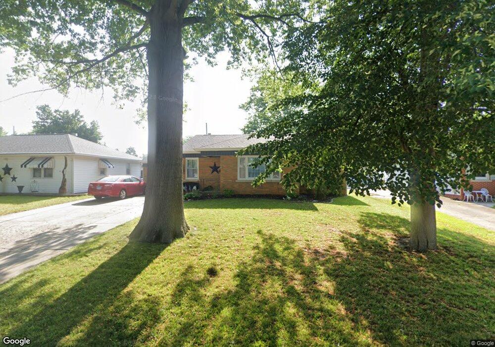
40 Bob o Link Dr Springfield, IL 62702
Estimated Value: $116,000 - $165,000
Studio
--
Bath
--
Sq Ft
7,362
Sq Ft Lot
About This Home
This home is located at 40 Bob o Link Dr, Springfield, IL 62702 and is currently estimated at $143,075. 40 Bob o Link Dr is a home located in Sangamon County with nearby schools including Jane Addams Elementary School, U.S. Grant Middle School, and Springfield High School.
Ownership History
Date
Name
Owned For
Owner Type
Purchase Details
Closed on
Jan 4, 2019
Sold by
David H Hatton Irrevocable Living Trust
Bought by
Hess Matthew Robert and Lewis Courtney Leigh
Current Estimated Value
Home Financials for this Owner
Home Financials are based on the most recent Mortgage that was taken out on this home.
Original Mortgage
$73,514
Outstanding Balance
$64,386
Interest Rate
4.8%
Mortgage Type
FHA
Estimated Equity
$78,689
Purchase Details
Closed on
May 24, 2018
Sold by
Hatton David H
Bought by
David H Hatton Irrevocable Liv
Create a Home Valuation Report for This Property
The Home Valuation Report is an in-depth analysis detailing your home's value as well as a comparison with similar homes in the area
Purchase History
| Date | Buyer | Sale Price | Title Company |
|---|---|---|---|
| Hess Matthew Robert | $74,900 | Cornerstone Title | |
| David H Hatton Irrevocable Liv | -- | Jon K Ellis Pc | |
| David H Hatton Irrevocable Living Trust | -- | -- |
Source: Public Records
Mortgage History
| Date | Status | Borrower | Loan Amount |
|---|---|---|---|
| Open | Hess Matthew Robert | $73,514 |
Source: Public Records
Tax History
| Year | Tax Paid | Tax Assessment Tax Assessment Total Assessment is a certain percentage of the fair market value that is determined by local assessors to be the total taxable value of land and additions on the property. | Land | Improvement |
|---|---|---|---|---|
| 2024 | $2,200 | $32,190 | $7,715 | $24,475 |
| 2023 | $2,069 | $29,403 | $7,047 | $22,356 |
| 2022 | $1,962 | $27,892 | $6,685 | $21,207 |
| 2021 | $1,877 | $26,848 | $6,435 | $20,413 |
| 2020 | $1,840 | $26,889 | $6,445 | $20,444 |
| 2019 | $1,808 | $26,796 | $6,423 | $20,373 |
| 2018 | $1,988 | $34,528 | $6,392 | $28,136 |
| 2017 | $1,935 | $34,081 | $6,309 | $27,772 |
| 2016 | $1,883 | $33,584 | $6,217 | $27,367 |
| 2015 | $1,854 | $33,183 | $6,143 | $27,040 |
| 2014 | $1,715 | $32,968 | $6,103 | $26,865 |
| 2013 | $1,676 | $31,691 | $6,104 | $25,587 |
Source: Public Records
Map
Nearby Homes
- 2011 W Jefferson St
- 832 Independence Ridge
- 2102 W Jefferson St
- 66 Dawn Dr
- 1921 Jeanette Ln Unit 2
- 1910 Jeanette Ln Unit 2
- 2553 Chapel Hill Dr
- 1016 Johnson Ln
- 24 Wenzel Ln
- 9 Bryant Ln
- 2612 Cedar Pond Dr
- 1319 Crestview Dr
- 29 N Oxford Rd
- 2081 W Monroe St Unit 1 or A
- 1386 Valley Dr
- 259 N Columbia Ave
- 160 S Durkin Dr Unit 4
- 2309 W Lawrence Ave
- 2134 W Lawrence Ave
- 2138 W Lawrence Ave
- 40 Bob-O-link Dr
- 44 Bob o Link Dr
- 48 Bob o Link Dr
- 32 Bob o Link Dr
- 17 Sunnyside Dr
- 19 Sunnyside Dr
- 35 Bob o Link Dr
- 31 Bob o Link Dr
- 27 Bob o Link Dr
- 27 Bob-O-link Dr
- 15 Sunnyside Dr
- 52 Bob o Link Dr
- 39 Bob-O-link Dr
- 21 Sunnyside Dr
- 28 Bob o Link Dr
- 23 Bob o Link Dr
- 43 Bob o Link Dr
- 56 Bob o Link Dr Unit 1
- 13 Sunnyside Dr
Your Personal Tour Guide
Ask me questions while you tour the home.