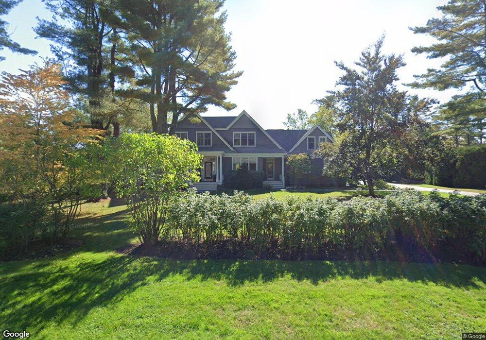
40 Carroll St Falmouth, ME 04105
Estimated Value: $2,338,618 - $3,124,000
4
Beds
6
Baths
4,551
Sq Ft
$578/Sq Ft
Est. Value
About This Home
This home is located at 40 Carroll St, Falmouth, ME 04105 and is currently estimated at $2,628,405, approximately $577 per square foot. 40 Carroll St is a home located in Cumberland County with nearby schools including Falmouth Middle School, Falmouth High School, and Baxter Academy for Tech & Sciences.
Ownership History
Date
Name
Owned For
Owner Type
Purchase Details
Closed on
Jan 26, 2023
Sold by
Hastings Debra G
Bought by
Hastings Debra G and Hastings Peter G
Current Estimated Value
Home Financials for this Owner
Home Financials are based on the most recent Mortgage that was taken out on this home.
Original Mortgage
$300,000
Outstanding Balance
$290,242
Interest Rate
6.13%
Mortgage Type
Purchase Money Mortgage
Estimated Equity
$2,338,163
Purchase Details
Closed on
Nov 21, 2014
Sold by
Hastings 2Nd Peter G
Bought by
Hastings Debra G
Purchase Details
Closed on
Sep 15, 2014
Sold by
Hastings Debra G
Bought by
Hastings 2Nd Peter G and Hastings Debra G
Home Financials for this Owner
Home Financials are based on the most recent Mortgage that was taken out on this home.
Original Mortgage
$564,000
Interest Rate
4.12%
Mortgage Type
Unknown
Create a Home Valuation Report for This Property
The Home Valuation Report is an in-depth analysis detailing your home's value as well as a comparison with similar homes in the area
Home Values in the Area
Average Home Value in this Area
Purchase History
| Date | Buyer | Sale Price | Title Company |
|---|---|---|---|
| Hastings Debra G | -- | None Available | |
| Hastings Debra G | -- | -- | |
| Hastings 2Nd Peter G | -- | -- |
Source: Public Records
Mortgage History
| Date | Status | Borrower | Loan Amount |
|---|---|---|---|
| Open | Hastings Debra G | $300,000 | |
| Previous Owner | Hastings 2Nd Peter G | $564,000 |
Source: Public Records
Tax History Compared to Growth
Tax History
| Year | Tax Paid | Tax Assessment Tax Assessment Total Assessment is a certain percentage of the fair market value that is determined by local assessors to be the total taxable value of land and additions on the property. | Land | Improvement |
|---|---|---|---|---|
| 2024 | $24,508 | $1,831,700 | $655,200 | $1,176,500 |
| 2023 | $23,103 | $1,827,800 | $655,200 | $1,172,600 |
| 2022 | $21,787 | $1,827,800 | $655,200 | $1,172,600 |
| 2021 | $18,755 | $1,076,000 | $415,700 | $660,300 |
| 2020 | $18,346 | $1,076,000 | $415,700 | $660,300 |
| 2019 | $18,152 | $1,076,000 | $415,700 | $660,300 |
| 2018 | $17,722 | $1,076,000 | $415,700 | $660,300 |
| 2017 | $16,807 | $1,076,000 | $415,700 | $660,300 |
| 2016 | $16,237 | $1,076,000 | $415,700 | $660,300 |
| 2015 | $15,742 | $1,076,000 | $415,700 | $660,300 |
| 2014 | $15,031 | $1,076,000 | $415,700 | $660,300 |
| 2012 | -- | $1,076,000 | $415,700 | $660,300 |
Source: Public Records
Map
Nearby Homes
- 56 Carroll St
- 5 Cobblestone St Unit 53
- 5 Phillips Rd
- 6 Tidewater Cove
- 3 Tidewater Cove
- 27 Colonial Village
- 53 Waites Landing Rd
- 62 Waites Landing Rd
- 57 Foreside Rd
- 75 Clearwater Dr Unit 305
- 9-11 Bismark St
- 45 Middle Rd
- 242 Veranda St
- 24 Oakland Rd
- 11 Osprey Terrace
- 24 Lunt Rd
- 109 Foreside Rd
- 54-56 Veranda St
- 56 Saint Jude St
- 17 Wildwood Cir