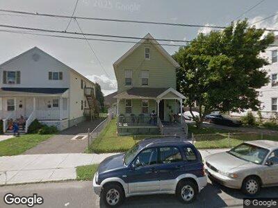
40 Elizabeth St Bridgeport, CT 06610
East End NeighborhoodEstimated Value: $270,000 - $408,000
4
Beds
2
Baths
1,986
Sq Ft
$177/Sq Ft
Est. Value
About This Home
This home is located at 40 Elizabeth St, Bridgeport, CT 06610 and is currently estimated at $351,717, approximately $177 per square foot. 40 Elizabeth St is a home located in Fairfield County with nearby schools including Jettie S. Tisdale School and Harding High School.
Ownership History
Date
Name
Owned For
Owner Type
Purchase Details
Closed on
Mar 14, 2011
Sold by
Bauer Peter H
Bought by
Sanford Mckinley
Current Estimated Value
Home Financials for this Owner
Home Financials are based on the most recent Mortgage that was taken out on this home.
Original Mortgage
$56,529
Outstanding Balance
$39,611
Interest Rate
4.83%
Estimated Equity
$312,106
Purchase Details
Closed on
May 5, 1992
Sold by
Savko Dawn
Bought by
Bauer Peter
Create a Home Valuation Report for This Property
The Home Valuation Report is an in-depth analysis detailing your home's value as well as a comparison with similar homes in the area
Home Values in the Area
Average Home Value in this Area
Purchase History
| Date | Buyer | Sale Price | Title Company |
|---|---|---|---|
| Sanford Mckinley | -- | -- | |
| Sanford Mckinley | -- | -- | |
| Bauer Peter | $82,000 | -- | |
| Bauer Peter | $82,000 | -- |
Source: Public Records
Mortgage History
| Date | Status | Borrower | Loan Amount |
|---|---|---|---|
| Open | Bauer Peter | $56,529 | |
| Closed | Bauer Peter | $56,529 | |
| Previous Owner | Bauer Peter | $45,110 |
Source: Public Records
Tax History Compared to Growth
Tax History
| Year | Tax Paid | Tax Assessment Tax Assessment Total Assessment is a certain percentage of the fair market value that is determined by local assessors to be the total taxable value of land and additions on the property. | Land | Improvement |
|---|---|---|---|---|
| 2024 | $6,315 | $145,350 | $60,200 | $85,150 |
| 2023 | $6,315 | $145,350 | $60,200 | $85,150 |
| 2022 | $6,315 | $145,350 | $60,200 | $85,150 |
| 2021 | $6,315 | $145,350 | $60,200 | $85,150 |
| 2020 | $5,061 | $93,740 | $23,790 | $69,950 |
| 2019 | $5,061 | $93,740 | $23,790 | $69,950 |
| 2018 | $5,097 | $93,740 | $23,790 | $69,950 |
| 2017 | $5,097 | $93,740 | $23,790 | $69,950 |
| 2016 | $5,097 | $93,740 | $23,790 | $69,950 |
| 2015 | $5,781 | $136,990 | $41,260 | $95,730 |
| 2014 | $5,781 | $136,990 | $41,260 | $95,730 |
Source: Public Records
Map
Nearby Homes
- 133 Pixlee Place
- 394 Bishop Ave Unit 396
- 1840 Barnum Ave
- 290 Ridgefield Ave
- 400 East Ave
- 519 Bdlg-53 Success Ave Unit 519
- 102 Bowe Ave
- 121 Victory St
- 69 Weber Ave
- 880 Connecticut Ave Unit 882
- 26 Post St
- 135 N Bishop Ave
- 610 Wilmot Ave Unit 4
- 1149 Central Ave
- 39 Post St
- 407 Hollister St
- 67 Harvey St
- 2076 Seaview Ave
- 3 Granfield Ave
- 230 Boston Ave
- 40 Elizabeth St
- 42 Elizabeth St
- 86 Elizabeth St Unit 86
- 86 Elizabeth St
- 88 Elizabeth St Unit 88
- 90 Elizabeth St Unit 90
- 90 Elizabeth St
- 88 Elizabeth St
- 92 Elizabeth St Unit 92
- 1606 Barnum Ave
- 1600 Barnum Ave
- 1600 Barnum Ave Unit 1
- 56 Elizabeth St
- 77 Elizabeth St
- 1590 Barnum Ave Unit 10
- 24 Elizabeth St Unit 26
- 69 Elizabeth St Unit 71
- 1618 Barnum Ave
- 77-79 Elizabeth St
- 55 Elizabeth St Unit 57