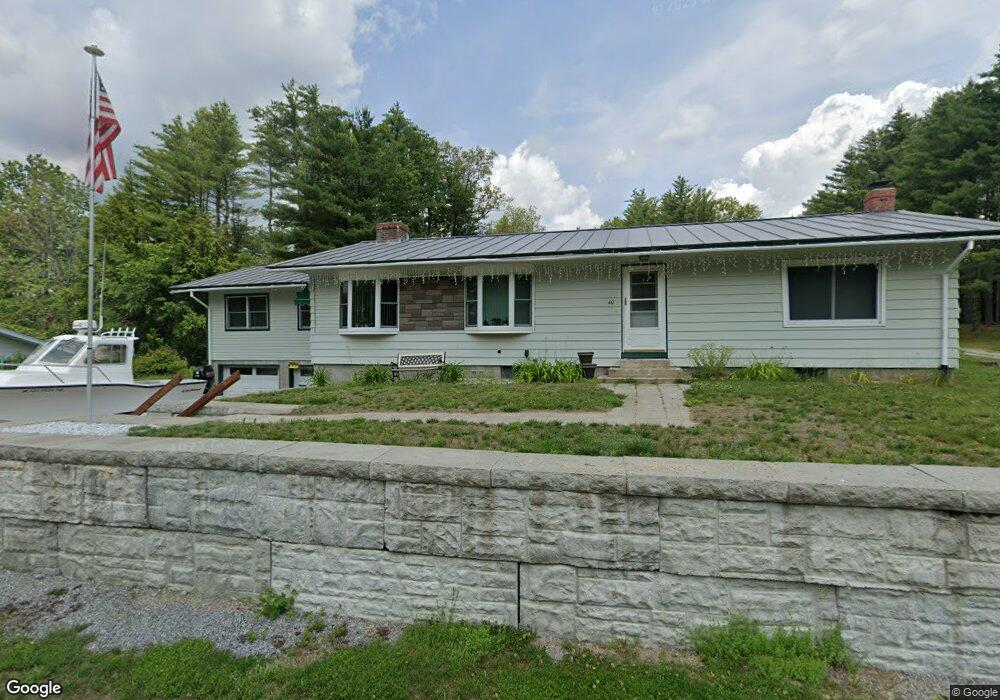
40 Harvey Way Hillsborough, NH 03244
Hillsboro NeighborhoodEstimated Value: $415,839 - $472,000
2
Beds
2
Baths
2,301
Sq Ft
$189/Sq Ft
Est. Value
About This Home
This home is located at 40 Harvey Way, Hillsborough, NH 03244 and is currently estimated at $435,710, approximately $189 per square foot. 40 Harvey Way is a home located in Hillsborough County with nearby schools including Hillsboro-Deering Elementary School, Hillsboro-Deering High School, and Hillsboro Christian School.
Ownership History
Date
Name
Owned For
Owner Type
Purchase Details
Closed on
Feb 1, 2024
Sold by
Mailloux Christine B
Bought by
Christine Mailloux T and Christine Mailloux
Current Estimated Value
Purchase Details
Closed on
Sep 1, 1998
Sold by
Davis Doris I
Bought by
Mailloux Luc R and Mailloux Christine B
Home Financials for this Owner
Home Financials are based on the most recent Mortgage that was taken out on this home.
Original Mortgage
$89,900
Interest Rate
6.9%
Mortgage Type
Purchase Money Mortgage
Create a Home Valuation Report for This Property
The Home Valuation Report is an in-depth analysis detailing your home's value as well as a comparison with similar homes in the area
Home Values in the Area
Average Home Value in this Area
Purchase History
| Date | Buyer | Sale Price | Title Company |
|---|---|---|---|
| Christine Mailloux T | -- | None Available | |
| Mailloux Luc R | $89,900 | -- |
Source: Public Records
Mortgage History
| Date | Status | Borrower | Loan Amount |
|---|---|---|---|
| Previous Owner | Mailloux Luc R | $15,000 | |
| Previous Owner | Mailloux Luc R | $89,900 |
Source: Public Records
Tax History Compared to Growth
Tax History
| Year | Tax Paid | Tax Assessment Tax Assessment Total Assessment is a certain percentage of the fair market value that is determined by local assessors to be the total taxable value of land and additions on the property. | Land | Improvement |
|---|---|---|---|---|
| 2024 | $6,534 | $195,400 | $35,100 | $160,300 |
| 2023 | $6,100 | $195,400 | $35,100 | $160,300 |
| 2022 | $5,215 | $195,400 | $35,100 | $160,300 |
| 2021 | $5,651 | $195,400 | $35,100 | $160,300 |
| 2020 | $5,614 | $195,400 | $35,100 | $160,300 |
| 2018 | $5,688 | $192,800 | $46,200 | $146,600 |
| 2017 | $5,875 | $192,800 | $46,200 | $146,600 |
| 2016 | $5,821 | $197,200 | $49,200 | $148,000 |
| 2015 | $5,729 | $197,200 | $49,200 | $148,000 |
| 2014 | $5,435 | $197,200 | $49,200 | $148,000 |
| 2013 | $5,533 | $197,200 | $49,200 | $148,000 |
Source: Public Records
Map
Nearby Homes
- 0 W Main St Unit 1
- 212 W Main St
- 11B -425 W Main St
- 0 Route 202 Route Unit 4983445
- 37 Meeting Hill Rd
- 31 Woodlawn Ave
- 82 Church St
- 20-22 Church St
- 31 Central St Unit G
- 88 W Mill St
- 25 Wyman Rd Unit 68
- 4 Chamberlain Ct
- 21 School St
- 1 W Main St
- 23 Gay Ave
- Lot 14 Old Mill Farm Rd
- 32 Union St
- 77 Henniker St
- 165 Second New Hampshire Turnpike
- 000 Gibson Mountain Rd Unit 10
- 34 Harvey Way
- 48 Harvey Way
- 35 Harvey Way
- 32 Harvey Way
- 43 Harvey Way
- 25 Harvey Way
- 28 Harvey Way
- 0 Harvey Way Unit Map 11O, lot 152
- 0 Harvey Way Unit 4925619
- 0 Harvey Way Unit 4848593
- 18 Bible Hill Rd
- 233 W Main St
- 219 W Main St
- 0 Gay Ave Unit 4939263
- Lot CE13 Pine Glen Rd
- 223 W Main St
- 0 Cardinal Cir Unit 4961497
- 0 W Main St Unit 23 4686650
- 0 W Main St Unit 4632756