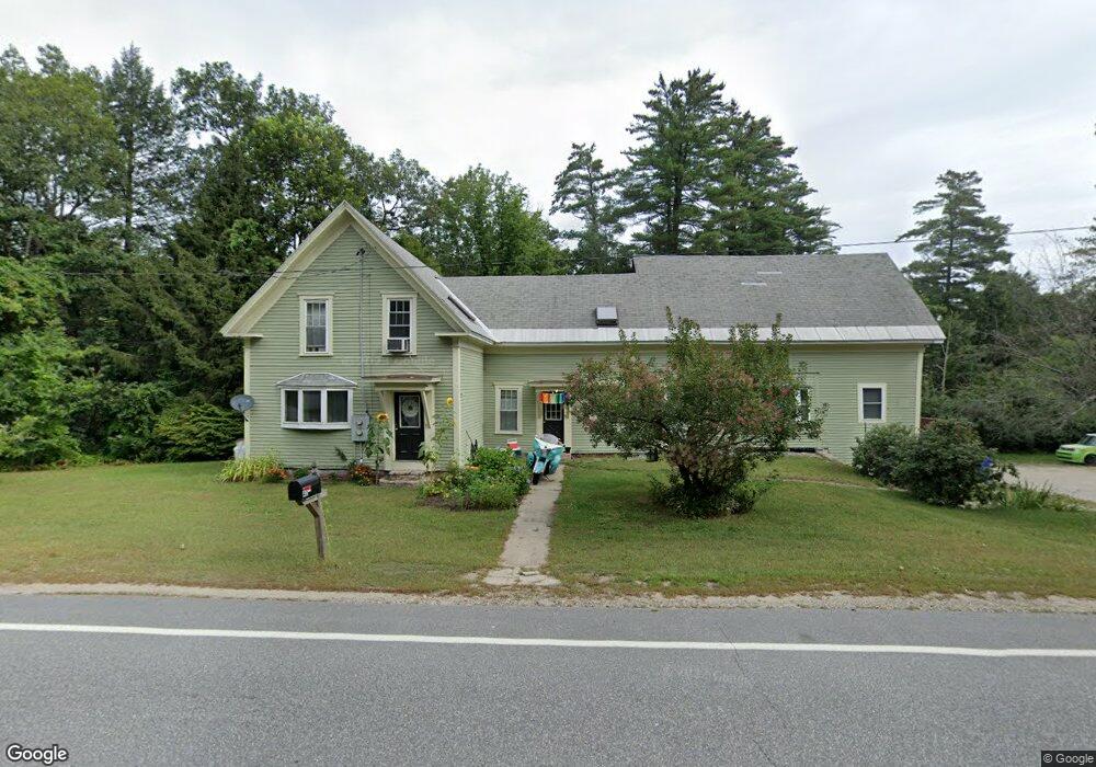
40 Henry Bridge Rd Goffstown, NH 03045
Estimated Value: $368,000 - $509,746
4
Beds
2
Baths
2,099
Sq Ft
$224/Sq Ft
Est. Value
About This Home
This home is located at 40 Henry Bridge Rd, Goffstown, NH 03045 and is currently estimated at $471,187, approximately $224 per square foot. 40 Henry Bridge Rd is a home located in Hillsborough County with nearby schools including Mountain View Middle School, Goffstown High School, and Namaste Montessori School.
Ownership History
Date
Name
Owned For
Owner Type
Purchase Details
Closed on
Feb 4, 2011
Sold by
Fhlmc
Bought by
Cassidy Andrew R
Current Estimated Value
Home Financials for this Owner
Home Financials are based on the most recent Mortgage that was taken out on this home.
Original Mortgage
$131,398
Outstanding Balance
$89,754
Interest Rate
4.82%
Mortgage Type
Purchase Money Mortgage
Estimated Equity
$381,433
Purchase Details
Closed on
Aug 30, 2010
Sold by
Lavigne Bobbie-Jo and Ocwen Loan Servicing L
Bought by
Fhlmc
Create a Home Valuation Report for This Property
The Home Valuation Report is an in-depth analysis detailing your home's value as well as a comparison with similar homes in the area
Home Values in the Area
Average Home Value in this Area
Purchase History
| Date | Buyer | Sale Price | Title Company |
|---|---|---|---|
| Cassidy Andrew R | $100,000 | -- | |
| Fhlmc | $189,400 | -- |
Source: Public Records
Mortgage History
| Date | Status | Borrower | Loan Amount |
|---|---|---|---|
| Open | Fhlmc | $44,000 | |
| Open | Fhlmc | $131,398 | |
| Previous Owner | Fhlmc | $175,000 |
Source: Public Records
Tax History Compared to Growth
Tax History
| Year | Tax Paid | Tax Assessment Tax Assessment Total Assessment is a certain percentage of the fair market value that is determined by local assessors to be the total taxable value of land and additions on the property. | Land | Improvement |
|---|---|---|---|---|
| 2024 | $8,321 | $407,100 | $201,600 | $205,500 |
| 2023 | $7,678 | $407,100 | $201,600 | $205,500 |
| 2022 | $6,183 | $235,000 | $126,700 | $108,300 |
| 2021 | $5,833 | $235,000 | $126,700 | $108,300 |
| 2020 | $5,220 | $241,400 | $133,100 | $108,300 |
| 2019 | $37 | $241,400 | $133,100 | $108,300 |
| 2018 | $4,640 | $241,400 | $133,100 | $108,300 |
| 2017 | $5,679 | $207,100 | $112,200 | $94,900 |
| 2016 | $5,474 | $207,100 | $112,200 | $94,900 |
| 2015 | $5,669 | $201,300 | $101,400 | $99,900 |
| 2014 | $5,432 | $201,200 | $101,400 | $99,800 |
Source: Public Records
Map
Nearby Homes
- 0 Mast Rd Unit 49 5054665
- 76 Donald Dr
- 243 Donald Dr
- 16 Roger Rd
- 4 Arabian Ct Unit B
- 5 Mustang Ct
- 3D Dearborn Cir
- 3A Dearborn Cir
- 3B Dearborn Cir
- 4B Dearborn Cir
- 12 Maplewood Ave
- 2 Larch St Unit 1
- 53 Rachael Cir
- 11-1 Chatel Rd
- 4 Chip St
- 152 S Mast St
- 22 Winter Hill Rd
- 11 Timberwood Dr Unit 206
- 21A Apple Tree Dr
- 120 S Mast St