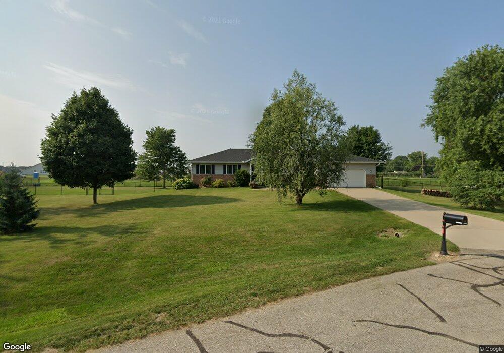
40 Kinson Ct Robins, IA 52328
Estimated Value: $319,000 - $339,000
4
Beds
3
Baths
1,500
Sq Ft
$219/Sq Ft
Est. Value
About This Home
This home is located at 40 Kinson Ct, Robins, IA 52328 and is currently estimated at $328,798, approximately $219 per square foot. 40 Kinson Ct is a home located in Linn County with nearby schools including Nixon Elementary School, Ponderosa Elementary School, and Harding Middle School.
Ownership History
Date
Name
Owned For
Owner Type
Purchase Details
Closed on
Jul 18, 2007
Sold by
Burke John and Burke Sheryl A
Bought by
Wood David W and Wood Shannon S
Current Estimated Value
Home Financials for this Owner
Home Financials are based on the most recent Mortgage that was taken out on this home.
Original Mortgage
$162,400
Outstanding Balance
$102,876
Interest Rate
6.76%
Mortgage Type
Purchase Money Mortgage
Estimated Equity
$225,922
Create a Home Valuation Report for This Property
The Home Valuation Report is an in-depth analysis detailing your home's value as well as a comparison with similar homes in the area
Home Values in the Area
Average Home Value in this Area
Purchase History
| Date | Buyer | Sale Price | Title Company |
|---|---|---|---|
| Wood David W | $202,500 | None Available |
Source: Public Records
Mortgage History
| Date | Status | Borrower | Loan Amount |
|---|---|---|---|
| Open | Wood David W | $162,400 |
Source: Public Records
Tax History Compared to Growth
Tax History
| Year | Tax Paid | Tax Assessment Tax Assessment Total Assessment is a certain percentage of the fair market value that is determined by local assessors to be the total taxable value of land and additions on the property. | Land | Improvement |
|---|---|---|---|---|
| 2025 | $3,450 | $322,900 | $37,200 | $285,700 |
| 2024 | $3,642 | $266,100 | $37,200 | $228,900 |
| 2023 | $3,642 | $266,100 | $37,200 | $228,900 |
| 2022 | $3,878 | $247,900 | $37,200 | $210,700 |
| 2021 | $3,806 | $247,900 | $37,200 | $210,700 |
| 2020 | $3,806 | $226,200 | $37,200 | $189,000 |
| 2019 | $3,756 | $227,200 | $55,800 | $171,400 |
| 2018 | $3,692 | $227,200 | $55,800 | $171,400 |
| 2017 | $3,598 | $214,400 | $55,800 | $158,600 |
| 2016 | $3,690 | $214,400 | $55,800 | $158,600 |
| 2015 | $3,700 | $214,400 | $55,800 | $158,600 |
| 2014 | $3,550 | $214,400 | $55,800 | $158,600 |
| 2013 | $3,470 | $214,400 | $55,800 | $158,600 |
Source: Public Records
Map
Nearby Homes
- 9124 Grand Oaks Dr NE
- 8926 Norway Dr NE
- 8908 Norway Dr NE
- 1332 Stratton Dr NE
- 9014 Grand Oaks Dr NE
- 8809 Middlebury Ct NE
- 165 Timber Ln
- 70.78 Acres M L Quass Rd
- 0 Maple St
- 8201 Council St NE
- 1623 Petrus Dr NE
- 545 Evergreen Ln
- 8139 Turtlerun Dr NE
- 923 Messina Dr NE
- 929 Messina Dr NE
- 1127 Tiara Dr NE
- Lot 9 Kervin Ct
- Lot 10 Kervin Ct
- 3230 N Center Point Rd Unit Lot 3
- 620 Hampton St
- 45 Kinson Ct
- 30 Kinson Ct
- 9118 Grand Oaks Dr NE
- 35 Kinson Ct
- 9201 Grand Oaks Dr NE
- 9112 Grand Oaks Dr NE
- 280 S Mentzer Rd
- 9213 Grand Oaks Dr NE
- 25 Kinson Ct
- 9106 Grand Oaks Dr NE
- 260 S Mentzer Rd
- 9303 Grand Oaks Dr NE
- 30 Charlotte Ct
- 20 Kinson Ct
- 9100 Grand Oaks Dr NE
- 8919 Middlebury Ct NE
- 8915 Norway Dr NE
- 9309 Grand Oaks Dr NE
- 8920 Norway Dr NE
- 9038 Grand Oaks Dr NE