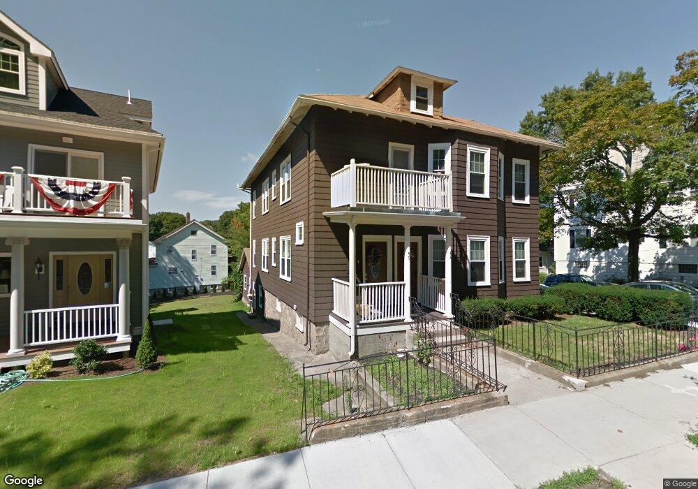
40 Lagrange St Unit 42 West Roxbury, MA 02132
Upper Washington-Spring Street NeighborhoodEstimated Value: $799,088
6
Beds
2
Baths
6,335
Sq Ft
$126/Sq Ft
Est. Value
About This Home
This home is located at 40 Lagrange St Unit 42, West Roxbury, MA 02132 and is currently estimated at $799,088, approximately $126 per square foot. 40 Lagrange St Unit 42 is a home located in Suffolk County with nearby schools including St Theresa School, Holy Name Parish School, and The Roxbury Latin School.
Ownership History
Date
Name
Owned For
Owner Type
Purchase Details
Closed on
Nov 27, 2015
Sold by
Shedd Robert P
Bought by
Fiore Rocco J
Current Estimated Value
Home Financials for this Owner
Home Financials are based on the most recent Mortgage that was taken out on this home.
Original Mortgage
$311,250
Outstanding Balance
$246,145
Interest Rate
3.87%
Mortgage Type
New Conventional
Estimated Equity
$552,943
Purchase Details
Closed on
Jan 30, 2009
Sold by
Mary Hamaty 2007 Nt
Bought by
Hamaty Mary
Purchase Details
Closed on
Nov 29, 2007
Sold by
Mmh Rt
Bought by
Mary Hamaty 2007 Nt
Create a Home Valuation Report for This Property
The Home Valuation Report is an in-depth analysis detailing your home's value as well as a comparison with similar homes in the area
Home Values in the Area
Average Home Value in this Area
Purchase History
| Date | Buyer | Sale Price | Title Company |
|---|---|---|---|
| Fiore Rocco J | $415,000 | -- | |
| Hamaty Mary | -- | -- | |
| Mary Hamaty 2007 Nt | -- | -- |
Source: Public Records
Mortgage History
| Date | Status | Borrower | Loan Amount |
|---|---|---|---|
| Open | Fiore Rocco J | $311,250 |
Source: Public Records
Tax History Compared to Growth
Tax History
| Year | Tax Paid | Tax Assessment Tax Assessment Total Assessment is a certain percentage of the fair market value that is determined by local assessors to be the total taxable value of land and additions on the property. | Land | Improvement |
|---|---|---|---|---|
| 2025 | $0 | $0 | $0 | $0 |
| 2024 | $0 | $0 | $0 | $0 |
| 2023 | $0 | $0 | $0 | $0 |
| 2022 | $0 | $0 | $0 | $0 |
| 2021 | $0 | $0 | $0 | $0 |
| 2020 | $0 | $0 | $0 | $0 |
| 2019 | $0 | $0 | $0 | $0 |
| 2018 | $0 | $0 | $0 | $0 |
| 2017 | $0 | $0 | $0 | $0 |
| 2016 | $6,089 | $0 | $0 | $0 |
| 2015 | $6,089 | $502,800 | $188,600 | $314,200 |
| 2014 | -- | $434,245 | $179,170 | $255,075 |
Source: Public Records
Map
Nearby Homes
- 2 Lagrange St Unit 4
- 2 Lagrange St Unit 7
- 12 Loyola Cir
- 87 Searle Rd
- 4873 Washington St Unit 2
- 35 Heron St
- 12 Eagle St
- 231 Lagrange St
- 15 White Oak Rd
- 15 Starling St
- 4959 Washington St
- 10 Starling St
- 4975 Washington St Unit 311
- 4975 Washington St Unit 305
- 150 Aldrich St
- 141 Bellevue St
- 276 Cornell St
- 51 Wren St
- 296 Kittredge St Unit 298
- 45 Weymouth Ave
- 42 Lagrange St Unit 42
- 42 Lagrange St Unit 1
- 40 Lagrange St Unit 1
- 42 Lagrange St
- 40 Lagrange St Unit 1
- 36 Lagrange St
- 48 Lagrange St
- 48 Lagrange St Unit 2
- 32 Lagrange St
- 5 Bobolink St
- 14 Bobolink St
- 22 Lagrange St
- 7 Bobolink St
- 20 Lagrange St Unit 2
- 20 Lagrange St Unit 1
- 20 Lagrange St Unit 2,20
- 20 Lagrange St Unit A
- 10R Partridge St
- 16 Bobolink St
- 12 Partridge St