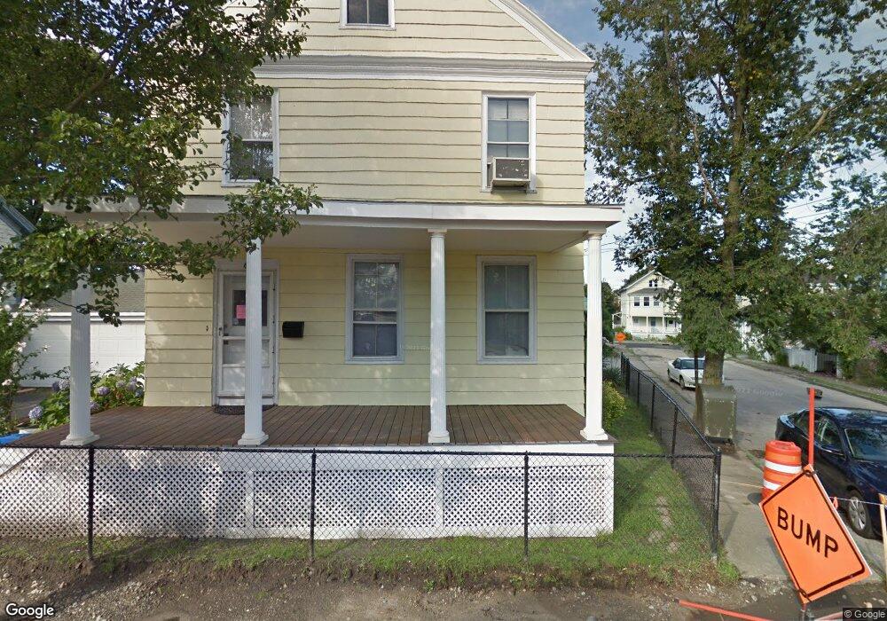
40 Newport Ave Newport, RI 02840
Estimated Value: $673,000 - $781,000
4
Beds
2
Baths
1,755
Sq Ft
$407/Sq Ft
Est. Value
About This Home
This home is located at 40 Newport Ave, Newport, RI 02840 and is currently estimated at $714,776, approximately $407 per square foot. 40 Newport Ave is a home located in Newport County with nearby schools including Rogers High School, St Michael's Country Day School, and St George's School.
Ownership History
Date
Name
Owned For
Owner Type
Purchase Details
Closed on
Aug 16, 2000
Sold by
Toto Joseph L and Toto Teresa
Bought by
Cooper John M and Cooper Karen
Current Estimated Value
Purchase Details
Closed on
Mar 28, 1997
Sold by
Sirany Egon and Sirany Janis
Bought by
Toto Joseph L and Toto Teressa
Purchase Details
Closed on
May 25, 1993
Sold by
Freitas Frank
Bought by
Sirany Egon and Sirany Janis
Create a Home Valuation Report for This Property
The Home Valuation Report is an in-depth analysis detailing your home's value as well as a comparison with similar homes in the area
Home Values in the Area
Average Home Value in this Area
Purchase History
| Date | Buyer | Sale Price | Title Company |
|---|---|---|---|
| Cooper John M | $160,000 | -- | |
| Toto Joseph L | $125,000 | -- | |
| Sirany Egon | $117,000 | -- |
Source: Public Records
Mortgage History
| Date | Status | Borrower | Loan Amount |
|---|---|---|---|
| Open | Sirany Egon | $165,000 | |
| Closed | Sirany Egon | $165,000 | |
| Closed | Sirany Egon | $50,000 |
Source: Public Records
Tax History Compared to Growth
Tax History
| Year | Tax Paid | Tax Assessment Tax Assessment Total Assessment is a certain percentage of the fair market value that is determined by local assessors to be the total taxable value of land and additions on the property. | Land | Improvement |
|---|---|---|---|---|
| 2025 | $4,194 | $482,700 | $147,000 | $335,700 |
| 2024 | $3,968 | $482,700 | $147,000 | $335,700 |
| 2023 | $3,327 | $335,400 | $112,500 | $222,900 |
| 2022 | $3,223 | $335,400 | $112,500 | $222,900 |
| 2021 | $3,129 | $335,400 | $112,500 | $222,900 |
| 2020 | $3,124 | $303,900 | $96,900 | $207,000 |
| 2019 | $3,124 | $303,900 | $96,900 | $207,000 |
| 2018 | $3,036 | $303,900 | $96,900 | $207,000 |
| 2017 | $2,978 | $265,700 | $74,500 | $191,200 |
| 2016 | $2,904 | $265,700 | $74,500 | $191,200 |
| 2015 | $2,835 | $265,700 | $74,500 | $191,200 |
| 2014 | $2,950 | $244,600 | $54,900 | $189,700 |
Source: Public Records
Map
Nearby Homes
- 125 Van Zandt Ave Unit 307
- 3 Vicksburg Place
- 7 Sheffield Ave
- 155 Evarts St
- 4 Newport Ave Unit B2
- 53 Warner St
- 26 Prescott Hall Rd
- 44 Warner St
- 1 Arnold Ave
- 5 Bowser Ct
- 17 Warner St
- 17 Lincoln St
- 6 Sunshine Ct
- 74 Third St
- 19 Princeton St Unit 21
- 102 Broadway Unit 2B
- 104 Second St
- 12 Poplar St
- 5 Elliot Place
- 11 Willow St Unit 5
- 31 Channing St
- 38 Newport Ave
- 33 Channing St
- 27 Channing St
- 37 Newport Ave
- 34 Channing St
- 34 Channing St Unit 1
- 34 Channing St
- 34 Channing St Unit 2
- 21 Hall Ave
- 32 Channing St
- 32 Channing St Unit 2
- 35 Channing St
- 35 Newport Ave
- 40 Channing St
- 13 1/2 Hall Ave
- 30 Channing St
- 30 Channing St Unit 2
- 30 Channing St Unit 1
- 30 Channing St Unit 3