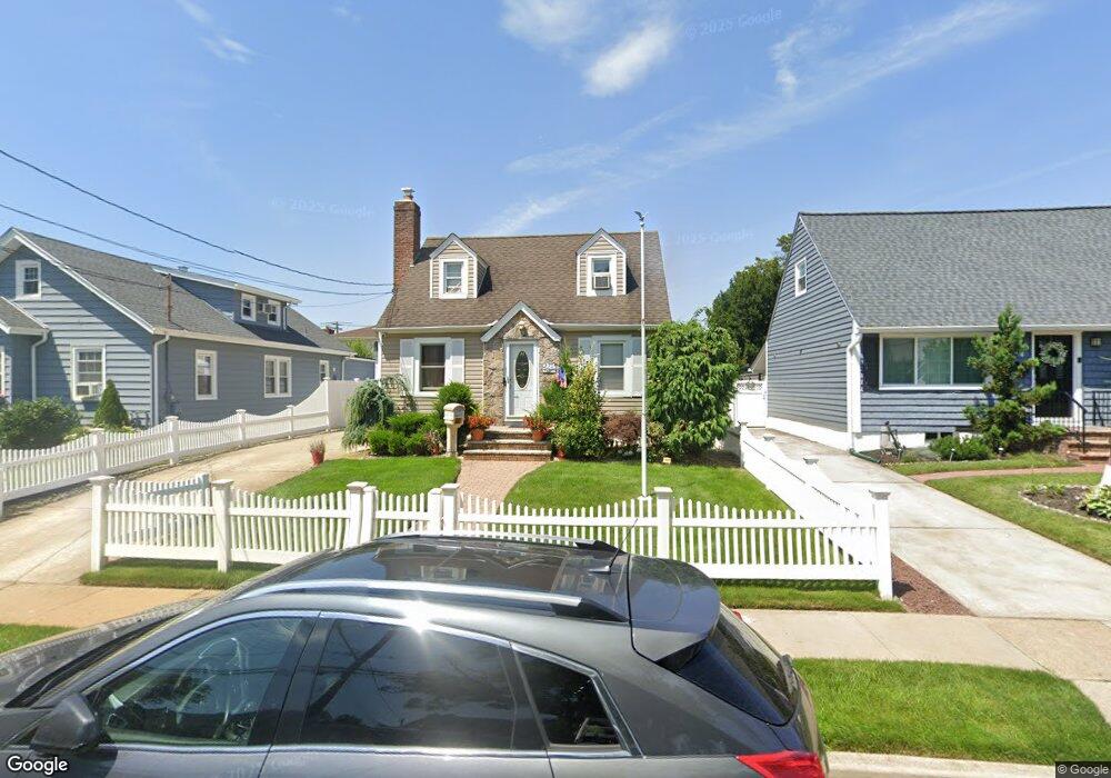
40 Saint Marks Ave Freeport, NY 11520
Estimated Value: $637,111 - $640,000
3
Beds
2
Baths
1,138
Sq Ft
$561/Sq Ft
Est. Value
About This Home
This home is located at 40 Saint Marks Ave, Freeport, NY 11520 and is currently estimated at $638,556, approximately $561 per square foot. 40 Saint Marks Ave is a home located in Nassau County with nearby schools including Columbus Avenue School, Caroline G. Atkinson Intermediate School, and John W Dodd Middle School.
Ownership History
Date
Name
Owned For
Owner Type
Purchase Details
Closed on
Mar 2, 2018
Sold by
Midgette Lorraine H and Midgette Bradley Etheridge
Bought by
Chery Terlie Vincent and Chery John W
Current Estimated Value
Home Financials for this Owner
Home Financials are based on the most recent Mortgage that was taken out on this home.
Original Mortgage
$365,700
Outstanding Balance
$313,376
Interest Rate
4.38%
Mortgage Type
New Conventional
Estimated Equity
$325,180
Create a Home Valuation Report for This Property
The Home Valuation Report is an in-depth analysis detailing your home's value as well as a comparison with similar homes in the area
Home Values in the Area
Average Home Value in this Area
Purchase History
| Date | Buyer | Sale Price | Title Company |
|---|---|---|---|
| Chery Terlie Vincent | $385,000 | None Available |
Source: Public Records
Mortgage History
| Date | Status | Borrower | Loan Amount |
|---|---|---|---|
| Open | Chery Terlie Vincent | $365,700 |
Source: Public Records
Tax History Compared to Growth
Tax History
| Year | Tax Paid | Tax Assessment Tax Assessment Total Assessment is a certain percentage of the fair market value that is determined by local assessors to be the total taxable value of land and additions on the property. | Land | Improvement |
|---|---|---|---|---|
| 2025 | $8,107 | $398 | $143 | $255 |
| 2024 | $802 | $396 | $143 | $253 |
| 2023 | $6,862 | $374 | $134 | $240 |
| 2022 | $6,862 | $375 | $143 | $232 |
| 2021 | $9,534 | $354 | $127 | $227 |
| 2020 | $6,320 | $398 | $397 | $1 |
| 2019 | $582 | $398 | $397 | $1 |
| 2018 | $3,282 | $407 | $0 | $0 |
| 2017 | $3,137 | $407 | $406 | $1 |
| 2016 | $3,673 | $431 | $369 | $62 |
| 2015 | $572 | $455 | $358 | $97 |
| 2014 | $572 | $455 | $358 | $97 |
| 2013 | $603 | $506 | $398 | $108 |
Source: Public Records
Map
Nearby Homes
- 78 Saint Marks Ave
- 437 Ray St
- 119 S Bay Ave
- 173 Cedar St
- 451 Atlantic Ave
- 88 Elliott Place
- 31 Casino St Unit PH
- 153 Westend Ave
- 171 Westside Ave
- 531 Ray St Unit 10
- 116 Westend Ave Unit 8
- 116 Westend Ave Unit 21
- 116 Westend Ave Unit 6
- 481 Archer St
- 159 Branch Ave
- 306 Park Ave
- 205 Saint Marks Ave
- 210 Westend Ave Unit 8B
- 208 Westend Ave Unit 11A
- 587 S Bayview Ave
- 36 Saint Marks Ave
- 48 Saint Marks Ave
- 7 Branch Ave
- 9 Branch Ave
- 5 Branch Ave
- 50 Saint Marks Ave
- 15 Branch Ave
- 41 Saint Marks Ave
- 39 Saint Marks Ave
- 35 Saint Marks Ave
- 43 Saint Marks Ave
- 47 Saint Marks Ave
- 19 Branch Ave
- 25 Saint Marks Ave
- 51 Saint Marks Ave
- 367 Ray St
- 58 Saint Marks Ave
- 23 Branch Ave
- 18 Westside Ave
- 18 Westside Ave Unit 2