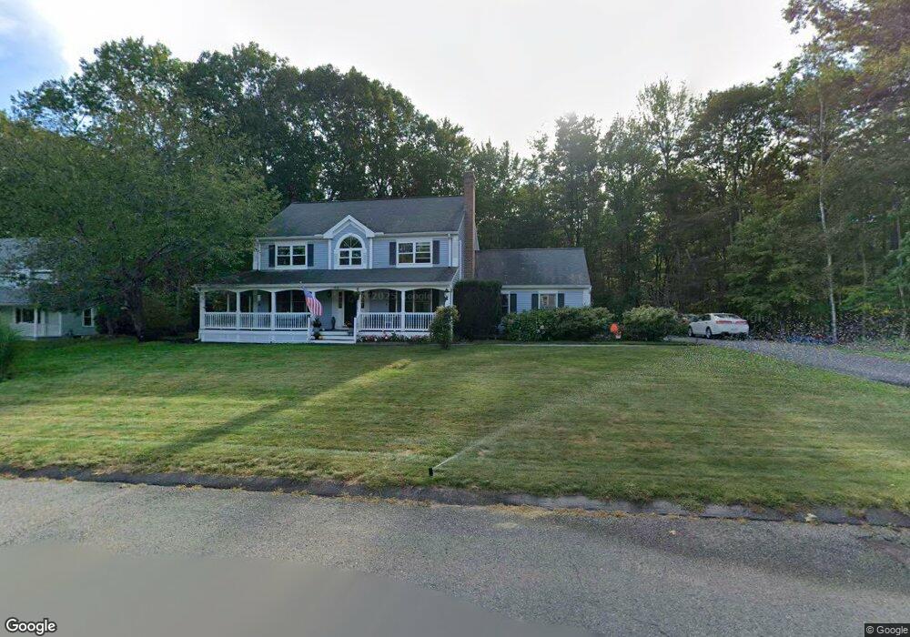
40 Slack Brook Rd Leominster, MA 01453
Estimated Value: $548,000 - $672,000
4
Beds
3
Baths
1,915
Sq Ft
$328/Sq Ft
Est. Value
About This Home
This home is located at 40 Slack Brook Rd, Leominster, MA 01453 and is currently estimated at $628,473, approximately $328 per square foot. 40 Slack Brook Rd is a home located in Worcester County with nearby schools including Leominster High School, St. Leo School, and St. Anna Catholic School.
Ownership History
Date
Name
Owned For
Owner Type
Purchase Details
Closed on
May 9, 2018
Sold by
Morand Garry M and Morand Carolyn M
Bought by
Morand Lt
Current Estimated Value
Purchase Details
Closed on
Feb 8, 2008
Sold by
Cartus Financial Corp
Bought by
Morand Garry M and Morand Carolyn
Home Financials for this Owner
Home Financials are based on the most recent Mortgage that was taken out on this home.
Original Mortgage
$350,000
Interest Rate
6.2%
Mortgage Type
Purchase Money Mortgage
Purchase Details
Closed on
Dec 4, 2007
Sold by
Kane Robert B and Kane Caron A
Bought by
Cartus Financial Corp
Purchase Details
Closed on
Dec 8, 1994
Sold by
Brian Carlson Custom
Bought by
Kane Robert B and Kane Caron
Home Financials for this Owner
Home Financials are based on the most recent Mortgage that was taken out on this home.
Original Mortgage
$179,700
Interest Rate
9%
Mortgage Type
Purchase Money Mortgage
Create a Home Valuation Report for This Property
The Home Valuation Report is an in-depth analysis detailing your home's value as well as a comparison with similar homes in the area
Home Values in the Area
Average Home Value in this Area
Purchase History
| Date | Buyer | Sale Price | Title Company |
|---|---|---|---|
| Morand Lt | -- | -- | |
| Morand Garry M | $355,500 | -- | |
| Cartus Financial Corp | $399,000 | -- | |
| Kane Robert B | $204,750 | -- |
Source: Public Records
Mortgage History
| Date | Status | Borrower | Loan Amount |
|---|---|---|---|
| Previous Owner | Morand Garry M | $350,000 | |
| Previous Owner | Kane Robert B | $179,300 | |
| Previous Owner | Kane Robert B | $21,000 | |
| Previous Owner | Kane Robert B | $179,700 |
Source: Public Records
Tax History
| Year | Tax Paid | Tax Assessment Tax Assessment Total Assessment is a certain percentage of the fair market value that is determined by local assessors to be the total taxable value of land and additions on the property. | Land | Improvement |
|---|---|---|---|---|
| 2025 | $7,916 | $564,200 | $174,600 | $389,600 |
| 2024 | $7,783 | $536,400 | $166,100 | $370,300 |
| 2023 | $7,423 | $477,700 | $144,500 | $333,200 |
| 2022 | $7,068 | $426,800 | $125,400 | $301,400 |
| 2021 | $6,933 | $382,400 | $97,400 | $285,000 |
| 2020 | $6,667 | $370,800 | $97,400 | $273,400 |
| 2019 | $6,528 | $352,100 | $92,900 | $259,200 |
| 2018 | $6,476 | $335,000 | $90,400 | $244,600 |
| 2017 | $6,264 | $317,500 | $84,400 | $233,100 |
| 2016 | $6,207 | $317,000 | $84,400 | $232,600 |
| 2015 | $5,700 | $293,200 | $84,400 | $208,800 |
| 2014 | $5,627 | $297,900 | $88,900 | $209,000 |
Source: Public Records
Map
Nearby Homes
- 204 Old Farm Rd
- 65 Helena St
- 121 Cumberland Rd
- 27 Haynes Ct
- 525 Lindell Ave
- 32 Haynes Ct
- Lot 2 Birch St
- 559 Merriam Ave
- 144 West St Unit 14
- LOT 1 Elm St
- 15 Arlington St
- 20 Oregon Ave
- 48 Chestnut St
- 60 Pearl St
- 51 Grove Ave
- 59 Church St
- 192 Pleasant St Unit 25
- 192 Pleasant St Unit 23
- 113 Pleasant St
- 20 Pleasantview Ave
- 32 Slack Brook Rd
- 37 Slack Brook Rd
- 48 Slack Brook Rd
- 24 Slack Brook Rd
- 25 Slack Brook Rd
- 49 Slack Brook Rd
- 247 Granite St
- 255 Granite St
- 261 Granite St
- 267 Granite St
- 249 Granite St
- 270 Granite St
- 239 Granite St
- 325 Granite St
- 123 Constitution Dr
- 256 Granite St
- 243 Granite St
- 300 Granite St
- 237 Granite St
- 335 Granite St
Your Personal Tour Guide
Ask me questions while you tour the home.