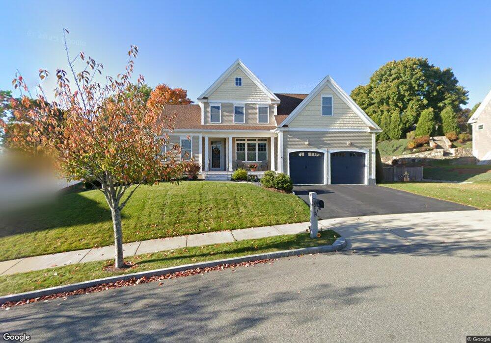
40 Winship Dr Stoneham, MA 02180
Bear Hill NeighborhoodEstimated Value: $1,299,354 - $1,452,000
4
Beds
3
Baths
2,339
Sq Ft
$590/Sq Ft
Est. Value
About This Home
This home is located at 40 Winship Dr, Stoneham, MA 02180 and is currently estimated at $1,380,839, approximately $590 per square foot. 40 Winship Dr is a home with nearby schools including Stoneham High School, St Joseph School, and St. Patrick Elementary School.
Ownership History
Date
Name
Owned For
Owner Type
Purchase Details
Closed on
Feb 19, 2019
Sold by
Litchfield Charles F and Litchfield Jeanne S
Bought by
J C F and S Litchfield T J
Current Estimated Value
Purchase Details
Closed on
Oct 1, 2012
Sold by
Stabile Hms Stoneham L
Bought by
Litchfield Charles F and Litchfield Jeanne S
Home Financials for this Owner
Home Financials are based on the most recent Mortgage that was taken out on this home.
Original Mortgage
$250,000
Interest Rate
3.62%
Mortgage Type
New Conventional
Purchase Details
Closed on
Jul 5, 2012
Sold by
Wincrest Properties Ll
Bought by
Stabile Homes Stoneham
Create a Home Valuation Report for This Property
The Home Valuation Report is an in-depth analysis detailing your home's value as well as a comparison with similar homes in the area
Home Values in the Area
Average Home Value in this Area
Purchase History
| Date | Buyer | Sale Price | Title Company |
|---|---|---|---|
| J C F | -- | -- | |
| Litchfield Charles F | $723,729 | -- | |
| Stabile Homes Stoneham | $275,000 | -- |
Source: Public Records
Mortgage History
| Date | Status | Borrower | Loan Amount |
|---|---|---|---|
| Previous Owner | Litchfield Charles F | $250,000 |
Source: Public Records
Tax History Compared to Growth
Tax History
| Year | Tax Paid | Tax Assessment Tax Assessment Total Assessment is a certain percentage of the fair market value that is determined by local assessors to be the total taxable value of land and additions on the property. | Land | Improvement |
|---|---|---|---|---|
| 2025 | $12,220 | $1,194,500 | $521,200 | $673,300 |
| 2024 | $11,798 | $1,114,100 | $481,200 | $632,900 |
| 2023 | $11,506 | $1,036,600 | $441,200 | $595,400 |
| 2022 | $10,040 | $964,500 | $401,200 | $563,300 |
| 2021 | $9,667 | $893,400 | $381,200 | $512,200 |
| 2020 | $9,601 | $889,800 | $381,200 | $508,600 |
| 2019 | $9,745 | $868,500 | $331,200 | $537,300 |
| 2018 | $9,767 | $834,100 | $326,200 | $507,900 |
| 2017 | $9,508 | $767,400 | $291,200 | $476,200 |
| 2016 | $9,453 | $744,300 | $291,200 | $453,100 |
| 2015 | $8,981 | $693,000 | $266,200 | $426,800 |
| 2014 | $9,529 | $706,400 | $266,200 | $440,200 |
Source: Public Records
Map
Nearby Homes
- 97 Macarthur Rd
- 4 Adams St
- 62 High St Unit 4
- 62 High St Unit 3
- 62 High St Unit Lot 12
- 62 High St Unit Lot 2
- 62 High St Unit Lot 7
- 62 High St Unit Lot 9
- 10 Converse St
- 90 Prospect St
- 5 Byron St
- 64 Main St Unit 41B
- 40 Friend St
- 4 Vernon Ave
- 68 Main St Unit 36C
- 40 Main St Unit 505
- 8 Steele St
- 106 Elm St
- 34 Cedar St
- 26 Curve St
- 42 Winship Dr
- 38 Winship Dr
- 41 Winship Dr
- 84 Converse St
- 80 Converse St
- 88 Converse St
- 45 Winship Dr
- 36 Winship Dr
- 37 Winship Dr
- 76 Converse St
- 46 Winship Dr
- 103 Macarthur Rd
- 47 Winship Dr
- 105 Macarthur Rd
- 81 Converse St
- 85 Converse St
- 101 Macarthur Rd
- 34 Winship Dr Unit 1
- 6 Spalding Rd
- 8 Spalding Rd