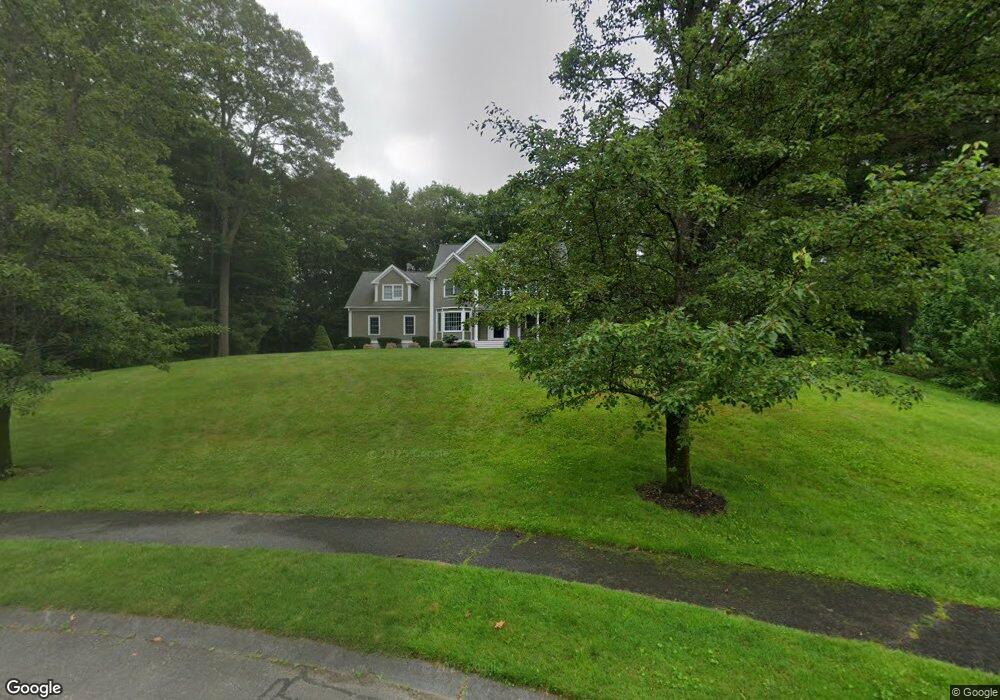
40 Wisteria Way Wrentham, MA 02093
Estimated Value: $1,027,171 - $1,213,000
4
Beds
3
Baths
3,065
Sq Ft
$360/Sq Ft
Est. Value
About This Home
This home is located at 40 Wisteria Way, Wrentham, MA 02093 and is currently estimated at $1,103,293, approximately $359 per square foot. 40 Wisteria Way is a home located in Norfolk County with nearby schools including Delaney Elementary School, Charles E Roderick, and Foxborough Regional Charter School.
Ownership History
Date
Name
Owned For
Owner Type
Purchase Details
Closed on
Jul 3, 2024
Sold by
Soukas Angelo and Soukas Serin M
Bought by
Soukas Angelo
Current Estimated Value
Purchase Details
Closed on
Nov 19, 1999
Sold by
Voyager Bldg Corp Est
Bought by
Soukas Angelo
Home Financials for this Owner
Home Financials are based on the most recent Mortgage that was taken out on this home.
Original Mortgage
$180,000
Interest Rate
7.76%
Mortgage Type
Purchase Money Mortgage
Create a Home Valuation Report for This Property
The Home Valuation Report is an in-depth analysis detailing your home's value as well as a comparison with similar homes in the area
Home Values in the Area
Average Home Value in this Area
Purchase History
| Date | Buyer | Sale Price | Title Company |
|---|---|---|---|
| Soukas Angelo | -- | None Available | |
| Soukas Angelo | -- | None Available | |
| Soukas Angelo | $370,000 | -- |
Source: Public Records
Mortgage History
| Date | Status | Borrower | Loan Amount |
|---|---|---|---|
| Previous Owner | Soukas Angelo | $50,000 | |
| Previous Owner | Soukas Angelo | $175,000 | |
| Previous Owner | Soukas Angelo | $180,000 | |
| Previous Owner | Soukas Angelo | $35,000 |
Source: Public Records
Tax History Compared to Growth
Tax History
| Year | Tax Paid | Tax Assessment Tax Assessment Total Assessment is a certain percentage of the fair market value that is determined by local assessors to be the total taxable value of land and additions on the property. | Land | Improvement |
|---|---|---|---|---|
| 2025 | $10,808 | $932,500 | $341,500 | $591,000 |
| 2024 | $9,695 | $807,900 | $341,500 | $466,400 |
| 2023 | $9,377 | $743,000 | $310,300 | $432,700 |
| 2022 | $8,840 | $646,700 | $282,000 | $364,700 |
| 2021 | $8,688 | $617,500 | $282,000 | $335,500 |
| 2020 | $8,835 | $620,000 | $231,700 | $388,300 |
| 2019 | $8,506 | $602,400 | $231,700 | $370,700 |
| 2018 | $8,161 | $573,100 | $232,000 | $341,100 |
| 2017 | $7,969 | $559,200 | $227,500 | $331,700 |
| 2016 | $7,801 | $546,300 | $220,900 | $325,400 |
| 2015 | $7,959 | $531,300 | $212,400 | $318,900 |
| 2014 | $7,828 | $511,300 | $204,300 | $307,000 |
Source: Public Records
Map
Nearby Homes
- 131 Washington St Unit 42
- 25 Foxboro Rd
- 11 Goodwin Dr
- 7 Hill St Unit 10
- 65 Pond St
- 71 Pond St
- 362 East St
- 1 Lorraine Metcalf Dr
- 270 Dedham St
- 155 Clark Rd Unit 155
- 483 Thurston St
- 10 W Birch Rd
- 0 W Birch Rd
- 11 Orchard Place Unit 11
- 375 Winter St
- 16R Eldor Dr
- 14 Baker St
- 120 Hawes St
- 3 Oak Rd
- 14 Foxhill Rd
- 30 Wisteria Way
- 1025 East St
- 25 Wisteria Way
- 15 Wisteria Way
- 1015 East St
- 20 Wisteria Way
- 5 Wisteria Way
- 990 East St
- 998 East St
- 1005 East St Unit LOT #1
- 1005 East St
- 10 Wisteria Way
- 131 Washington St
- 112 Foxboro Rd
- 110 Foxboro Rd
- 112 Foxboro Rd Unit 112
- 114 Foxboro Rd
- 114 Foxboro Rd Unit 114
- 997 East St
- 80 Foxboro Rd