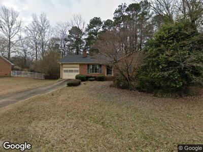
400 Brookstone Dr Athens, GA 30605
Estimated Value: $292,219 - $312,000
3
Beds
2
Baths
1,423
Sq Ft
$210/Sq Ft
Est. Value
About This Home
This home is located at 400 Brookstone Dr, Athens, GA 30605 and is currently estimated at $299,055, approximately $210 per square foot. 400 Brookstone Dr is a home located in Clarke County with nearby schools including Barnett Shoals Elementary School, Hilsman Middle School, and Cedar Shoals High School.
Ownership History
Date
Name
Owned For
Owner Type
Purchase Details
Closed on
Jan 29, 2010
Sold by
Robbins Gayle M and Kenn Sally A
Bought by
Newman Daniel A
Current Estimated Value
Home Financials for this Owner
Home Financials are based on the most recent Mortgage that was taken out on this home.
Original Mortgage
$113,200
Interest Rate
5.16%
Mortgage Type
New Conventional
Purchase Details
Closed on
Oct 13, 2004
Sold by
Robbins Gayle M
Bought by
Robbins Gayle M and Kennedy Sally A
Purchase Details
Closed on
Feb 26, 2003
Sold by
Zeng Wei
Bought by
Zeng Wei and Tongrui Liu
Purchase Details
Closed on
Feb 28, 2001
Sold by
Carr Martha M
Bought by
Zeng Wei and Tongrui Liu
Purchase Details
Closed on
Jun 18, 1992
Sold by
Tyner Mark K and Tyner Jean S
Bought by
Carr Martha M
Purchase Details
Closed on
Nov 8, 1990
Sold by
Evans Timothy D
Bought by
Tyner Mark K and Tyner Jean S
Create a Home Valuation Report for This Property
The Home Valuation Report is an in-depth analysis detailing your home's value as well as a comparison with similar homes in the area
Home Values in the Area
Average Home Value in this Area
Purchase History
| Date | Buyer | Sale Price | Title Company |
|---|---|---|---|
| Newman Daniel A | $141,500 | -- | |
| Robbins Gayle M | -- | -- | |
| Robbins Gayle M | $130,000 | -- | |
| Zeng Wei | -- | -- | |
| Zeng Wei | $106,500 | -- | |
| Carr Martha M | $77,900 | -- | |
| Tyner Mark K | $73,000 | -- |
Source: Public Records
Mortgage History
| Date | Status | Borrower | Loan Amount |
|---|---|---|---|
| Open | Newman Daniel A | $11,800 | |
| Open | Newman Daniel A | $93,600 | |
| Closed | Newman Daniel A | $113,200 |
Source: Public Records
Tax History Compared to Growth
Tax History
| Year | Tax Paid | Tax Assessment Tax Assessment Total Assessment is a certain percentage of the fair market value that is determined by local assessors to be the total taxable value of land and additions on the property. | Land | Improvement |
|---|---|---|---|---|
| 2024 | $2,689 | $102,037 | $12,000 | $90,037 |
| 2023 | $1,938 | $97,024 | $12,000 | $85,024 |
| 2022 | $2,335 | $83,192 | $10,400 | $72,792 |
| 2021 | $1,898 | $66,326 | $10,400 | $55,926 |
| 2020 | $1,646 | $58,842 | $10,400 | $48,442 |
| 2019 | $1,562 | $56,023 | $10,400 | $45,623 |
| 2018 | $1,471 | $53,322 | $10,400 | $42,922 |
| 2017 | $1,278 | $47,636 | $10,400 | $37,236 |
| 2016 | $1,187 | $44,952 | $10,400 | $34,552 |
| 2015 | $1,204 | $45,389 | $10,400 | $34,989 |
| 2014 | $1,205 | $45,364 | $10,400 | $34,964 |
Source: Public Records
Map
Nearby Homes
- 123 Stonybrook Ct
- 440 Wood Ln
- 125 & 127 Laurie Dr
- 159 Oak Meadow Dr
- 266 Wiltshire Dr
- 195 Wolfe Ln
- 175 Greenwood Ln
- 175 Williamsburg Ln
- 3920 Old Lexington Rd
- 111 Sapphire Ct
- 165 Red Fox Run
- 162 Wakefield Trace
- 154 Diamond Dr
- 235 Ansley Dr
- 226 Highland Park Dr
- 150 Wakefield Dr
- 172 Highland Park Dr
- 166/168/170 Highland Park Dr
- 166 Highland Park Dr
- 155 Tamarack Dr
- 400 Brookstone Dr
- 410 Brookstone Dr
- 390 Brookstone Dr
- 155 McKey Ct
- 170 McKey Ct
- 161 Woodberry Dr
- 370 Brookstone Dr
- 395 Brookstone Dr
- 171 Woodberry Dr
- 405 Brookstone Dr
- 151 Woodberry Dr
- 385 Brookstone Dr
- 415 Brookstone Dr
- 135 McKey Ct
- 360 Brookstone Dr
- 141 Woodberry Dr
- 375 Brookstone Dr
- 425 Brookstone Dr
- 160 McKey Ct
- 365 Brookstone Dr