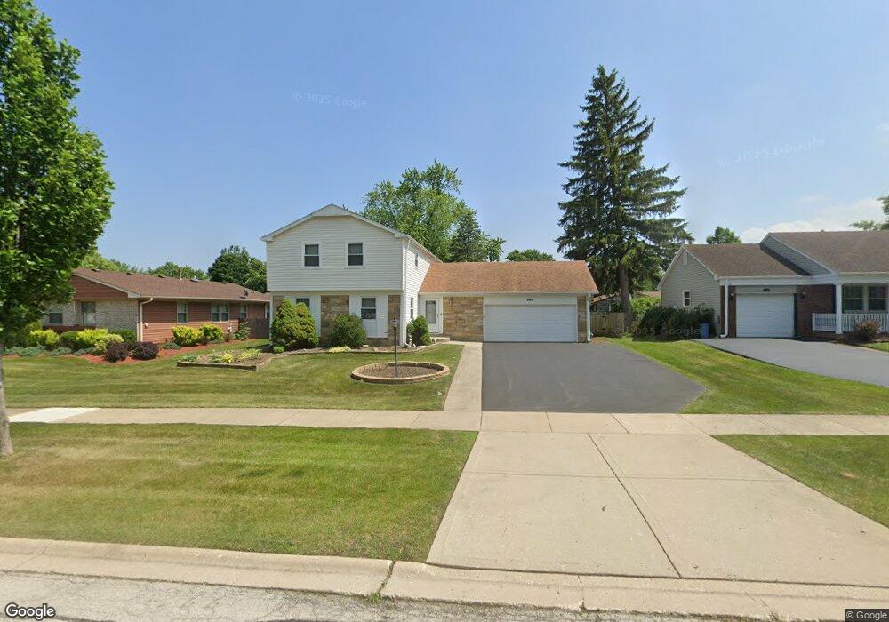
400 Checker Dr Buffalo Grove, IL 60089
Estimated Value: $507,060 - $587,000
--
Bed
3
Baths
2,115
Sq Ft
$261/Sq Ft
Est. Value
About This Home
This home is located at 400 Checker Dr, Buffalo Grove, IL 60089 and is currently estimated at $551,515, approximately $260 per square foot. 400 Checker Dr is a home located in Lake County with nearby schools including Ivy Hall Elementary School, Twin Groves Middle School, and Adlai E Stevenson High School.
Ownership History
Date
Name
Owned For
Owner Type
Purchase Details
Closed on
Aug 20, 2016
Sold by
Milstein Jeffrey and Milstein Myrna
Bought by
Milstein Jeffrey D and Milstein Myrna L
Current Estimated Value
Create a Home Valuation Report for This Property
The Home Valuation Report is an in-depth analysis detailing your home's value as well as a comparison with similar homes in the area
Home Values in the Area
Average Home Value in this Area
Purchase History
| Date | Buyer | Sale Price | Title Company |
|---|---|---|---|
| Milstein Jeffrey D | -- | Attorney |
Source: Public Records
Tax History Compared to Growth
Tax History
| Year | Tax Paid | Tax Assessment Tax Assessment Total Assessment is a certain percentage of the fair market value that is determined by local assessors to be the total taxable value of land and additions on the property. | Land | Improvement |
|---|---|---|---|---|
| 2024 | $13,810 | $151,156 | $32,353 | $118,803 |
| 2023 | $12,965 | $142,626 | $30,527 | $112,099 |
| 2022 | $12,965 | $130,341 | $27,897 | $102,444 |
| 2021 | $12,474 | $128,935 | $27,596 | $101,339 |
| 2020 | $12,180 | $129,375 | $27,690 | $101,685 |
| 2019 | $12,013 | $128,898 | $27,588 | $101,310 |
| 2018 | $5,837 | $118,177 | $27,265 | $90,912 |
| 2017 | $10,423 | $115,419 | $26,629 | $88,790 |
| 2016 | $10,149 | $110,522 | $25,499 | $85,023 |
| 2015 | $9,876 | $103,359 | $23,846 | $79,513 |
| 2014 | $10,223 | $102,953 | $25,611 | $77,342 |
| 2012 | $9,907 | $103,159 | $25,662 | $77,497 |
Source: Public Records
Map
Nearby Homes
- 390 Springside Ln
- 746 Old Checker Rd Unit E5
- 610 Checker Dr
- 1112 Auburn Ln
- 412 Chateau Dr
- 800 Clohesey Dr
- 711 Woodhollow Ln
- 98 Stonegate Rd
- 931 Shady Grove Ln
- 950 Belmar Ln
- 12 Cloverdale Ct
- 603 Cherbourg Ct N
- 1141 Devonshire Rd
- 887 Saybrook Ln Unit 2
- 625 Marseilles Cir
- 670 Dunhill Dr
- 315 Cherrywood Rd
- 720 Dunhill Dr
- 938 Hidden Lake Dr
- 1514 Sumter Dr
- 390 Checker Dr Unit 5
- 410 Checker Dr Unit 5
- 391 Springside Ln
- 401 Springside Ln
- 381 Springside Ln
- 380 Checker Dr
- 420 Checker Dr
- 371 Springside Ln Unit 5
- 411 Springside Ln
- 411 Checker Dr
- 401 Checker Dr
- 421 Checker Dr
- 370 Checker Dr
- 430 Checker Dr
- 391 Checker Dr
- 431 Checker Dr
- 421 Springside Ln
- 361 Springside Ln
- 10 Springside Ct
- 360 Checker Dr