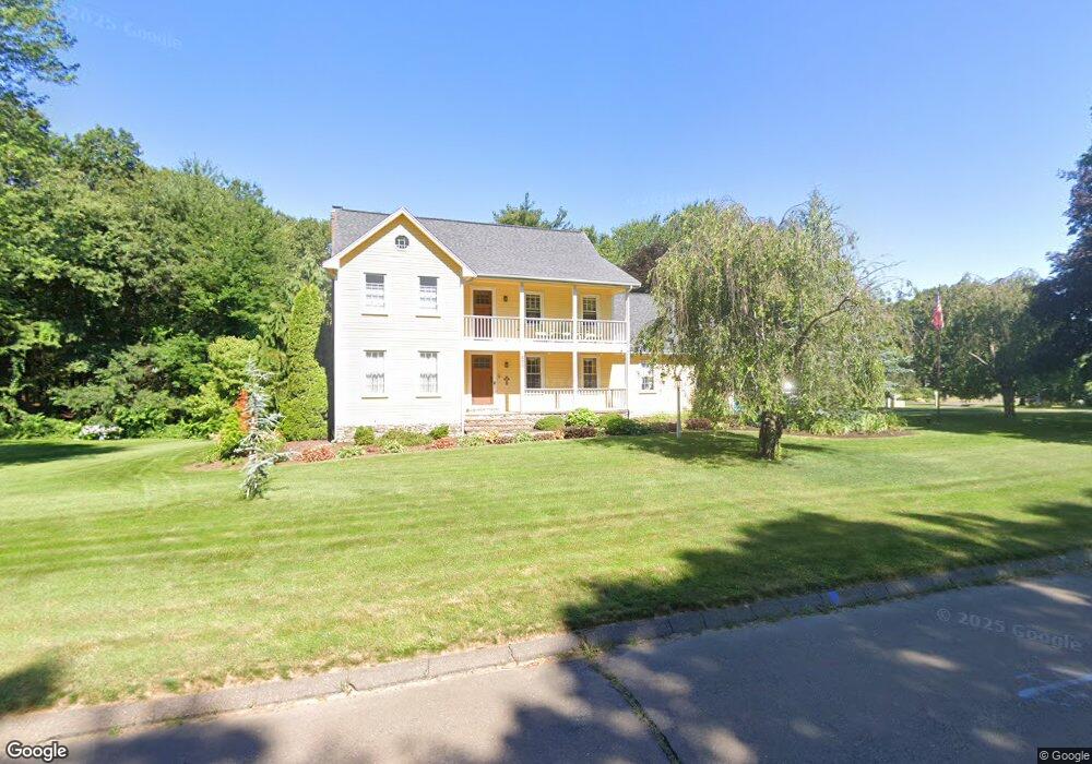
400 Lantern Way Windsor, CT 06095
West Windsor NeighborhoodEstimated Value: $528,000 - $601,000
4
Beds
3
Baths
2,324
Sq Ft
$239/Sq Ft
Est. Value
About This Home
This home is located at 400 Lantern Way, Windsor, CT 06095 and is currently estimated at $555,491, approximately $239 per square foot. 400 Lantern Way is a home located in Hartford County with nearby schools including Poquonock Elementary School, Clover Street School, and Sage Park Middle School.
Ownership History
Date
Name
Owned For
Owner Type
Purchase Details
Closed on
Jun 3, 1991
Sold by
Cook Theodore and Cook Carol
Bought by
Grockowski Carol and Grockowski Anthony
Current Estimated Value
Purchase Details
Closed on
Feb 3, 1987
Sold by
Meadow Crossing Inc
Bought by
Cook Theodore
Create a Home Valuation Report for This Property
The Home Valuation Report is an in-depth analysis detailing your home's value as well as a comparison with similar homes in the area
Home Values in the Area
Average Home Value in this Area
Purchase History
| Date | Buyer | Sale Price | Title Company |
|---|---|---|---|
| Grockowski Carol | $239,000 | -- | |
| Cook Theodore | $217,500 | -- |
Source: Public Records
Mortgage History
| Date | Status | Borrower | Loan Amount |
|---|---|---|---|
| Closed | Cook Theodore | $129,374 | |
| Closed | Cook Theodore | $50,000 | |
| Closed | Cook Theodore | $182,200 | |
| Closed | Cook Theodore | $192,000 |
Source: Public Records
Tax History
| Year | Tax Paid | Tax Assessment Tax Assessment Total Assessment is a certain percentage of the fair market value that is determined by local assessors to be the total taxable value of land and additions on the property. | Land | Improvement |
|---|---|---|---|---|
| 2025 | $9,079 | $319,130 | $77,000 | $242,130 |
| 2024 | $9,676 | $319,130 | $77,000 | $242,130 |
| 2023 | $7,117 | $211,820 | $60,480 | $151,340 |
| 2022 | $7,047 | $211,820 | $60,480 | $151,340 |
| 2021 | $7,047 | $211,820 | $60,480 | $151,340 |
| 2020 | $7,013 | $211,820 | $60,480 | $151,340 |
| 2019 | $6,859 | $211,820 | $60,480 | $151,340 |
| 2018 | $6,661 | $202,090 | $60,480 | $141,610 |
| 2017 | $6,558 | $202,090 | $60,480 | $141,610 |
| 2016 | $6,370 | $202,090 | $60,480 | $141,610 |
| 2015 | $6,249 | $202,090 | $60,480 | $141,610 |
| 2014 | $6,158 | $202,090 | $60,480 | $141,610 |
Source: Public Records
Map
Nearby Homes
- 10 Cleary Ln
- 24 Mary Catherine Cir
- 16 Hilltop Rd
- 1 Deanne Lynn Cir
- 823 Stone Rd
- 109 Old Village Cir
- 39 Loren Cir
- 22 Eastview Dr
- 999 Stone Rd
- 1946 Poquonock Ave
- 22 Apple Tree Ln
- 25 High St
- 490 Old Day Hill Rd
- 58 Hollow Brook Rd
- 16 Cornfield Rd
- 0 Walnut and Larch Dr
- 485 River St
- 49 Seymour Rd
- 16 Seymour Rd Unit 21C
- 16 Seymour Rd Unit 2H
- 115 Fieldstone Dr
- 410 Lantern Way
- 322 Hitching Post Ln
- 105 Fieldstone Dr
- 114 Fieldstone Dr
- 100 Fieldstone Dr
- 119 Fieldstone Dr
- 414 Lantern Way
- 318 Hitching Post Ln
- 415 Lantern Way
- 120 Fieldstone Dr
- 101 Fieldstone Dr
- 418 Lantern Way
- 96 Fieldstone Dr
- 319 Hitching Post Ln
- 43 Lang Rd
- 310 Hitching Post Ln
- 123 Fieldstone Dr
- 25 Lang Rd
- 304 Hitching Post Ln
Your Personal Tour Guide
Ask me questions while you tour the home.