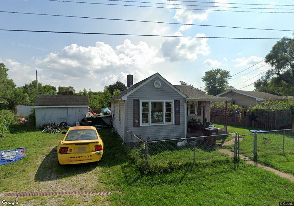
400 Manitee St Middletown, OH 45044
Estimated Value: $80,817 - $131,000
3
Beds
2
Baths
1,132
Sq Ft
$99/Sq Ft
Est. Value
About This Home
This home is located at 400 Manitee St, Middletown, OH 45044 and is currently estimated at $111,954, approximately $98 per square foot. 400 Manitee St is a home located in Butler County with nearby schools including Amanda Elementary School, Highview 6th Grade Center, and Middletown Middle School.
Ownership History
Date
Name
Owned For
Owner Type
Purchase Details
Closed on
Apr 26, 2023
Sold by
Flack Kelli J and Flack John W
Bought by
Flack John W and Flack Kelli J
Current Estimated Value
Purchase Details
Closed on
Feb 4, 2002
Sold by
Flack Johnnie A and Flack Freda M
Bought by
Elgin Kelli J
Home Financials for this Owner
Home Financials are based on the most recent Mortgage that was taken out on this home.
Original Mortgage
$57,855
Interest Rate
7.23%
Mortgage Type
FHA
Purchase Details
Closed on
Jan 1, 1985
Create a Home Valuation Report for This Property
The Home Valuation Report is an in-depth analysis detailing your home's value as well as a comparison with similar homes in the area
Home Values in the Area
Average Home Value in this Area
Purchase History
| Date | Buyer | Sale Price | Title Company |
|---|---|---|---|
| Flack John W | -- | None Listed On Document | |
| Elgin Kelli J | $60,000 | Prodigy Title Agency Inc | |
| -- | $33,500 | -- |
Source: Public Records
Mortgage History
| Date | Status | Borrower | Loan Amount |
|---|---|---|---|
| Previous Owner | Elgin Kelli J | $57,855 |
Source: Public Records
Tax History Compared to Growth
Tax History
| Year | Tax Paid | Tax Assessment Tax Assessment Total Assessment is a certain percentage of the fair market value that is determined by local assessors to be the total taxable value of land and additions on the property. | Land | Improvement |
|---|---|---|---|---|
| 2024 | $1,823 | $29,520 | $3,810 | $25,710 |
| 2023 | $1,721 | $29,520 | $3,810 | $25,710 |
| 2022 | $1,444 | $20,980 | $3,810 | $17,170 |
| 2021 | $1,404 | $20,980 | $3,810 | $17,170 |
| 2020 | $1,454 | $20,980 | $3,810 | $17,170 |
| 2019 | $1,345 | $18,600 | $3,390 | $15,210 |
| 2018 | $1,421 | $18,600 | $3,390 | $15,210 |
| 2017 | $1,204 | $18,600 | $3,390 | $15,210 |
| 2016 | $1,431 | $17,970 | $3,390 | $14,580 |
| 2015 | $1,197 | $17,970 | $3,390 | $14,580 |
| 2014 | $1,894 | $17,970 | $3,390 | $14,580 |
| 2013 | $1,894 | $28,000 | $6,650 | $21,350 |
Source: Public Records
Map
Nearby Homes
- 3109 Locust St
- 720 Diamond Loop
- 580 Diamond Loop
- 514 Granada Ave
- 0 Jackson St Unit 895859
- 0 Jackson St Unit 1780028
- 1102 Forrer St
- 3620 S Main St
- 712 Buena Ave
- 3004 Judy Dr
- 2004 Minnesota St
- 3113 Rufus St
- 3107 Rufus St
- 3209 Rufus St
- 2900 Morgan St
- 707 Nathan Dr
- 504 16th Ave
- 1613 Sheridan Ave
- 1602 Oxford State Rd
- 608 15th Ave
- 3101 Locust St
- 3103 Locust St
- 3009 Locust St
- 3009 Locust St
- 405 Manitee St
- 406 Manitee St
- 407 Manitee St
- 409 Manitee St
- 3105 Locust St
- 0 Locust Ln Unit 1373946
- 0 Locust Ln Unit 579875
- 3102 Locust St
- 408 Manitee St
- 3014 Locust St
- 3107 Locust St
- 3008 Locust St
- 3008 Locust St
- 3100 Locust St
- 402 Hickory Ave
- 400 Hickory Ave