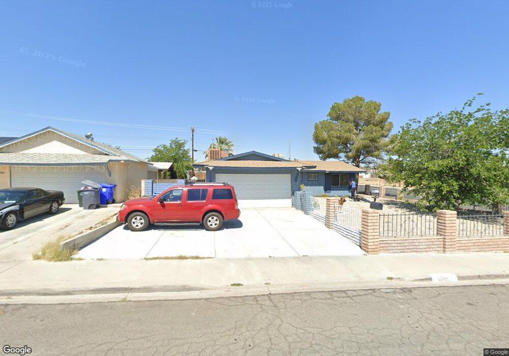
400 Mcbroom Ave Barstow, CA 92311
Estimated Value: $271,000 - $345,000
3
Beds
3
Baths
1,130
Sq Ft
$264/Sq Ft
Est. Value
About This Home
This home is located at 400 Mcbroom Ave, Barstow, CA 92311 and is currently estimated at $298,099, approximately $263 per square foot. 400 Mcbroom Ave is a home located in San Bernardino County with nearby schools including Crestline Elementary School, Barstow Junior High School, and Barstow High School.
Ownership History
Date
Name
Owned For
Owner Type
Purchase Details
Closed on
Aug 11, 2015
Sold by
Green Planet Enterprises Llc
Bought by
Hodges Otis Anthony
Current Estimated Value
Home Financials for this Owner
Home Financials are based on the most recent Mortgage that was taken out on this home.
Original Mortgage
$127,687
Interest Rate
3.85%
Mortgage Type
VA
Purchase Details
Closed on
Jan 18, 2013
Sold by
Levens Stacy
Bought by
Green Planet Enterprise Llc
Home Financials for this Owner
Home Financials are based on the most recent Mortgage that was taken out on this home.
Original Mortgage
$500,000
Interest Rate
3.33%
Mortgage Type
Purchase Money Mortgage
Purchase Details
Closed on
Apr 22, 2003
Sold by
Miers Jeffrey
Bought by
Levens Stacy
Create a Home Valuation Report for This Property
The Home Valuation Report is an in-depth analysis detailing your home's value as well as a comparison with similar homes in the area
Home Values in the Area
Average Home Value in this Area
Purchase History
| Date | Buyer | Sale Price | Title Company |
|---|---|---|---|
| Hodges Otis Anthony | $125,000 | Stewart Title Of Ca Inc | |
| Green Planet Enterprise Llc | $40,000 | Commerce Title Company | |
| Levens Stacy | -- | -- |
Source: Public Records
Mortgage History
| Date | Status | Borrower | Loan Amount |
|---|---|---|---|
| Previous Owner | Hodges Otis Anthony | $127,687 | |
| Previous Owner | Green Planet Enterprise Llc | $500,000 |
Source: Public Records
Tax History Compared to Growth
Tax History
| Year | Tax Paid | Tax Assessment Tax Assessment Total Assessment is a certain percentage of the fair market value that is determined by local assessors to be the total taxable value of land and additions on the property. | Land | Improvement |
|---|---|---|---|---|
| 2025 | $106 | $147,973 | $23,674 | $124,299 |
| 2024 | $106 | $145,072 | $23,210 | $121,862 |
| 2023 | $1,616 | $142,228 | $22,755 | $119,473 |
| 2022 | $1,610 | $139,439 | $22,309 | $117,130 |
| 2021 | $1,563 | $136,705 | $21,872 | $114,833 |
| 2020 | $1,566 | $135,304 | $21,648 | $113,656 |
| 2019 | $1,483 | $132,651 | $21,224 | $111,427 |
| 2018 | $1,557 | $130,050 | $20,808 | $109,242 |
| 2017 | $1,407 | $127,500 | $20,400 | $107,100 |
| 2016 | $1,391 | $125,000 | $20,000 | $105,000 |
| 2015 | $661 | $40,985 | $15,369 | $25,616 |
| 2014 | $649 | $40,182 | $15,068 | $25,114 |
Source: Public Records
Map
Nearby Homes
- 313 Forest Ave
- 316 Mcbroom Ave
- 321 Muir Ave
- 313 Broadway Ave
- 1505 Sunrise Rd
- 308 Muir Ave
- 1305 Piute St
- 500 Mcbroom Ave
- 1516 Sunrise Rd
- 1504 Church St
- 1517 De Anza St
- 305 Beverly Ave
- 0 Church St
- 1208 Gen Ct
- 1537 De Anza St
- 1240 E Navajo St
- 0 De Anza St
- 1201 E Elizabeth St
- 1612 De Anza St
- 761 Upton Dr
- 410 Mcbroom Ave
- 420 Mcbroom Ave
- 336 Mcbroom Ave
- 430 Mcbroom Ave
- 401 Mcbroom Ave
- 411 Mcbroom Ave
- 332 Mcbroom Ave
- 421 Mcbroom Ave
- 337 Forest Ave
- 440 Mcbroom Ave
- 337 Mcbroom Ave
- 431 Mcbroom Ave
- 328 Mcbroom Ave
- 333 Forest Ave
- 450 Mcbroom Ave
- 333 Mcbroom Ave
- 441 Mcbroom Ave
- 400 Broadway Ave
- 329 Forest Ave